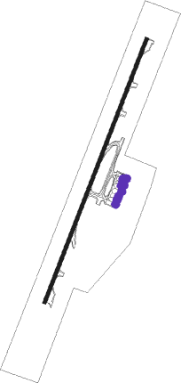
Van Don - Van Don Intl
Airport details
| Country | Vietnam |
| State | Quang Ninh Province |
| Region | |
| Airspace | Hanoi Ctr |
| Municipality | Vân Đồn District |
| Elevation | 23ft (7m) |
| Timezone | GMT +7 |
| Coordinates | 21.10581, 107.40775 |
| Magnetic var | |
| Type | land |
| Available since | X-Plane v10.40 |
| ICAO code | VVVD |
| IATA code | n/a |
| FAA code | n/a |
Communication
| Van Don Intl Tower_Pri | 118.100 |
| Van Don Intl Tower Sec | 118.850 |
Approach frequencies
| ILS-cat-I | RW03 | 109.9 | 18.00mi |
| 3° GS | RW03 | 109.9 | 18.00mi |
Nearby beacons
| code | identifier | dist | bearing | frequency |
|---|---|---|---|---|
| VDO | VANDON VOR/DME | 2.1 | 209° | 115.40 |
| CBI | CAT BI VOR/DME | 42.1 | 247° | 117.40 |
Departure and arrival routes
| Transition altitude | 2750ft |
| SID end points | distance | outbound heading | |
|---|---|---|---|
| RW03 | |||
| CATB1A, CATB1C | 18mi | 224° | |
| HALA1D, HALA1A | 18mi | 245° | |
| DOCH1D, DOCH1A | 17mi | 269° | |
| BACH1A | 16mi | 308° | |
| SAMS1A | 73mi | 313° | |
| RW21 | |||
| CATB1D, CATB1B | 18mi | 224° | |
| HALA1B, HALA1E | 18mi | 245° | |
| DOCH1B | 17mi | 269° | |
| BACH1B | 16mi | 308° | |
| DOCH1E | 73mi | 313° | |
| STAR starting points | distance | inbound heading | |
|---|---|---|---|
| ALL | |||
| HALA1C | 17.9 | 65° | |
| DOCH1C | 17.0 | 89° | |
| BACH1C | 15.6 | 128° | |
| RW03 | |||
| DOCH1F | 17.0 | 89° | |
| BACH1D | 15.6 | 128° | |
| RW21 | |||
| HALA1F | 17.9 | 65° | |
| DOCH1G | 17.0 | 89° | |
| NAKH1A | 72.6 | 133° | |
Instrument approach procedures
| runway | airway (heading) | route (dist, bearing) |
|---|---|---|
| RW03-Y | VD901 (320°) | VD901 3000ft VD902 (9mi, 267°) 3000ft VD031 (5mi, 294°) 2630ft |
| RNAV | VD031 2630ft VD030 (5mi, 27°) 1780ft VVVD (5mi, 27°) 80ft VD900 (5mi, 27°) VD901 (17mi, 155°) 3000ft VD901 (turn) 3000ft | |
| RW03-Z | VD032 (56°) | VD032 4000ft VD031 (6mi, 114°) 2630ft |
| RNAV | VD031 2630ft VD030 (5mi, 27°) 1780ft VVVD (5mi, 27°) 80ft VD900 (5mi, 27°) VD901 (17mi, 155°) 3000ft VD901 (turn) 3000ft | |
| RW21-Y | VD801 (286°) | VD801 3000ft VD802 (13mi, 347°) 3000ft VD211 (5mi, 294°) 2600ft |
| RNAV | VD211 2600ft VD210 (4mi, 208°) 1970ft VVVD (8mi, 207°) 71ft VD800 (2mi, 207°) VD801 (13mi, 97°) 3000ft VD801 (turn) 3000ft | |
| RW21-Z | SAMSU (172°) | SAMSU 5000ft VD211 (8mi, 114°) 2600ft |
| RNAV | VD211 2600ft VD210 (4mi, 208°) 1970ft VVVD (8mi, 207°) 71ft VD800 (2mi, 207°) VD801 (13mi, 97°) 3000ft VD801 (turn) 3000ft |
Holding patterns
| STAR name | hold at | type | turn | heading* | altitude | leg | speed limit |
|---|---|---|---|---|---|---|---|
| BACH1D | BACHE | VHF | right | 354 (174)° | 6000ft - 14000ft | 1.0min timed | 230 |
| DOCH1F | DOCHU | VHF | right | 315 (135)° | 6000ft - 14000ft | 1.0min timed | 230 |
| DOCH1G | DOCHU | VHF | right | 315 (135)° | 6000ft - 14000ft | 1.0min timed | 230 |
| DOCH1G | SAMSU | VHF | right | 298 (118)° | 5000ft - 14000ft | 1.0min timed | 230 |
| HALA1F | HALAM | VHF | right | 214 (34)° | 7000ft - 14000ft | 1.0min timed | 230 |
| HALA1F | SAMSU | VHF | right | 298 (118)° | 5000ft - 14000ft | 1.0min timed | 230 |
| NAKH1A | SAMSU | VHF | right | 298 (118)° | 5000ft - 14000ft | 1.0min timed | 230 |
| VAMA1A | VAMAP | VHF | right | 252 (72)° | 6000ft - 14000ft | 1.0min timed | 230 |
| *) magnetic outbound (inbound) holding course | |||||||
Disclaimer
The information on this website is not for real aviation. Use this data with the X-Plane flight simulator only! Data taken with kind consent from X-Plane 12 source code and data files. Content is subject to change without notice.
