Kupang-timor Island - Kupang El Tari
Airport details
| Country | Indonesia |
| State | East Nusa Tenggara |
| Region | WA |
| Airspace | Ujung Pandang Ctr |
| Municipality | Kupang |
| Elevation | 333ft (101m) |
| Timezone | GMT +8 |
| Coordinates | -10.16547, 123.68084 |
| Magnetic var | |
| Type | land |
| Available since | X-Plane v10.40 |
| ICAO code | WATT |
| IATA code | KOE |
| FAA code | n/a |
Communication
| Kupang El Tari Tower | 118.300 |
| Kupang El Tari KUPANG Approach | 122.200 |
Approach frequencies
| ILS-cat-I | RW25 | 110.5 | 18.00mi |
| 3° GS | RW25 | 110.5 | 18.00mi |
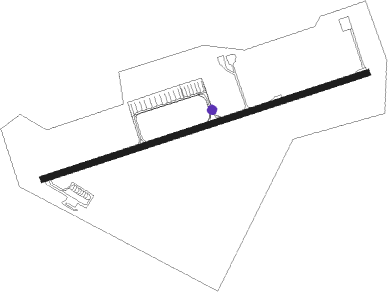
Nearby Points of Interest:
Benteng Fort Concordia
Nearby beacons
| code | identifier | dist | bearing | frequency |
|---|---|---|---|---|
| KPG | KUPANG VOR/DME | 0.6 | 97° | 112.20 |
| OEC | OECUSSI VOR/DME | 69.7 | 34° | 113.60 |
Departure and arrival routes
| Transition altitude | 11000ft |
| Transition level | 13000ft |
| SID end points | distance | outbound heading | |
|---|---|---|---|
| RW07 | |||
| MUBR1A | 128mi | 42° | |
| SPRI2A | 112mi | 94° | |
| ALEG2A | 90mi | 108° | |
| WGP1A | 202mi | 278° | |
| MOF1A | 125mi | 317° | |
| RW25 | |||
| MUBR1B | 128mi | 42° | |
| SPRI2B | 112mi | 94° | |
| ALEG2B | 90mi | 108° | |
| WGP1B | 202mi | 278° | |
| MOF1B | 125mi | 317° | |
| STAR starting points | distance | inbound heading | |
|---|---|---|---|
| RW07 | |||
| WGP1C | 201.9 | 98° | |
| MOF1C | 125.1 | 137° | |
| MUBR1C | 128.2 | 222° | |
| SPRI2C | 112.2 | 274° | |
| ALEG2C | 90.4 | 288° | |
| RW25 | |||
| WGP1D | 201.9 | 98° | |
| MOF1D | 125.1 | 137° | |
| MUBR1D | 128.2 | 222° | |
| SPRI2D | 112.2 | 274° | |
| ALEG2D | 90.4 | 288° | |
Instrument approach procedures
| runway | airway (heading) | route (dist, bearing) |
|---|---|---|
| RW07 | VIDUN (76°) | VIDUN 4500ft TT421 (5mi, 77°) 3000ft |
| RNAV | TT421 3000ft TT422 (5mi, 77°) 2000ft WATT (7mi, 75°) 385ft VIDUN (16mi, 256°) 4500ft VIDUN (turn) 4500ft | |
| RW25 | ESBOV (258°) | ESBOV 4000ft TT601 (4mi, 257°) 3000ft |
| RNAV | TT601 3000ft TT602 (5mi, 257°) 2000ft WATT (5mi, 259°) 385ft ESBOV (14mi, 78°) 4000ft ESBOV (turn) 4000ft |
Holding patterns
| STAR name | hold at | type | turn | heading* | altitude | leg | speed limit |
|---|---|---|---|---|---|---|---|
| ALEG2C | VIDUN | VHF | left | 255 (75)° | > 4500ft | 1.0min timed | ICAO rules |
| ALEG2D | ESBOV | VHF | right | 75 (255)° | > 4000ft | 1.0min timed | ICAO rules |
| MOF1C | VIDUN | VHF | left | 255 (75)° | > 4500ft | 1.0min timed | ICAO rules |
| MOF1D | ESBOV | VHF | right | 75 (255)° | > 4000ft | 1.0min timed | ICAO rules |
| MUBR1C | VIDUN | VHF | left | 255 (75)° | > 4500ft | 1.0min timed | ICAO rules |
| MUBR1D | ESBOV | VHF | right | 75 (255)° | > 4000ft | 1.0min timed | ICAO rules |
| SPRI2C | VIDUN | VHF | left | 255 (75)° | > 4500ft | 1.0min timed | ICAO rules |
| SPRI2D | ESBOV | VHF | right | 75 (255)° | > 4000ft | 1.0min timed | ICAO rules |
| WGP1C | VIDUN | VHF | left | 255 (75)° | > 4500ft | 1.0min timed | ICAO rules |
| WGP1D | ESBOV | VHF | right | 75 (255)° | > 4000ft | 1.0min timed | ICAO rules |
| *) magnetic outbound (inbound) holding course | |||||||
Disclaimer
The information on this website is not for real aviation. Use this data with the X-Plane flight simulator only! Data taken with kind consent from X-Plane 12 source code and data files. Content is subject to change without notice.