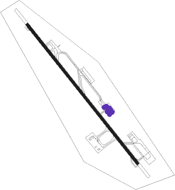
Labuan
Airport details
| Country | Malaysia |
| State | Labuan |
| Region | WB |
| Airspace | Kota Kinabalu Ctr |
| Municipality | Victoria |
| Elevation | 101ft (31m) |
| Timezone | GMT +8 |
| Coordinates | 5.30591, 115.24933 |
| Magnetic var | |
| Type | land |
| Available since | X-Plane v10.40 |
| ICAO code | WBKL |
| IATA code | LBU |
| FAA code | n/a |
Communication
| Labuan ATIS | 126.850 |
| Labuan Ground Control | 118.350 |
| Labuan Tower | 119.150 |
| Labuan Tower | 118.100 |
| Labuan Tower | 119.125 |
| Labuan Approach | 119.700 |
| Labuan Approach | 122.350 |
Approach frequencies
| ILS-cat-I | RW14 | 111.1 | 18.00mi |
| 3° GS | RW14 | 111.1 | 18.00mi |
Nearby beacons
| code | identifier | dist | bearing | frequency |
|---|---|---|---|---|
| VLB | LABUAN VOR/DME | 1.1 | 152° | 116.30 |
| LAB | LABUAN NDB | 1.4 | 151° | 260 |
| BR | BRUNEI NDB | 32 | 221° | 318 |
| BRU | BRUNEI VOR/DME | 33.8 | 220° | 112 |
| VLG | LIMBANG VOR/DME | 33.9 | 206° | 113.40 |
| JSL | KOTA KINABALU NDB | 58.9 | 53° | 400 |
| VJN | KOTA KINABALU VOR/DME | 58.9 | 53° | 113.10 |
| AKI | ANDUKI NDB | 66.3 | 232° | 250 |
Departure and arrival routes
| Transition altitude | 11000ft |
| Transition level | 13000ft |
| SID end points | distance | outbound heading | |
|---|---|---|---|
| RW14 | |||
| NOLO1R, NOLO1S | 59mi | 53° | |
| IDAT1S, IDAT1R | 76mi | 109° | |
| BRU1S, BRU1R | 26mi | 186° | |
| VLG1S, VLG1R | 34mi | 206° | |
| LAVE1S, LAVE1R | 34mi | 275° | |
| RW32 | |||
| NOLO1W, NOLO1U | 59mi | 53° | |
| IDAT1U, IDAT1W | 76mi | 109° | |
| BRU1U, BRU1W | 26mi | 186° | |
| VLG1U, VLG1W | 34mi | 206° | |
| LAVE1W, LAVE1U | 34mi | 275° | |
| STAR starting points | distance | inbound heading | |
|---|---|---|---|
| RW14 | |||
| BRU1P | 26.2 | 6° | |
| VLG1P | 33.9 | 26° | |
| LAVE1P | 34.3 | 95° | |
| NOLO1P | 58.9 | 233° | |
| IDAT1P | 75.7 | 289° | |
| RW32 | |||
| BRU1T | 26.2 | 6° | |
| VLG1T | 33.9 | 26° | |
| LAVE1T | 34.3 | 95° | |
| NOLO1T | 58.9 | 233° | |
| IDAT1T | 75.7 | 289° | |
Instrument approach procedures
| runway | airway (heading) | route (dist, bearing) |
|---|---|---|
| RW14-Z | KAPLA (44°) | KAPLA 4000ft BU733 (6mi, 348°) 3000ft BU703 (4mi, 29°) 1800ft SARAX (3mi, 108°) 900ft |
| RW14-Z | LAVED (95°) | LAVED 4000ft UKIBA (12mi, 98°) 4000ft BU703 (9mi, 71°) 1800ft SARAX (3mi, 108°) 900ft |
| RW14-Z | UKIBA (92°) | UKIBA 4000ft BU703 (9mi, 71°) 1800ft SARAX (3mi, 108°) 900ft |
| RNAV | SARAX 900ft WBKL (3mi, 143°) 154ft BU793 (4mi, 148°) BU795 (7mi, 232°) KAPLA (3mi, 319°) 4000ft | |
| RW32-Z | KAPLA (44°) | KAPLA 4000ft BU603 (4mi, 112°) 2900ft BU601 (1mi, 97°) 2500ft UPDIT (5mi, 24°) 900ft |
| RW32-Z | LAVED (95°) | LAVED 4000ft KAPLA (20mi, 111°) 4000ft BU603 (4mi, 112°) 2900ft BU601 (1mi, 97°) 2500ft UPDIT (5mi, 24°) 900ft |
| RW32-Z | RUPUB (48°) | RUPUB 4000ft BU601 (9mi, 83°) 2500ft UPDIT (5mi, 24°) 900ft |
| RNAV | UPDIT 900ft WBKL (3mi, 328°) 145ft BU692 (4mi, 324°) BU695 (6mi, 241°) KAPLA (6mi, 157°) 4000ft |
Holding patterns
| STAR name | hold at | type | turn | heading* | altitude | leg | speed limit |
|---|---|---|---|---|---|---|---|
| BRU1P | KAPLA | VHF | left | 155 (335)° | > 5500ft | 1.0min timed | 220 |
| LAVE1T | KAPLA | VHF | left | 155 (335)° | > 5500ft | 1.0min timed | 220 |
| NOLO1P | NOLOT | VHF | right | 52 (232)° | > 5500ft | 1.0min timed | 230 |
| NOLO1T | NOLOT | VHF | right | 52 (232)° | > 5500ft | 1.0min timed | 230 |
| VLG1P | KAPLA | VHF | left | 155 (335)° | > 5500ft | 1.0min timed | 220 |
| *) magnetic outbound (inbound) holding course | |||||||
Disclaimer
The information on this website is not for real aviation. Use this data with the X-Plane flight simulator only! Data taken with kind consent from X-Plane 12 source code and data files. Content is subject to change without notice.
