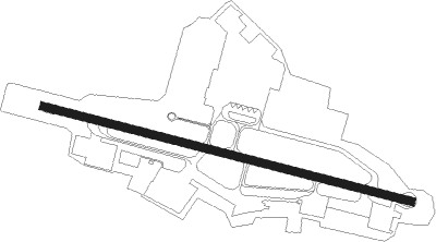
Bandung-java Island - Bandung Husein Sastranegara
Airport details
| Country | Indonesia |
| State | West Java |
| Region | WI |
| Airspace | Jakarta Ctr |
| Municipality | Bandung |
| Elevation | 2436ft (742m) |
| Timezone | GMT +7 |
| Coordinates | -6.90139, 107.57304 |
| Magnetic var | |
| Type | land |
| Available since | X-Plane v10.32 |
| ICAO code | WICC |
| IATA code | BDO |
| FAA code | n/a |
Communication
| Bandung Husein Sastranegara ATIS | 128.400 |
| Bandung Husein Sastranegara Bandung Approach Secondary | 119.650 |
| Bandung Husein Sastranegara Husein Tower | 118.650 |
| Bandung Husein Sastranegara Husein Tower Secondary | 122.700 |
| Bandung Husein Sastranegara Bandung Approach TCA | 121.000 |
Nearby beacons
| code | identifier | dist | bearing | frequency |
|---|---|---|---|---|
| YY | BANDUNG NDB | 1.2 | 293° | 205 |
| BND | BANDUNG VOR/DME | 3.8 | 288° | 117 |
| OY | BANDUNG NDB | 4.6 | 106° | 300 |
| PW | PURWAKARTA NDB | 21.4 | 340° | 250 |
| OZ | KALIJATI NDB | 22.1 | 17° | 385 |
| KTJ | MAJALENGKA VOR/DME | 38.6 | 67° | 112.10 |
| TM | TASIKMALAYA NDB | 48.1 | 123° | 391 |
| AS | ATANG SENDJAJA (BOGOR) NDB | 52.5 | 294° | 398 |
| AL | HALIM PERDANAKUSUMA (JAKARTA) NDB | 53 | 323° | 215 |
| HLM | HALIM PERDANAKUSUMA (JAKA VOR/DME | 55.7 | 313° | 113.30 |
| IMU | INDRAMAYU VOR/DME | 58 | 52° | 116.40 |
| PG | CIREBON NDB | 58.2 | 81° | 276 |
| CB | PONDOK CABE (JAKARTA) NDB | 58.9 | 305° | 225 |
| CA | CIREBON NDB | 60 | 78° | 365 |
| OB | JAKARTA NDB | 60.2 | 315° | 360 |
| TG | JAKARTA NDB | 63.6 | 317° | 275 |
| DKI | JAKARTA VOR/DME | 64.9 | 330° | 114.60 |
| CL | SOEKARNO-HATTA INTL (JAKARTA) NDB | 69.1 | 314° | 258 |
| CR | SOEKARNO-HATTA INTL (JAKARTA) NDB | 70.4 | 314° | 242 |
| BB | JAKARTA NDB | 71.6 | 322° | 310 |
| NW | NUSAWIRU (PANGANDARAN) NDB | 73.6 | 132° | 357 |
| GL | SOEKARNO-HATTA INTL (JAKARTA) NDB | 74.8 | 307° | 324 |
Departure and arrival routes
| Transition altitude | 11000ft |
| Transition level | 13000ft |
| SID end points | distance | outbound heading | |
|---|---|---|---|
| RW11 | |||
| PIA1E | 93mi | 86° | |
| CLP2, CLP1E | 98mi | 117° | |
| CKG1E | 76mi | 304° | |
| RW29 | |||
| PIA1W | 93mi | 86° | |
| CLP1, CLP1W | 98mi | 117° | |
| CKG1W | 76mi | 304° | |
| STAR starting points | distance | inbound heading | |
|---|---|---|---|
| ALL | |||
| CLP | 97.9 | 297° | |
| RW11 | |||
| HLM1A | 55.7 | 133° | |
| CLP1A | 97.9 | 297° | |
| RW29 | |||
| HLM1B | 55.7 | 133° | |
| CLP1B | 97.9 | 297° | |
Instrument approach procedures
| runway | airway (heading) | route (dist, bearing) |
|---|---|---|
| RW11 | ANDIK (109°) | ANDIK 4500ft DANIA (7mi, 109°) |
| RW11 | TARIS (49°) | TARIS 11000ft CC740 (5mi, 290°) CC742 (9mi, 339°) 6200ft DANIA (8mi, 68°) |
| RNAV | DANIA BAGOL (5mi, 109°) 4500ft WICC (7mi, 110°) 2495ft CC704 (12mi, 108°) TIGAN (9mi, 198°) CC700 (5mi, 287°) CC698 (turn) CC696 (12mi, 276°) TARIS (1mi, 283°) 11000ft TARIS (turn) 11000ft | |
| RW29 | BND (108°) | BND 8500ft CC556 (2mi, 114°) FAJAR (2mi, 124°) DARIP (9mi, 133°) NIBAS (5mi, 31°) |
| RW29 | KUSMA (301°) | KUSMA 6200ft CC542 (6mi, 292°) CC540 (4mi, 315°) CC538 (6mi, 339°) CC536 (2mi, 329°) CC534 (6mi, 319°) RIFKA (3mi, 304°) PRIMA (13mi, 289°) 5200ft NIBAS (8mi, 289°) |
| RW29 | MASET (260°) | MASET 7900ft CC514 (10mi, 257°) EKAVI (3mi, 238°) 4700ft CC510 (3mi, 219°) NIBAS (3mi, 254°) |
| RNAV | NIBAS ZUFKA (2mi, 289°) 4500ft WICC (7mi, 288°) 2456ft CC504 (1mi, 294°) CC502 (3mi, 269°) CC501 (8mi, 248°) CC500 (7mi, 1°) BND (9mi, 114°) 8500ft BND (turn) 8500ft |
Holding patterns
| STAR name | hold at | type | turn | heading* | altitude | leg | speed limit |
|---|---|---|---|---|---|---|---|
| CA1A | TARIS | VHF | left | 110 (290)° | 11000ft - 14000ft | 1.0min timed | 250 |
| CA1B | MASET | VHF | left | 77 (257)° | 7900ft - 14000ft | 1.0min timed | 230 |
| CLP1A | TARIS | VHF | left | 110 (290)° | 11000ft - 14000ft | 1.0min timed | 250 |
| CLP1B | KUSMA | VHF | left | 112 (292)° | 6200ft - 14000ft | 1.0min timed | 250 |
| HLM1B | BND | NDB | right | 294 (114)° | 8500ft - 14000ft | 1.0min timed | 230 |
| *) magnetic outbound (inbound) holding course | |||||||
Disclaimer
The information on this website is not for real aviation. Use this data with the X-Plane flight simulator only! Data taken with kind consent from X-Plane 12 source code and data files. Content is subject to change without notice.