Maimun Saleh
Airport details
| Country | Indonesia |
| State | Aceh |
| Region | WI |
| Airspace | Jakarta Ctr |
| Municipality | Sabang |
| Elevation | 393ft (120m) |
| Timezone | GMT +7 |
| Coordinates | 5.87667, 95.33500 |
| Magnetic var | |
| Type | land |
| Available since | X-Plane v10.40 |
| ICAO code | WITN |
| IATA code | n/a |
| FAA code | n/a |
Communication
| Maimun Saleh Saleh Info | 122.600 |
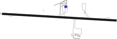
Runway info
| Runway 10 / 28 | ||
| length | 1845m (6053ft) | |
| bearing | 98° / 278° | |
| width | 32m (105ft) | |
| surface | asphalt | |
| blast zone | 38m (125ft) / 63m (207ft) | |
Nearby beacons
| code | identifier | dist | bearing | frequency |
|---|---|---|---|---|
| WE | SABANG NDB | 0.1 | 96° | 310 |
| BAC | BANDA ACEH VOR/DME | 21.8 | 166° | 113.40 |
Instrument approach procedures
| runway | airway (heading) | route (dist, bearing) |
|---|---|---|
| RW28 | SABAN (278°) | SABAN 3500ft |
| RNAV | SABAN 3500ft TN401 (5mi, 278°) 2000ft WITN (6mi, 279°) 400ft SABAN (11mi, 98°) 3500ft SABAN (turn) 3500ft |
Disclaimer
The information on this website is not for real aviation. Use this data with the X-Plane flight simulator only! Data taken with kind consent from X-Plane 12 source code and data files. Content is subject to change without notice.