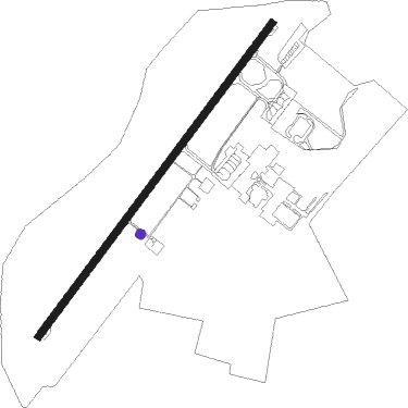
Ipoh - Ipoh/sultan Azlan Shah
Airport details
| Country | Malaysia |
| State | Perak |
| Region | WM |
| Airspace | Kuala Lumpur Ctr |
| Municipality | Ipoh |
| Elevation | 127ft (39m) |
| Timezone | GMT +8 |
| Coordinates | 4.56917, 101.09306 |
| Magnetic var | |
| Type | land |
| Available since | X-Plane v10.40 |
| ICAO code | WMKI |
| IATA code | IPH |
| FAA code | n/a |
Communication
| Ipoh/Sultan Azlan Shah IPOH Tower | 122.100 |
| Ipoh/Sultan Azlan Shah IPOH Tower | 121.600 |
Approach frequencies
| ILS-cat-I | RW04 | 110.5 | 18.00mi |
| 3° GS | RW04 | 110.5 | 18.00mi |
Nearby beacons
| code | identifier | dist | bearing | frequency |
|---|---|---|---|---|
| VIH | IPOH VOR/DME | 0.2 | 11° | 117.30 |
| VPG | PENANG VOR/DME | 65.5 | 310° | 116.20 |
| VBT | BUTTERWORTH VORTAC | 68.7 | 322° | 113.30 |
Departure and arrival routes
| Transition altitude | 11000ft |
| Transition level | 13000ft |
| SID end points | distance | outbound heading | |
|---|---|---|---|
| RW22 | |||
| LUTM1B, LUTM1D | 48mi | 164° | |
| DUDA1B, DUDA1D | 49mi | 170° | |
| AGRE1B, AGRE1D | 66mi | 310° | |
| STAR starting points | distance | inbound heading | |
|---|---|---|---|
| RW04 | |||
| MARD1G | 58.9 | 4° | |
| TEPU1G, TEPU1E | 31.2 | 40° | |
| MINO1E, MINO1G | 65.5 | 130° | |
| SOTR1G, SOTR1E | 99.1 | 143° | |
| NITI1G, NITI1E | 105.6 | 157° | |
| TUVS1G, TUVS1E | 120.5 | 163° | |
| MARD1E | 47.8 | 344° | |
Disclaimer
The information on this website is not for real aviation. Use this data with the X-Plane flight simulator only! Data taken with kind consent from X-Plane 12 source code and data files. Content is subject to change without notice.
