Malacca
Airport details
| Country | Malaysia |
| State | Malacca |
| Region | WM |
| Airspace | Kuala Lumpur Ctr |
| Municipality | Hang Tuah Jaya Municipal Council |
| Elevation | 35ft (11m) |
| Timezone | GMT +8 |
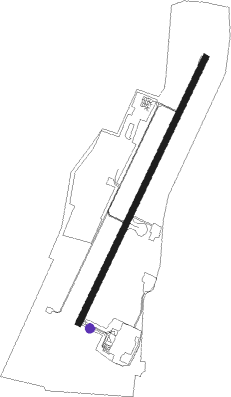
| Coordinates | 2.26306, 102.25250 |
| Magnetic var | |
| Type | land |
| Available since | X-Plane v10.40 |
| ICAO code | WMKM |
| IATA code | MKZ |
| FAA code | n/a |
Communication
| Malacca Ground Control | 121.600 |
| Malacca Tower | 118.000 |
Approach frequencies
| ILS-cat-I | RW03 | 111.7 | 18.00mi |
| 3° GS | RW03 | 111.7 | 18.00mi |
Nearby Points of Interest:
Malacca
Nearby beacons
| code | identifier | dist | bearing | frequency |
|---|---|---|---|---|
| VMK | MALACCA VOR/DME | 0.4 | 233° | 117.40 |
| VKL | KUALA LUMPUR VOR/DME | 41.4 | 312° | 116.10 |
| VSP | SEPANG VOR/DME | 45.7 | 310° | 114.40 |
| DM | PINANG KAMPAI (DUMAI) NDB | 60.5 | 232° | 343 |
Departure and arrival routes
| Transition altitude | 11000ft |
| Transition level | 13000ft |
| SID end points | distance | outbound heading | |
|---|---|---|---|
| RW03 | |||
| RUSB1Q, RUSB2Q | 21mi | 133° | |
| OGAK1Q, OGAK2Q | 20mi | 147° | |
| DOSI2Q, DOSI1Q | 32mi | 203° | |
| SAPA1Q, SAPA2Q | 21mi | 322° | |
| IRMI2Q, IRMI1Q | 74mi | 330° | |
| RW21 | |||
| RUSB2R, RUSB1R | 21mi | 133° | |
| OGAK2R, OGAK1R | 20mi | 147° | |
| DOSI2R, DOSI1R | 32mi | 203° | |
| SAPA1R, SAPA2R | 21mi | 322° | |
| IRMI2R, IRMI1R | 74mi | 330° | |
| STAR starting points | distance | inbound heading | |
|---|---|---|---|
| RW03 | |||
| DOSI1S, DOSI2S | 32.4 | 23° | |
| VELT1S | 17.7 | 92° | |
| DUMO1S, DUMO2S | 15.0 | 98° | |
| INTU1S | 11.9 | 117° | |
| VELT2S, INTU2S | 30.2 | 123° | |
| AKRU1S | 37.0 | 266° | |
| AKRU2S | 69.5 | 276° | |
| GUPT2S, GUPT1S | 24.1 | 284° | |
| RW21 | |||
| DOSI2T, DOSI1T | 32.4 | 23° | |
| DUMO1T, DUMO2T | 15.0 | 98° | |
| VELT1T, VELT2T, INTU2T, INTU1T | 30.2 | 123° | |
| AKRU2T, AKRU1T | 69.5 | 276° | |
| GUPT2T, GUPT1T | 24.1 | 284° | |
Instrument approach procedures
| runway | airway (heading) | route (dist, bearing) |
|---|---|---|
| RW03 | EMRUN (5°) | EMRUN 4000ft KAGPA (6mi, 300°) 3000ft KM509 (5mi, 30°) 1600ft |
| RW03 | KAGPA (30°) | KAGPA 3000ft KM509 (5mi, 30°) 1600ft |
| RW03 | OMKER (55°) | OMKER 4000ft KAGPA (6mi, 120°) 3000ft KM509 (5mi, 30°) 1600ft |
| RNAV | KM509 1600ft FF03 (3mi, 30°) 1600ft WMKM (5mi, 31°) 74ft (6140mi, 269°) 1500ft IRMOV (6143mi, 89°) 5000ft IRMOV (turn) 5000ft | |
| RW21 | KM507 (180°) | KM507 3300ft NIVOB (6mi, 120°) 2100ft |
| RW21 | KM508 (240°) | KM508 3300ft NIVOB (6mi, 300°) 2100ft |
| RNAV | NIVOB 2100ft FR21 (3mi, 210°) 2100ft WMKM (7mi, 209°) 90ft (6140mi, 269°) 1500ft RUVEX (6147mi, 89°) 5000ft RUVEX (turn) 5000ft |
Disclaimer
The information on this website is not for real aviation. Use this data with the X-Plane flight simulator only! Data taken with kind consent from X-Plane 12 source code and data files. Content is subject to change without notice.