Osoyoos
Airport details
| Country | Canada |
| State | British Columbia |
| Region | CY |
| Airspace | Vancouver Ctr |
| Municipality | Osoyoos |
| Elevation | 1100ft (335m) |
| Timezone | GMT -8 |
| Coordinates | 49.03722, -119.48889 |
| Magnetic var | |
| Type | land |
| Available since | X-Plane v10.40 |
| ICAO code | XC0076 |
| IATA code | n/a |
| FAA code | n/a |
Communication
| Osoyoos CTAF | 123.200 |
Nearby Points of Interest:
Lost Lake Guard Station
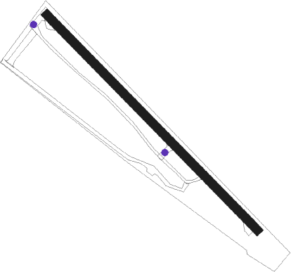
Runway info
| Runway 12 / 30 | ||
| length | 774m (2539ft) | |
| bearing | 128° / 308° | |
| width | 23m (75ft) | |
| surface | asphalt | |
Nearby beacons
| code | identifier | dist | bearing | frequency |
|---|---|---|---|---|
| ON | OKANAGAN (PENTICTON) NDB | 18.6 | 345° | 356 |
| YYF | PENTICTON NDB | 27.4 | 346° | 290 |
| UNT | NARAMATA (PENTICTON) NDB | 33.9 | 349° | 312 |
| YDC | PRINCETON VOR/DME | 40.4 | 291° | 113.90 |
| YWB | WESTBANK (KELOWNA) NDB | 46.7 | 350° | 389 |
| EX | RUTLAND (KELOWNA) NDB | 54.3 | 7° | 374 |
Disclaimer
The information on this website is not for real aviation. Use this data with the X-Plane flight simulator only! Data taken with kind consent from X-Plane 12 source code and data files. Content is subject to change without notice.