Stirling
Airport details
| Country | Canada |
| State | Ontario |
| Region | CY |
| Airspace | Toronto Ctr |
| Municipality | Quinte West |
| Elevation | 625ft (190m) |
| Timezone | GMT -5 |
| Coordinates | 44.24139, -77.56167 |
| Magnetic var | |
| Type | land |
| Available since | X-Plane v10.40 |
| ICAO code | XC007T |
| IATA code | n/a |
| FAA code | n/a |
Communication
Nearby Points of Interest:
Belleville City Hall
-Glanmore House
-Carrying Place
-Havelock railway station
-Tara Hall
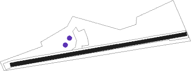
Runway info
Runway 08W / 26-W-  | ||
| length | 9023286m (29603957ft) | |
| bearing | 120° / 300° | |
| width | 15m (50ft) | |
| surface | grass | |
| Runway 08 / 26 | ||
| length | 287m (942ft) | |
| bearing | 86° / 266° | |
| width | 14m (45ft) | |
| surface | asphalt | |
Nearby beacons
| code | identifier | dist | bearing | frequency |
|---|---|---|---|---|
| UTR | TRENTON TACAN | 7.3 | 165° | 109.70 |
| YTR | TRENTON NDB | 7.4 | 107° | 215 |
| YCF | DME | 8.2 | 303° | 113.50 |
| ZZR | SEVERN (TRENTON) NDB | 11.6 | 199° | 317 |
| VIE | COEHILL VOR/DME | 28.8 | 322° | 115.10 |
| YPQ | PETERBOROUGH NDB | 38.8 | 268° | 379 |
| YGK | KINGSTON NDB | 41.2 | 87° | 263 |
Disclaimer
The information on this website is not for real aviation. Use this data with the X-Plane flight simulator only! Data taken with kind consent from X-Plane 12 source code and data files. Content is subject to change without notice.