Orono - Orono Hawkefield
Airport details
| Country | Canada |
| State | Ontario |
| Region | CY |
| Airspace | Toronto Ctr |
| Municipality | Clarington |
| Elevation | 620ft (189m) |
| Timezone | GMT -5 |
| Coordinates | 44.00226, -78.64883 |
| Magnetic var | |
| Type | land |
| Available since | X-Plane v10.40 |
| ICAO code | XC0083 |
| IATA code | n/a |
| FAA code | n/a |
Communication
Nearby Points of Interest:
Cream of Barley Mill
-George Manning Furby House
-Whitby Junction station
-Victoria Hall
-Uxbridge railway station
-Bead Hill archaeological site
-Lebovic Centre for Arts & Entertainment – Nineteen on the Park
-Markham Village Town Hall
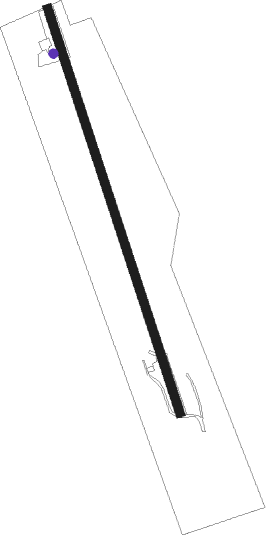
Runway info
| Runway 16 / 34 | ||
| length | 1205m (3953ft) | |
| bearing | 161° / 341° | |
| width | 24m (80ft) | |
| surface | grass | |
Nearby beacons
| code | identifier | dist | bearing | frequency |
|---|---|---|---|---|
| YO | DME-ILS | 11.4 | 251° | 111.35 |
| OO | OSHAWA NDB | 11.9 | 252° | 391 |
| YPQ | PETERBOROUGH NDB | 14.9 | 41° | 379 |
| YSO | DME | 26.6 | 294° | 117.35 |
| KZ | BUTTONVILLE NDB | 29.6 | 264° | 248 |
| TZ | GIBRALTAR POINT NDB | 39.5 | 242° | 257 |
| YCF | DME | 45.2 | 71° | 113.50 |
| ZYZ | QUEENSWAY (TORONTO) NDB | 45.2 | 247° | 368 |
| YYZ | TORONTO VOR/DME | 47.3 | 251° | 112.15 |
| VIE | COEHILL VOR/DME | 51.3 | 49° | 115.10 |
| IA | KATHI (NIAGRA FALLS) NDB | 54.2 | 192° | 329 |
| IAG | NIAGARA FALLS TACAN | 55.1 | 199° | 111 |
| SN | ST CATHARINES NDB | 57.7 | 215° | 408 |
| ROC | ROCHESTER VOR/DME | 68 | 132° | 110 |
Disclaimer
The information on this website is not for real aviation. Use this data with the X-Plane flight simulator only! Data taken with kind consent from X-Plane 12 source code and data files. Content is subject to change without notice.