Omemee
Airport details
| Country | Canada |
| State | Ontario |
| Region | CY |
| Airspace | Toronto Ctr |
| Municipality | Kawartha Lakes |
| Elevation | 838ft (255m) |
| Timezone | GMT -5 |
| Coordinates | 44.28556, -78.62752 |
| Magnetic var | |
| Type | land |
| Available since | X-Plane v10.40 |
| ICAO code | XC0085 |
| IATA code | n/a |
| FAA code | n/a |
Communication
Nearby Points of Interest:
Cream of Barley Mill
-Uxbridge railway station
-George Manning Furby House
-Canal Lake Concrete Arch Bridge
-Victoria Hall
-Whitby Junction station
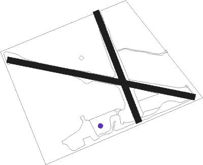
Runway info
Runway 10 / 28  | ||
| length | 475m (1558ft) | |
| bearing | 101° / 281° | |
| width | 15m (50ft) | |
| surface | grass | |
| Runway 16 / 34 | ||
| length | 290m (951ft) | |
| bearing | 157° / 337° | |
| width | 15m (50ft) | |
| surface | grass | |
Nearby beacons
| code | identifier | dist | bearing | frequency |
|---|---|---|---|---|
| YPQ | PETERBOROUGH NDB | 8.3 | 114° | 379 |
| YSO | DME | 23.5 | 265° | 117.35 |
| YO | DME-ILS | 24.6 | 215° | 111.35 |
| OO | OSHAWA NDB | 24.8 | 217° | 391 |
| KZ | BUTTONVILLE NDB | 36.9 | 243° | 248 |
| VIE | COEHILL VOR/DME | 38.8 | 63° | 115.10 |
| YCF | DME | 39.7 | 87° | 113.50 |
| TZ | GIBRALTAR POINT NDB | 52 | 228° | 257 |
| ZYZ | QUEENSWAY (TORONTO) NDB | 56.4 | 234° | 368 |
Disclaimer
The information on this website is not for real aviation. Use this data with the X-Plane flight simulator only! Data taken with kind consent from X-Plane 12 source code and data files. Content is subject to change without notice.