Baldwin - Baldwin West
Airport details
| Country | Canada |
| State | Ontario |
| Region | CY |
| Airspace | Toronto Ctr |
| Municipality | Georgina |
| Elevation | 750ft (229m) |
| Timezone | GMT -5 |
| Coordinates | 44.27750, -79.36158 |
| Magnetic var | |
| Type | land |
| Available since | X-Plane v10.32 |
| ICAO code | XC008B |
| IATA code | n/a |
| FAA code | n/a |
Communication
Nearby Points of Interest:
Sutton radial station
-The Briars
-Queensville Radial Station
-Newmarket Railway Station
-Old Newmarket Town Hall and Courthouse
-Uxbridge railway station
-Lebovic Centre for Arts & Entertainment – Nineteen on the Park
-Orillia Railway Station
-Canal Lake Concrete Arch Bridge
-Shift
-Richmond Hill railway station
-Kinghorn Methodist Episcopal Cemetery
-Markham Village Town Hall
-David Dunlap Observatory
-Markham Civic Centre
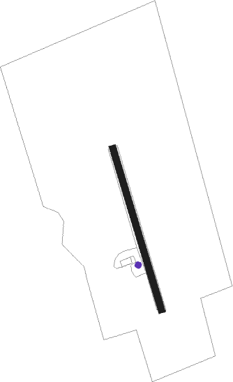
Runway info
| Runway 16 / 34 | ||
| length | 580m (1903ft) | |
| bearing | 163° / 343° | |
| width | 23m (75ft) | |
| surface | grass | |
Nearby beacons
| code | identifier | dist | bearing | frequency |
|---|---|---|---|---|
| YSO | DME | 8.4 | 102° | 117.35 |
| KZ | BUTTONVILLE NDB | 20.7 | 175° | 248 |
| YEE | MIDLAND VOR/DME | 26 | 305° | 112.80 |
| OO | OSHAWA NDB | 29.2 | 128° | 391 |
| YO | DME-ILS | 29.7 | 127° | 111.35 |
| YMS | MANS (MANSFIELD) VOR/DME | 34.7 | 260° | 114.50 |
| ZTO | WOODHILL (TORONTO) NDB | 35.5 | 212° | 403 |
| YTP | PEARSON (TORONTO) VOR/DME | 38.6 | 207° | 116.55 |
| YPQ | PETERBOROUGH NDB | 38.8 | 94° | 379 |
| YYZ | TORONTO VOR/DME | 38.9 | 204° | 112.15 |
| TZ | GIBRALTAR POINT NDB | 39.9 | 182° | 257 |
| ZYZ | QUEENSWAY (TORONTO) NDB | 40.3 | 196° | 368 |
| ZKF | WELLINGTON (KITCHENER) NDB | 61.8 | 230° | 335 |
Disclaimer
The information on this website is not for real aviation. Use this data with the X-Plane flight simulator only! Data taken with kind consent from X-Plane 12 source code and data files. Content is subject to change without notice.