Rm Of Brokenhead - Beausejour/av-ranch Airpark
Airport details
| Country | Canada |
| State | Manitoba |
| Region | CY |
| Airspace | Winnipeg Ctr |
| Municipality | Rural Municipality of Brokenhead |
| Elevation | 798ft (243m) |
| Timezone | GMT -6 |
| Coordinates | 50.04201, -96.58965 |
| Magnetic var | |
| Type | land |
| Available since | X-Plane v11.10 |
| ICAO code | XCAV6 |
| IATA code | n/a |
| FAA code | n/a |
Communication
| Beausejour/AV-Ranch Airpark Unicom | 123.200 |
Nearby Points of Interest:
Red River Floodway
-Oak Hammock Marsh
-Ukrainian Labour Temple
-St. Vital Historical Society
-The Forks, Winnipeg
-Confederation Building
-Union Bank Building
-Birks Building
-Burton Cummings Theatre
-Metropolitan Theatre
-Manitoba Legislative Building
-Granite Curling Club
-Cornish Library
-Minto Armoury
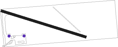
Runway info
| Runway 11 / 29 | ||
| length | 610m (2001ft) | |
| bearing | 104° / 284° | |
| width | 18m (60ft) | |
| surface | grass | |
Nearby beacons
| code | identifier | dist | bearing | frequency |
|---|---|---|---|---|
| ZWG | STONEY (WINNIPEG) NDB | 24.5 | 265° | 287 |
| ZHT | FORKS (WINNIPEG) NDB | 24.8 | 249° | 236 |
| YWG | WINNIPEG VORTAC | 26 | 260° | 115.50 |
| BM | BALMORAL NDB | 28.3 | 278° | 375 |
| ZWN | DOWNS (WINNIPEG) NDB | 28.6 | 264° | 201 |
| ZWW | BOINE (WINNIPEG) NDB | 28.7 | 252° | 215 |
| WG | WINNIPEG NDB | 30.5 | 259° | 248 |
| LF | LA SALLE NDB | 36.5 | 241° | 336 |
| M4 | GIMLI NDB | 40 | 323° | 296 |
Disclaimer
The information on this website is not for real aviation. Use this data with the X-Plane flight simulator only! Data taken with kind consent from X-Plane 12 source code and data files. Content is subject to change without notice.