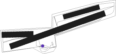
Büren - Bueren
Airport details
| Country | Germany |
| State | North Rhine-Westphalia |
| Region | |
| Airspace | Langen Ctr |
| Municipality | Büren |
| Elevation | 909ft (277m) |
| Timezone | GMT +1 |
| Coordinates | 51.54189, 8.57576 |
| Magnetic var | |
| Type | land |
| Available since | X-Plane v10.40 |
| ICAO code | XED000Z |
| IATA code | n/a |
| FAA code | n/a |
Communication
| Bueren Bueren Info | 133.430 |
Nearby beacons
| code | identifier | dist | bearing | frequency |
|---|---|---|---|---|
| PAD | DME-ILS | 4.4 | 32° | 108.50 |
| PAD | PADERBORN-LIPPSTADT NDB | 5.4 | 38° | 354 |
| WRB | WARBURG VOR/DME | 20.1 | 94° | 113.70 |
| DKS | DME-ILS | 31.8 | 98° | 111.50 |
| GMH | GERMINGHAUSEN VOR/DME | 33.9 | 241° | 115.40 |
| DWI | DORTMUND-WICKEDE NDB | 35.1 | 269° | 357 |
| DOR | WICKEDE (DORTMUND) VOR/DME | 35.3 | 269° | 108.65 |
| HMM | HAMM VOR/DME | 37.4 | 290° | 115.65 |
| OSB | OSNABRUCK TACAN | 40.9 | 336° | 108.35 |
| OSN | OSNABRUECK VOR | 40.9 | 336° | 114.30 |
| FTZ | FRITZLAR NDB | 41.8 | 119° | 468 |
| MYN | MUENSTER/OSNABRUECK NDB | 46.9 | 309° | 371 |
| MOD | DME | 48.6 | 304° | 114.05 |
| BYC | BUECKEBURG NDB | 48.8 | 35° | 368 |
| SLD | DME | 53.5 | 211° | 108.05 |
| SIL | SIEGERLAND NDB | 54.3 | 207° | 489 |
| COL | COLA VOR/DME | 58.6 | 232° | 108.80 |
| WUN | WUNSTORF TACAN | 63.2 | 43° | 114.85 |
| HW | HANNOVER NDB | 66.2 | 46° | 358 |
| FUL | FULDA VOR/DME | 68.3 | 134° | 112.10 |
Disclaimer
The information on this website is not for real aviation. Use this data with the X-Plane flight simulator only! Data taken with kind consent from X-Plane 12 source code and data files. Content is subject to change without notice.

