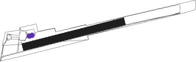
Langenbrettach - Baumerlenbach
Airport details
| Country | Germany |
| State | Baden-Württemberg |
| Region | |
| Airspace | Langen Ctr |
| Municipality | Langenbrettach |
| Elevation | 756ft (230m) |
| Timezone | GMT +1 |
| Coordinates | 49.23120, 9.42259 |
| Magnetic var | |
| Type | land |
| Available since | X-Plane v10.40 |
| ICAO code | XEDAS |
| IATA code | n/a |
| FAA code | n/a |
Communication
| Baumerlenbach Baumerlenbach Info | 118.115 |
Nearby Points of Interest:
Spital Öhringen
-Saint Luke Church
-Grabkapelle der Freiherren von Ellrichshausen
-Gasthaus zum Ochsen (Eschenau)
-Holy Trinity Chapel
-Gasthaus zum Adler
-Baukelter Weinsberg
-Taharahaus
-Doppelt versteinte Hällische Straße
-Wartberg-Gasthaus (Heilbronn)
-Bildstock Aschhäuser Weg (Oberkessach)
-Wartbergsteige (Heilbronn)
-Katharinenstift
-Villa Fuchs (Heilbronn)
-Pfühlstraße 51
-Villa Racher
-Synagogue (Sennfeld)
-Karlstraße 82
-Kernerstraße 60
-Haller Straße 3
-Altes Wasserwerk
-Karlstraße 72
-Bismarckstraße 67
-Bismarckstraße 61
-Bismarckstraße 54
Nearby beacons
| code | identifier | dist | bearing | frequency |
|---|---|---|---|---|
| SHD | HALL DME | 15.5 | 108° | 108.05 |
| LBU | LUBURG VOR/DME | 19.3 | 195° | 109.20 |
| NDD | DME-ILS | 23.2 | 73° | 108.70 |
| NSN | NIEDERSTETTEN NDB | 23.4 | 73° | 311 |
| NKR | NECKAR NDB | 27.7 | 279° | 292 |
| DKB | DINKELSBUEHL VORTAC | 32.4 | 96° | 117.80 |
| STG | STUTTGART VOR/DME | 32.7 | 197° | 116.85 |
| SGD | DME | 33.5 | 200° | 115.45 |
| KRH | KARLSRUHE VOR/DME | 35.9 | 254° | 115.95 |
| TGO | TANGO TACAN | 37.3 | 195° | 112.50 |
| MND | DME | 38.2 | 285° | 113.55 |
| ILM | ILLESHEIM NDB | 40.4 | 76° | 488 |
| CHA | CHARLIE VOR/DME | 44 | 331° | 115.35 |
| RID | RIED VOR/DME | 47.6 | 302° | 112.20 |
| VFM | NAUHEIM VOR | 57.4 | 308° | 113.75 |
| FR | FRANKFURT NDB | 57.7 | 318° | 297 |
| FFM | FRANKFURT VORTAC | 58 | 316° | 114.20 |
| FRD | DME | 58.3 | 313° | 115.90 |
| SUL | SULZ VOR | 59.5 | 222° | 116.10 |
| FW | FRANKFURT NDB | 60.4 | 308° | 382 |
Disclaimer
The information on this website is not for real aviation. Use this data with the X-Plane flight simulator only! Data taken with kind consent from X-Plane 12 source code and data files. Content is subject to change without notice.