Wiesenthau - Dobenreuth
Airport details
| Country | Germany |
| State | Bavaria |
| Region | |
| Airspace | Munich Ctr |
| Municipality | Pinzberg |
| Elevation | 1064ft (324m) |
| Timezone | GMT +1 |
| Coordinates | 49.69726, 11.14012 |
| Magnetic var | |
| Type | land |
| ICAO code | XEDBK |
| IATA code | n/a |
| FAA code | n/a |
Communication
| Dobenreuth Dobenreuth Info | 123.805 |
Nearby Points of Interest:
Rathaus
-Burgruine
-Tanzlinde
-Torwache
-Pfalz
-Kasberger Linde
-Burgstall Altes Schloss
-Rüssenbach Castle
-Egloffsteiner Felsenkeller
-Wasserfall bei Äpfelbach
-Evangelisch-lutherisches Pfarrhaus
-Burgstall Altes Schloss (Affalterthal)
-Burgstall Thüngfelderstein
-Augustinerchorherrenstift Neunkirchen am Brand
-Rathaus in Ebermannstadt
-Amtsgericht
-Wolkenstein Castle
-Bürgerhaus
-Kirche
-Pfarrkirche
-Burgstall Dörnhof
-St. Jakobus (Marloffstein)
-Ehemaliges Gasthaus Zum Schloss
-Kleinseebacher Mühle
-Burgstall Bieberbach
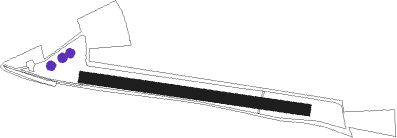
Runway info
| Runway 10 / 28 | ||
| length | 473m (1552ft) | |
| bearing | 98° / 278° | |
| width | 24m (79ft) | |
| surface | grass | |
Nearby beacons
| code | identifier | dist | bearing | frequency |
|---|---|---|---|---|
| ERL | ERLANGEN VOR/DME | 2.5 | 166° | 114.90 |
| NGD | DME | 12 | 197° | 113.10 |
| NUB | NUERNBERG VOR/DME | 12.3 | 208° | 115.75 |
| RTB | ROETHENBACH NDB | 13.6 | 152° | 415 |
| BAY | BAYREUTH VOR | 25.8 | 60° | 110.60 |
| ANS | ANSBACH NDB | 30.6 | 233° | 452 |
| GRF | GRAFENWOHR TACAN | 31 | 90° | 111.80 |
| GRW | GRAFENWOHR NDB | 31.1 | 90° | 405 |
| ILM | ILLESHEIM NDB | 32.2 | 253° | 488 |
| HFX | HOHENFELS NDB | 40.1 | 124° | 286 |
| DKB | DINKELSBUEHL VORTAC | 48.4 | 238° | 117.80 |
| NEU | NEUBURG TACAN | 59.2 | 176° | 108.90 |
| IGL | INGOLSTADT NDB | 60.9 | 152° | 345 |
| IGL | INGOLSTADT TACAN | 61.1 | 156° | 111.40 |
Disclaimer
The information on this website is not for real aviation. Use this data with the X-Plane flight simulator only! Data taken with kind consent from X-Plane 12 source code and data files. Content is subject to change without notice.