Airports for X-Plane offers a convenient way to explore airports and their related communication information for the X-Plane flight simulator. It only uses data from the X-Plane flight simulator itself, and is therefore more reliable than the data that comes from real aviation websites. You can search for airports by using the ICAO code, or browse for airports per country and state. The information displayed is categorized by airport details, runway information, airport communication, approach frequencies (ILS and Glidepath details), details of nearby beacons, SIDs, STARs and approach procedures.

runway port seaplane hospital airport terminal air safety passengers grass airfield train international taxi stol pilot drome flights tarmac embassy public transport warfare

Weißensberg - Wildberg/lindau

Airport details

CountryGermany
StateBavaria
Region
AirspaceMunich Ctr
MunicipalityWeißensberg
Elevation1722ft (525m)
TimezoneGMT +1
Coordinates47.59796, 9.74005
Magnetic var
Typeland
Available sinceX-Plane v10.40
ICAO codeXEDGY
IATA coden/a
FAA coden/a

Communication

Wildberg/Lindau Wildberg Info118.550
Nearby Points of Interest:
Pfarrkirche hl. Martin
-
rectory
-
Heilig-Geist-Spital
-
Pfarrkirche Hl. Ulrich
-
Lindavia-Brunnen
-
brauereigasthof reiner
-
Luitpold-Kaserne in Lindau
-
Ulrichskapelle
-
Ansitz Wellenstein
-
Kleindenkmal Langer Stein
-
Villa Gravenreuth
-
Klausturm (Lochau Vbg)
-
Villa Mauthe
-
Neue Schanze in Lochau Vbg
-
Bilgeri-Kaserne
-
Höhere Technische Lehranstalt Bregenz
-
St. Wendelin, Fluh
-
Rathaus Bregenz
-
Magazin 4
-
Weinstube Kinz (Bregenz)
-
Ansitz Blumenegg
-
Kirchstraße 18 (Bregenz)
-
Ehregutaplatz 1

Runway info

Runway 03 / 21
 length480m (1575ft)
 bearing38° / 218°
 width20m (66ft)
 surfacegrass
 displ threshold105m (344ft) / 0m (0ft)

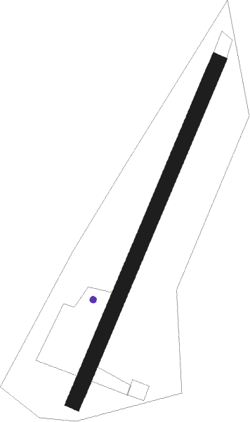
Airport layout - parking location Grass


Parking locations

Nearby beacons

codeidentifierdistbearingfrequency
FHDDME10.3286°112.60
KPTKEMPTEN VOR/DME26.276°108.40
ALD(MEMMINGEN/ALLGAU) DME30.751°117.20
ALGALLGAEU (MEMMINGEN) NDB31.953°341
ZUEZURICH EAST VOR/DME37.3270°110.05
LUPLAUPHEIM NDB37.815°407
WFJDME45.9176°113.75

Disclaimer

The information on this website is not for real aviation. Use this data with the X-Plane flight simulator only! Data taken with kind consent from X-Plane 12 source code and data files. Content is subject to change without notice.