Borne Sulinowo
Airport details
| Country | Poland |
| State | West Pomeranian Voivodeship |
| Region | |
| Airspace | Warsaw Ctr |
| Municipality | Borne Sulinowo |
| Elevation | 466ft (142m) |
| Timezone | GMT +1 |
| Coordinates | 53.57598, 16.52574 |
| Magnetic var | |
| Type | land |
| Available since | X-Plane v11.05 |
| ICAO code | XEPBS |
| IATA code | n/a |
| FAA code | n/a |
Communication
| Borne Sulinowo RADIO | 123.450 |
Nearby Points of Interest:
Castle of the Pomeranian Dukes in Szczecinek
-Bismarck tower in Okonek
-Czaplinek town hall
-Kościół Podwyższenia Krzyża Świętego w Czaplinku
-Church of the Ascension of Christ in Łomczewo
-Saint Stanislaus church in Węgorzewo
-Kościół Narodzenia Najświętszej Maryi Panny w Karsiborze
-Zamek w Czarnem
-Palace in Białowąs
-Town hall in Wałcz
-Castle in Złocieniec
-Kościół św. Jakuba Apostoła w Bronikowie
-Palace in Darskowo
-Immaculate Conception church in Mirosławiec
-Relicts of Mirosławiec Castle
-Saint Catherine of Alexandria church in Marcinkowice
-Church of the Assumption of Mary in Bobolice
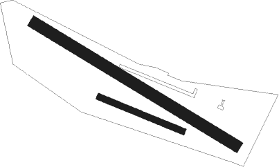
Runway info
Runway 11 / 29  | ||
| length | 234m (768ft) | |
| bearing | 107° / 287° | |
| width | 16m (54ft) | |
| surface | asphalt | |
| Runway 13 / 31 | ||
| length | 612m (2008ft) | |
| bearing | 113° / 293° | |
| width | 30m (99ft) | |
| surface | grass | |
Nearby beacons
| code | identifier | dist | bearing | frequency |
|---|---|---|---|---|
| CZA | DME | 9 | 253° | 117 |
| NA | MIROSLAWIEC NDB | 18.8 | 245° | 297 |
| TMI | MIROSLAWIEC TACAN | 19.3 | 249° | 115.35 |
| ND | SWIDWIN NDB | 26.8 | 287° | 280 |
| TSN | SWIDWIN TACAN | 26.9 | 287° | 116 |
| TZE | DME | 42.7 | 41° | 113.80 |
| TDA | DARLOWO TACAN | 50.1 | 349° | 116.85 |
| DAR | DARLOWO VOR/DME | 50.3 | 351° | 114.20 |
| S | DARLOWO NDB | 50.6 | 349° | 436 |
| SA | DARLOWO NDB | 51.6 | 351° | 474 |
| DRE | DME | 51.9 | 222° | 115.30 |
Disclaimer
The information on this website is not for real aviation. Use this data with the X-Plane flight simulator only! Data taken with kind consent from X-Plane 12 source code and data files. Content is subject to change without notice.