Old Fig Garden - Sierra Sky Park
Airport details
| Country | United States of America |
| State | California |
| Region | |
| Airspace | Oakland Ctr |
| Municipality | Fresno |
| Elevation | 318ft (97m) |
| Timezone | GMT -8 |
| Coordinates | 36.84245, -119.87257 |
| Magnetic var | |
| Type | land |
| Available since | X-Plane v10.40 |
| ICAO code | XKE79 |
| IATA code | n/a |
| FAA code | n/a |
Communication
Nearby Points of Interest:
Einstein House
-Fresno Bee Building
-San Joaquin Light and Power Corporation Building
-Bank of Italy
-Southern Pacific Depot
-Fresno Municipal Sanitary Landfill
-Fort Miller
-Fowler
-Orange Cove Santa Fe Railway Depot
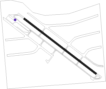
Runway info
| Runway 12 / 30 | ||
| length | 754m (2474ft) | |
| bearing | 126° / 306° | |
| width | 15m (50ft) | |
| surface | asphalt | |
| displ threshold | 27m (89ft) / 27m (89ft) | |
Nearby beacons
| code | identifier | dist | bearing | frequency |
|---|---|---|---|---|
| CZQ | CLOVIS (FRESNO) VORTAC | 3.7 | 54° | 112.90 |
| FRA | FRIANT VORTAC | 20.5 | 47° | 115.60 |
| NLC | NAVY LEMOORE TACAN | 30.2 | 191° | 113.30 |
| HYP | EL NIDO (MERCED) VOR/DME | 33.9 | 306° | 114.20 |
| VIS | VISALIA VOR/DME | 34.1 | 141° | 109.40 |
| PXN | PANOCHE VORTAC | 44.2 | 262° | 112.60 |
| TTE | TULE VOR/DME | 69.3 | 137° | 109.20 |
Disclaimer
The information on this website is not for real aviation. Use this data with the X-Plane flight simulator only! Data taken with kind consent from X-Plane 12 source code and data files. Content is subject to change without notice.