Airports for X-Plane offers a convenient way to explore airports and their related communication information for the X-Plane flight simulator. It only uses data from the X-Plane flight simulator itself, and is therefore more reliable than the data that comes from real aviation websites. You can search for airports by using the ICAO code, or browse for airports per country and state. The information displayed is categorized by airport details, runway information, airport communication, approach frequencies (ILS and Glidepath details), details of nearby beacons, SIDs, STARs and approach procedures.

bus road airplane city downtown grass air safety nearby gravel seaplane kennedy drome air traffic control airline arriving commuter helicopters helipad airbase international airport

Orenburg - Kushkul'

Airport details

CountryRussian Federation
StateOrenburg Oblast
RegionUW
AirspaceSamara Ctr
MunicipalityТатаро-Каргалинский сельсовет
Elevation294ft (90m)
TimezoneGMT +5
Coordinates51.90646, 55.16314
Magnetic var
Typeland
Available sinceX-Plane v10.40
ICAO codeXU001A
IATA coden/a
FAA coden/a

Communication

Kushkul' Sakmara-start121.300
Nearby Points of Interest:
Yurov mill
-
Water tower
-
Orenburgskiĭ istoriko-kraevedcheskiĭ muzeĭ
-
House of the Soviets
-
House of the Congress of magistrates
-
Gostiny Dvor (Orenburg)
-
Church of the Intercession of Our Lady in Orenburg
-
Military prison, Orenburg
-
Former Theological School, Orenburg

Runway info

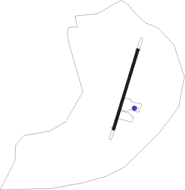
Runway 01 / 19
 length776m (2546ft)
 bearing33° / 213°
 width25m (82ft)
 surfacedirt

Airport layout - parking location 1


Parking locations

Nearby beacons

codeidentifierdistbearingfrequency
WPORENBURG NDB10.4117°415
WORENBURG NDB11.6113°843
ORNORENBURG VOR/DME12.5111°113.60
LORENBURG NDB13.8109°843
LMORENBURG NDB15.3107°415

Disclaimer

The information on this website is not for real aviation. Use this data with the X-Plane flight simulator only! Data taken with kind consent from X-Plane 12 source code and data files. Content is subject to change without notice.