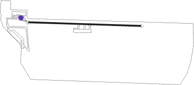
Suzhou - Chenghu
Airport details
| Country | China |
| State | Jiangsu |
| Region | |
| Airspace | Shanghai Ctr |
| Municipality | Suzhou City |
| Elevation | 0ft (0m) |
| Timezone | GMT +8 |
| Coordinates | 31.21577, 120.78685 |
| Magnetic var | |
| Type | land |
| ICAO code | XZ0011 |
| IATA code | n/a |
| FAA code | n/a |
Communication
Nearby beacons
| code | identifier | dist | bearing | frequency |
|---|---|---|---|---|
| CGT | CHONGGU VOR/DME | 20.8 | 91° | 112.50 |
| SUF | SHUOFANG VOR/DME | 24.8 | 309° | 114.10 |
| NXD | NANXUN VOR/DME | 26.5 | 228° | 116.50 |
| PK | NANXIANG NDB | 28.1 | 83° | 208 |
| SHA | HONGQIAO VOR/DME | 28.1 | 89° | 117.20 |
| JTN | JIUTING VOR/DME | 29 | 99° | 109.60 |
| VMB | WUXI VOR/DME | 43.9 | 312° | 113.90 |
| PDL | LIUZAO VOR/DME | 45.7 | 96° | 109.40 |
| W | XINGDONG (NANTONG) NDB | 50.9 | 13° | 425 |
| PUD | PUDONG VOR/DME | 51.2 | 93° | 116.90 |
| NTG | NANTONG VOR/DME | 53.9 | 12° | 115.60 |
| HGH | HANGZHOU VOR/DME | 60.9 | 199° | 113 |
| AND | ANDONG VOR/DME | 61.8 | 156° | 114.80 |
| CJ | JIANQIAO NDB | 63.3 | 214° | 324 |
Disclaimer
The information on this website is not for real aviation. Use this data with the X-Plane flight simulator only! Data taken with kind consent from X-Plane 12 source code and data files. Content is subject to change without notice.

