Amberley
Airport details
| Country | Australia |
| State | Queensland |
| Region | YB |
| Airspace | Brisbane Ctr |
| Municipality | Ipswich City |
| Elevation | 89ft (27m) |
| Timezone | GMT +10 |
| Coordinates | -27.63689, 152.70853 |
| Magnetic var | |
| Type | land |
| Available since | X-Plane v10.40 |
| ICAO code | YAMB |
| IATA code | n/a |
| FAA code | n/a |
Communication
| Amberley AMBERLEY DEL | 134.600 |
| Amberley AMBERLEY Ground Control | 129.350 |
| Amberley AMBERLEY Tower | 118.300 |
| Amberley AMBERLEY Departure | 118.300 |
Approach frequencies
| ILS-cat-I | RW15 | 110.7 | 18.00mi |
| 3° GS | RW15 | 110.7 | 18.00mi |
Nearby Points of Interest:
Sadliers Crossing Railway Bridge
-Sandstone Railway Culvert, Wulkuraka
-Ipswich Mental Hospital
-Notnel
-Penrhyn
-Old Ipswich Courthouse
-Ipswich Club House
-St Mary's Roman Catholic Church, Ipswich
-Ipswich Town Hall
-Railway Signal Cabin and Turntable, Ipswich
-Bremer River Rail Bridge
-Heiner Road Railway Overpass
-North Ipswich Railway Workshops
-Fairy Knoll
-James Sangster Memorial
-Queensland Woollen Manufacturing Company mill
-Garowie
-Sandstone Railway Culvert, North Ipswich
-Mihi Creek heritage site
-Klondyke Coke Ovens
-Ipswich Railway Workshops War Memorial
-Kyeewa
-Booval House
-Wright Family Houses
-United Welsh Church, Blackstone
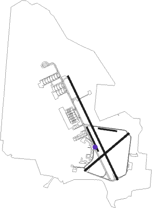
Runway info
Runway 10 / 28  | ||
| length | 477m (1565ft) | |
| bearing | 102° / 282° | |
| width | 35m (115ft) | |
| surface | grass | |
| Runway 15 / 33 | ||
| length | 3055m (10023ft) | |
| bearing | 156° / 336° | |
| width | 46m (151ft) | |
| surface | asphalt | |
| blast zone | 63m (207ft) / 73m (240ft) | |
| Runway 04 / 22 | ||
| length | 1524m (5000ft) | |
| bearing | 57° / 237° | |
| width | 46m (151ft) | |
| surface | asphalt | |
| Runway 15R / 33L | ||
| length | 690m (2264ft) | |
| bearing | 156° / 336° | |
| width | 34m (112ft) | |
| surface | grass | |
Nearby beacons
| code | identifier | dist | bearing | frequency |
|---|---|---|---|---|
| AMB | AMBERLEY TACAN | 0.4 | 121° | 108.10 |
| BML | BROMELTON NDB | 22.2 | 150° | 374 |
| BN | BRISBANE VOR/DME | 28.1 | 58° | 113.20 |
| CG | GOLD COAST NDB | 52.6 | 124° | 278 |
| CG | GOLD COAST VOR/DME | 52.9 | 124° | 112.30 |
| OK | OAKEY NDB | 53.3 | 283° | 254 |
| OK | OAKEY VOR/DME | 53.6 | 284° | 112.90 |
Departure and arrival routes
| Transition altitude | 10000ft |
| Transition level | 11000ft |
| SID end points | distance | outbound heading | |
|---|---|---|---|
| RW15 | |||
| TATEN1 | 52mi | 191° | |
| BOBOP4 | 95mi | 218° | |
| MESED4 | 49mi | 291° | |
| JEDDA4 | 50mi | 302° | |
| RW33 | |||
| TATEN1 | 52mi | 191° | |
| BOBOP4 | 95mi | 218° | |
| MESED4 | 49mi | 291° | |
| JEDDA4 | 50mi | 302° | |
Instrument approach procedures
| runway | airway (heading) | route (dist, bearing) |
|---|---|---|
| RW04 | AMBWJ (56°) | AMBWJ 5100ft AMBWI (5mi, 58°) 3530ft |
| RW04 | AMBWN (76°) | AMBWN 5100ft AMBWI (5mi, 121°) 3530ft |
| RNAV | AMBWI 3530ft AMBWF (5mi, 57°) 1830ft AMBWM (5mi, 57°) 136ft (8524mi, 280°) 600ft AMBWH (8531mi, 100°) (8531mi, 280°) 5100ft | |
| RW15 | AMBND (180°) | AMBND 3800ft AMBNI (5mi, 232°) 3330ft |
| RW15 | AMBNE (157°) | AMBNE 3800ft AMBNI (5mi, 156°) 3330ft |
| RW15 | AMBNG (136°) | AMBNG 3800ft AMBNI (5mi, 89°) 3330ft |
| RNAV | AMBNI 3330ft AMBNF (5mi, 156°) 1730ft AMBNM (5mi, 156°) 142ft AMBNH (7mi, 156°) (8522mi, 280°) 5100ft | |
| RW33 | AMBSK (350°) | AMBSK 3400ft AMBSI (3mi, 353°) 3320ft |
| RW33 | AMBSL (14°) | AMBSL 5100ft AMBSI (5mi, 66°) 3320ft |
| RNAV | AMBSI 3320ft AMBSF (4mi, 353°) 2050ft AMBSM (5mi, 353°) 459ft (8524mi, 280°) 600ft (turn) 3800ft |
Disclaimer
The information on this website is not for real aviation. Use this data with the X-Plane flight simulator only! Data taken with kind consent from X-Plane 12 source code and data files. Content is subject to change without notice.