Brisbane - Archerfield
Airport details
| Country | Australia |
| State | Queensland |
| Region | YB |
| Airspace | Brisbane Ctr |
| Municipality | Brisbane City |
| Elevation | 62ft (19m) |
| Timezone | GMT +10 |
| Coordinates | -27.56938, 153.00137 |
| Magnetic var | |
| Type | land |
| Available since | X-Plane v10.32 |
| ICAO code | YBAF |
| IATA code | ACF |
| FAA code | n/a |
Communication
| Archerfield YBAF ATIS | 120.900 |
| Archerfield ACHERFIELD MULT | 118.100 |
| Archerfield ACTIVATE LIGHTS ONLY MULT | 125.100 |
| Archerfield ARCHER Ground Control | 119.900 |
| Archerfield ARCHER Tower | 123.600 |
| Archerfield ARCHER Tower | 118.100 |
| Archerfield BRISBANE Approach | 125.600 |
Nearby Points of Interest:
Acacia Ridge Air Raid Shelter
-Archerfield Second World War Igloos Complex
-Oxley War Memorial
-Monkton
-Berry and MacFarlane Monument
-Yeronga Fire Station
-Sinnamon Farm
-Sinnamon Memorial Uniting Church
-Como, Yeronga
-Rhyndarra
-John Mills' residence
-Beth-Eden
-Graceville Memorial Park
-Chelmer Police College
-Greylands, Indooroopilly
-Chapel of St Peter's Lutheran College
-Annerley Army Reserve Depot
-Langer House
-Tighnabruaich, Indooroopilly
-Combined Services Detailed Interrogation Centre, Brisbane
-St Andrews Church Hall
-Fulton Residence
-Union College, University of Queensland
-Keating residence, Indooroopilly
-Hefferan Park Air Raid Shelter
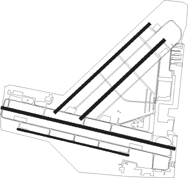
Runway info
Runway 10L / 28R  | ||
| length | 1711m (5614ft) | |
| bearing | 106° / 286° | |
| width | 30m (98ft) | |
| surface | asphalt | |
| displ threshold | 150m (492ft) / 210m (689ft) | |
| Runway 10R / 28L | ||
| length | 1100m (3609ft) | |
| bearing | 106° / 286° | |
| width | 17m (56ft) | |
| surface | asphalt | |
| Runway 04R / 22L | ||
| length | 1100m (3609ft) | |
| bearing | 55° / 235° | |
| width | 30m (100ft) | |
| surface | grass | |
| Runway 04L / 22R | ||
| length | 1245m (4085ft) | |
| bearing | 55° / 235° | |
| width | 30m (98ft) | |
| surface | grass | |
| displ threshold | 0m (0ft) / 290m (951ft) | |
Nearby beacons
| code | identifier | dist | bearing | frequency |
|---|---|---|---|---|
| BN | BRISBANE VOR/DME | 14.2 | 34° | 113.20 |
| AMB | AMBERLEY TACAN | 15.7 | 256° | 108.10 |
| BML | BROMELTON NDB | 24.4 | 194° | 374 |
| CG | GOLD COAST NDB | 44.5 | 140° | 278 |
| CG | GOLD COAST VOR/DME | 44.8 | 140° | 112.30 |
| SU | SUNSHINE COAST VOR/DME | 58.5 | 5° | 114.20 |
| SU | SUNSHINE COAST NDB | 58.8 | 5° | 380 |
Instrument approach procedures
| runway | airway (heading) | route (dist, bearing) |
|---|---|---|
| RW10LY | BAFWE (105°) | BAFWE 3400ft BAFWI (4mi, 106°) 2500ft |
| RNAV | BAFWI 2080ft BAFWF (3mi, 106°) 1100ft YBAF (3mi, 104°) 93ft BAFWT (2mi, 110°) BAFWH (6mi, 139°) 1500ft (8539mi, 280°) 3400ft | |
| RW10LZ | BAFWD (82°) | BAFWD 3400ft BAFWI (4mi, 41°) 2500ft |
| RW10LZ | BAFWE (105°) | BAFWE 3400ft BAFWI (4mi, 106°) 2500ft |
| RW10LZ | BAFWG (129°) | BAFWG 3800ft BAFWI (6mi, 155°) 2500ft |
| RNAV | BAFWI 2080ft BAFWF (3mi, 106°) 1100ft YBAF (3mi, 104°) 93ft BAFWT (2mi, 110°) BAFWH (6mi, 139°) 1500ft (8539mi, 280°) 3400ft | |
| RW28R | BAFEA (265°) | BAFEA 3400ft BAFEI (5mi, 221°) 2850ft |
| RW28R | BAFEB (286°) | BAFEB 3400ft BAFEI (5mi, 286°) 2850ft |
| RW28R | BAFEC (308°) | BAFEC 3400ft BAFEI (5mi, 357°) 2850ft |
| RNAV | BAFEI 2850ft BAFEF (4mi, 286°) 1570ft BAFEM (4mi, 286°) 301ft BAFEH (4mi, 286°) (8537mi, 280°) 3800ft |
Disclaimer
The information on this website is not for real aviation. Use this data with the X-Plane flight simulator only! Data taken with kind consent from X-Plane 12 source code and data files. Content is subject to change without notice.