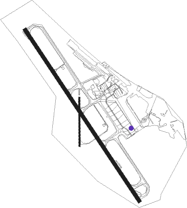
Gold Coast - Gold Coast Intl
Airport details
| Country | Australia |
| State | Queensland |
| Region | YB |
| Airspace | Brisbane Ctr |
| Municipality | Gold Coast City |
| Elevation | 20ft (6m) |
| Timezone | GMT +10 |
| Coordinates | -28.16632, 153.50867 |
| Magnetic var | |
| Type | land |
| Available since | X-Plane v10.40 |
| ICAO code | YBCG |
| IATA code | OOL |
| FAA code | n/a |
Communication
| Gold Coast Intl ATIS | 134.500 |
| Gold Coast Intl Gold Coast Delivery | 128.750 |
| Gold Coast Intl Gold Coast Ground | 121.800 |
| Gold Coast Intl Gold Coast Tower | 118.700 |
| Gold Coast Intl Brisbane Center | 119.500 |
Approach frequencies
| ILS-cat-I | RW14 | 111.1 | 18.00mi |
| 3° GS | RW14 | 111.1 | 18.00mi |
Nearby Points of Interest:
Currumbin Wildlife Sanctuary
-Tallebudgera Post Office
-Queensland Korean War Memorial
-Schmidt Farmhouse
-Kinkabool
-Murwillumbah railway station
-Southport Cable Hut
-Springbrook Road
-Main Beach Pavilion and Southport Surf Lifesaving Club
-Springbrook National Park
-Springbrook State School
-Southport Drill Hall
-Southport State High School Buildings
-Numinbah Nature Reserve
-H2 Hinde Tree
-Ernest Junction Railway Tunnel
-Binna Burra Cultural Landscape
-Wollumbin National Park
-Lahey's Canungra Tramway Tunnel
-Lahey's Canungra Sawmill Complex
-Lamington National Park
-Dux Hut
-Laurel Hill Farmhouse
-Tamborine Mountain Road
-Canning Downs
Nearby beacons
| code | identifier | dist | bearing | frequency |
|---|---|---|---|---|
| CG | GOLD COAST VOR/DME | 0.2 | 240° | 112.30 |
| CG | GOLD COAST NDB | 0.4 | 281° | 278 |
| BML | BROMELTON NDB | 34.3 | 288° | 374 |
| BNA | BALLINA NDB | 40.2 | 175° | 206 |
| BN | BRISBANE VOR/DME | 51.9 | 335° | 113.20 |
| AMB | AMBERLEY TACAN | 52.5 | 304° | 108.10 |
Departure and arrival routes
| Transition altitude | 10000ft |
| Transition level | 11000ft |
| SID end points | distance | outbound heading | |
|---|---|---|---|
| RW14 | |||
| APAGI5, CUDGN3 | 64mi | 234° | |
| RW32 | |||
| APAGI5, BURLI4 | 64mi | 234° | |
| STAR starting points | distance | inbound heading | |
|---|---|---|---|
| RW14 | |||
| BERN1Y | 40.4 | 4° | |
| LAMS1A, LAMS1Y | 39.8 | 292° | |
| BERN1A, BERN1V | 22.1 | 345° | |
| RW32 | |||
| LAMS1Y, LAMS1A | 39.8 | 292° | |
| BERN1V, BERN1A | 22.1 | 345° | |
Instrument approach procedures
| runway | airway (heading) | route (dist, bearing) |
|---|---|---|
| RW14-W | VAPMU (197°) | VAPMU 2500ft CG017 (2mi, 230°) 2500ft |
| RNAV | CG017 2500ft CG018 (3mi, 230°) 1670ft CG332 (2mi, 189°) 870ft YBCG (3mi, 146°) 71ft CG151 (8mi, 148°) 3000ft | |
| RW14-Y | KERRI (263°) | KERRI 3300ft CG045 (5mi, 318°) 3300ft |
| RNAV | CG045 3300ft CG004 (4mi, 287°) 2000ft CG332 (3mi, 206°) 870ft YBCG (3mi, 146°) 71ft CG151 (8mi, 148°) 3000ft | |
| RW14-Z | KEGAN (208°) | KEGAN 4000ft OOLNI (6mi, 269°) 2780ft |
| RW14-Z | OOLNC (170°) | OOLNC 4000ft OOLNI (5mi, 181°) 2780ft |
| RNAV | OOLNI 2780ft OOLNF (5mi, 181°) 1190ft YBCG (4mi, 146°) 71ft OOLNH (2mi, 150°) (8533mi, 280°) 3000ft | |
| RW32-X | FIKUL (328°) | FIKUL 4000ft CG411 (3mi, 327°) 4000ft |
| RNAV | CG411 4000ft CG412 (6mi, 327°) 2000ft YBCG (6mi, 328°) 63ft CG450 (3mi, 326°) CG460 (3mi, 350°) CG470 (5mi, 13°) 3000ft | |
| RW32-Y | ATKEN (307°) | ATKEN CG421 (3mi, 297°) 2500ft |
| RNAV | CG421 2500ft CG422 (4mi, 297°) 1360ft CG440 (2mi, 312°) YBCG (3mi, 329°) 63ft CG450 (3mi, 326°) CG460 (3mi, 350°) CG470 (5mi, 13°) 3000ft | |
| RW32-Z | FIKUL (328°) | FIKUL 4000ft OOLSI (5mi, 327°) 3250ft |
| RW32-Z | OOLSA (306°) | OOLSA 4000ft OOLSI (5mi, 262°) 3250ft |
| RW32-Z | OOLSC (355°) | OOLSC 5100ft OOLSI (6mi, 44°) 3250ft |
| RNAV | OOLSI 3250ft OOLSF (5mi, 327°) 1660ft YBCG (5mi, 328°) 63ft OOLSH (8mi, 4°) (8539mi, 280°) 3000ft |
Disclaimer
The information on this website is not for real aviation. Use this data with the X-Plane flight simulator only! Data taken with kind consent from X-Plane 12 source code and data files. Content is subject to change without notice.

