Townsville - Townsville Intl
Airport details
| Country | Australia |
| State | Queensland |
| Region | YB |
| Airspace | Brisbane Ctr |
| Municipality | Townsville |
| Elevation | 18ft (5m) |
| Timezone | GMT +10 |
| Coordinates | -19.25250, 146.76527 |
| Magnetic var | |
| Type | land |
| Available since | X-Plane v10.40 |
| ICAO code | YBTL |
| IATA code | TSV |
| FAA code | n/a |
Communication
| Townsville Intl ATIS | 114.100 |
| Townsville Intl AWIS | 133.500 |
| Townsville Intl TOWNSVILLE Traffic | 118.300 |
| Townsville Intl TOWNSVILLE Delivery | 128.100 |
| Townsville Intl TOWNSVILLE Ground | 121.800 |
| Townsville Intl TOWNSVILLE Tower | 118.300 |
| Townsville Intl TOWNSVILLE Departure | 126.800 |
Approach frequencies
| ILS-cat-I | RW01 | 109.3 | 18.00mi |
| 3° GS | RW01 | 109.3 | 18.00mi |
Nearby Points of Interest:
Kardinia, Townsville
-Lion Brewery, Townsville
-Rosebank
-Second Townsville General Hospital
-Old Townsville Railway Station
-Australian Mutual Provident Society Building
-Townsville Post Office
-Samuel Allen & Sons Building
-Aplin Brown & Company Building
-Agora House
-Atkinson & Powell Building
-Tobruk Memorial Baths
-Australian Joint Stock Bank Building, Townsville
-Burns Philp Building, Townsville
-Bank of New South Wales Building, Townsville
-St John's Anglican Church, South Townsville
-Cape Pallarenda Quarantine Station
-Ross River Meatworks Chimney
-Picnic Bay State School
-St Brigid's Church, Stuart
-Stewart's Creek Gaol
-Bowling Green Bay National Park
-Range Hotel site
-Little Crystal Creek Bridge
-Fantome Island Lock Hospital and Lazaret Sites
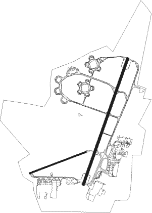
Runway info
Runway 07 / 25  | ||
| length | 1104m (3622ft) | |
| bearing | 75° / 255° | |
| width | 30m (98ft) | |
| surface | asphalt | |
| Runway 01 / 19 | ||
| length | 2449m (8035ft) | |
| bearing | 25° / 205° | |
| width | 45m (148ft) | |
| surface | asphalt | |
Nearby beacons
| code | identifier | dist | bearing | frequency |
|---|---|---|---|---|
| TVL | TOWNSVILLE NDB | 0.3 | 332° | 276 |
| TL | TOWNSVILLE VOR/DME | 0.6 | 319° | 114.10 |
| TVL | TOWNSVILLE TACAN | 2 | 221° | 113.50 |
Departure and arrival routes
| Transition altitude | 10000ft |
| Transition level | 11000ft |
| SID end points | distance | outbound heading | |
|---|---|---|---|
| RW01 | |||
| SWIFT1 | 54mi | 2° | |
| WALTA1, MAGGY2 | 54mi | 118° | |
| JEMMA2 | 42mi | 143° | |
| ANRUB1 | 44mi | 185° | |
| CATEY1 | 42mi | 253° | |
| CARMN1 | 37mi | 308° | |
| PEWEE6 | 81mi | 349° | |
| RW19 | |||
| SWIFT1 | 54mi | 2° | |
| WALTA1 | 54mi | 118° | |
| RURTO1 | 17mi | 122° | |
| KVALM1, JEMMA2 | 42mi | 143° | |
| ANRUB1 | 44mi | 185° | |
| CATEY1 | 42mi | 253° | |
| PEWEE6 | 81mi | 349° | |
| STAR starting points | distance | inbound heading | |
|---|---|---|---|
| RW01 | |||
| IBUX1A | 36.7 | 156° | |
| SPAR1A | 78.0 | 156° | |
| PORO1A, PORO1P | 35.0 | 309° | |
| VOMP1A, VOMP1P | 34.2 | 346° | |
| RW19 | |||
| IBUX1Z | 36.7 | 156° | |
| PORO1Z, PORO1P, PORO1B | 35.0 | 309° | |
| VOMP1B, VOMP1P, VOMP1Z | 34.2 | 346° | |
Instrument approach procedures
| runway | airway (heading) | route (dist, bearing) |
|---|---|---|
| RW01-P | GUGAN (340°) | GUGAN 5200ft KIRAN (3mi, 290°) 4900ft |
| RNAV | KIRAN 4900ft TL788 (3mi, 289°) 4200ft TL780 (4mi, 313°) 3100ft ESDAM (3mi, 2°) 2100ft YBTL (7mi, 24°) 67ft TL790 (2mi, 30°) TL670 (2mi, 25°) TL793 (3mi, 60°) WESTY (11mi, 93°) 3000ft | |
| RW01-Z | FREDY (54°) | FREDY 4000ft GOTSI (7mi, 106°) 3600ft |
| RW01-Z | KIRAN (351°) | KIRAN 5200ft GOTSI (7mi, 292°) 3600ft |
| RW01-Z | SATCO (25°) | SATCO 4000ft GOTSI (2mi, 25°) 3600ft |
| RNAV | GOTSI 3600ft TSVSF (5mi, 25°) 2140ft YBTL (7mi, 24°) 68ft TSVSH (3mi, 28°) (8539mi, 277°) 3000ft | |
| RW07-Z | SARGA (93°) | SARGA 4700ft TSVWI (5mi, 153°) 3990ft |
| RW07-Z | TSVWA (57°) | TSVWA 4700ft TSVWI (5mi, 4°) 3990ft |
| RW07-Z | TSVWB (75°) | TSVWB 4700ft TSVWI (5mi, 75°) 3990ft |
| RNAV | TSVWI 3990ft VEBTO (5mi, 75°) 2400ft TSVWM (6mi, 75°) 492ft (8535mi, 277°) 520ft TSVWH (8539mi, 97°) (8539mi, 277°) 3000ft | |
| RW19-P | VILUN (272°) | VILUN 5200ft TL688 (3mi, 333°) 4000ft TL684 (3mi, 302°) 4000ft BIXAX (3mi, 272°) 3200ft |
| RNAV | BIXAX 3200ft TL671 (3mi, 272°) 2400ft AGVIT (3mi, 272°) 1400ft TL670 (2mi, 240°) 700ft YBTL (3mi, 207°) 62ft TL679 (3mi, 203°) TL690 (3mi, 231°) TL694 (7mi, 185°) TL699 (5mi, 114°) TL809 (6mi, 58°) TL819 (6mi, 359°) TL829 (2mi, 18°) TL839 (5mi, 37°) TL849 (3mi, 65°) WESTY (2mi, 92°) WESTY (turn) 5000ft | |
| RW19-Z | ADNOD (188°) | ADNOD 3000ft TSVNI (5mi, 133°) 3000ft |
| RW19-Z | LEBOT (223°) | LEBOT 3000ft TSVNI (4mi, 274°) 3000ft |
| RW19-Z | TSVNE (206°) | TSVNE 3000ft TSVNI (5mi, 205°) 3000ft |
| RNAV | TSVNI 3000ft TSVNF (4mi, 205°) 2300ft TSVNM (7mi, 205°) 223ft (8539mi, 277°) 520ft TSVNH (8530mi, 97°) (8530mi, 277°) 4700ft |
Disclaimer
The information on this website is not for real aviation. Use this data with the X-Plane flight simulator only! Data taken with kind consent from X-Plane 12 source code and data files. Content is subject to change without notice.