Wenlock - Batavia Downs
Airport details
| Country | Australia |
| State | Queensland |
| Region | YB |
| Airspace | Brisbane Ctr |
| Municipality | Cook Shire |
| Elevation | 282ft (86m) |
| Timezone | GMT +10 |
| Coordinates | -12.65956, 142.67139 |
| Magnetic var | |
| Type | land |
| Available since | X-Plane v10.40 |
| ICAO code | YBTV |
| IATA code | BVW |
| FAA code | n/a |
Communication
Nearby Points of Interest:
Wenlock Goldfield
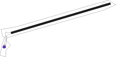
Runway info
| Runway 7 / 25 | ||
| length | 906m (2972ft) | |
| bearing | 78° / 258° | |
| width | 18m (59ft) | |
| surface | dirt | |
Nearby beacons
| code | identifier | dist | bearing | frequency |
|---|---|---|---|---|
| SGR | SCHERGER TACAN | 34.2 | 274° | 113.30 |
| LHR | LOCKHART RIVER NDB | 37.8 | 102° | 392 |
| WP | WEIPA VOR/DME | 43.8 | 269° | 112.80 |
| WP | WEIPA NDB | 45.2 | 270° | 377 |
Disclaimer
The information on this website is not for real aviation. Use this data with the X-Plane flight simulator only! Data taken with kind consent from X-Plane 12 source code and data files. Content is subject to change without notice.