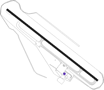
Wellcamp - Brisbane West Wellcamp
Airport details
| Country | Australia |
| State | Queensland |
| Region | YB |
| Airspace | Brisbane Ctr |
| Municipality | Toowoomba |
| Elevation | 1506ft (459m) |
| Timezone | GMT +10 |
| Coordinates | -27.55861, 151.79417 |
| Magnetic var | |
| Type | land |
| Available since | X-Plane v10.40 |
| ICAO code | YBWW |
| IATA code | WTB |
| FAA code | n/a |
Communication
| Brisbane West Wellcamp CTAF | 127.650 |
Nearby Points of Interest:
Westbrook Homestead
-Westbrook War Memorial
-St Matthew's Anglican Church, Drayton
-O'Shea's Drayton Cottage
-Weetwood, Toowoomba
-Ascot House
-Tor, Toowoomba
-Concordia College Administration Centre
-Smithfield House
-Oak Lodge and Spreydon
-Elphin, Newtown
-Baillie Henderson Hospital
-Toowoomba Hospital
-Cottage
-Toowoomba Maltings
-Tawa, Toowoomba
-Kensington, Toowoomba
-Clifford House, Toowoomba
-Vacy Hall
-Wislet
-St James Parish Hall, Toowoomba
-St James Church, Toowoomba
-The Downs Co-operative Dairy Association Limited Factory
-Carlton House, Toowoomba
-Men's Toilet, Russell Street, Toowoomba
Nearby beacons
| code | identifier | dist | bearing | frequency |
|---|---|---|---|---|
| OK | OAKEY NDB | 8.7 | 337° | 254 |
| OK | OAKEY VOR/DME | 10 | 340° | 112.90 |
| AMB | AMBERLEY TACAN | 49.3 | 95° | 108.10 |
Departure and arrival routes
| Transition altitude | 10000ft |
| Transition level | 11000ft |
| SID end points | distance | outbound heading | |
|---|---|---|---|
| RW12 | |||
| MESED1 | 15mi | 14° | |
| WOODY1 | 38mi | 62° | |
| PARRY1 | 32mi | 108° | |
| UPMOG1 | 27mi | 174° | |
| LOFFA1 | 87mi | 261° | |
| RW30 | |||
| MESED1 | 15mi | 14° | |
| WOODY1 | 38mi | 62° | |
| PARRY1 | 32mi | 108° | |
| UPMOG1 | 27mi | 174° | |
| LOFFA1 | 87mi | 261° | |
Instrument approach procedures
| runway | airway (heading) | route (dist, bearing) |
|---|---|---|
| RW12-X | AKVEM (93°) | AKVEM WW400 (7mi, 94°) 4200ft WW410 (5mi, 49°) 4200ft |
| RW12-X | UDERI (51°) | UDERI WW400 (8mi, 343°) 4200ft WW410 (5mi, 49°) 4200ft |
| RNAV | WW410 4200ft WW420 (4mi, 89°) 2900ft YBWW (5mi, 130°) 1486ft WW430 (2mi, 127°) WW440 (4mi, 153°) WW450 (6mi, 179°) 4200ft | |
| RW12-Y | OMBAS (103°) | OMBAS 4200ft BONRU (7mi, 63°) 4200ft |
| RNAV | BONRU 4200ft LUGDO (5mi, 129°) 3000ft WW2NM (4mi, 129°) 1727ft WW2NH (6mi, 208°) (8485mi, 280°) 4200ft | |
| RW12-Z | OMBAS (103°) | OMBAS 4200ft WW2NI (5mi, 96°) 4200ft |
| RW12-Z | WW2ND (84°) | WW2ND 4200ft WW2NI (5mi, 29°) 4200ft |
| RNAV | WW2NI 4200ft WW2NF (5mi, 96°) 2700ft WW2NM (3mi, 115°) 1722ft WW2NH (6mi, 208°) (8485mi, 280°) 4200ft | |
| RW30 | WW2SB (309°) | WW2SB 6000ft WW2SI (5mi, 309°) 4750ft |
| RW30 | WW2SC (331°) | WW2SC 6000ft WW2SI (5mi, 25°) 4750ft |
| RNAV | WW2SI 4750ft WW2SF (5mi, 309°) 3110ft YBWW (5mi, 308°) 1559ft WW2SH (6mi, 218°) (8485mi, 280°) 4200ft |
Disclaimer
The information on this website is not for real aviation. Use this data with the X-Plane flight simulator only! Data taken with kind consent from X-Plane 12 source code and data files. Content is subject to change without notice.