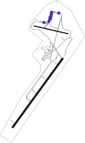
Coffs Harbour
Airport details
| Country | Australia |
| State | New South Wales |
| Region | YB |
| Airspace | Brisbane Ctr |
| Municipality | Coffs Harbour |
| Elevation | 18ft (5m) |
| Timezone | GMT +11 |
| Coordinates | -30.32055, 153.11639 |
| Magnetic var | |
| Type | land |
| Available since | X-Plane v10.40 |
| ICAO code | YCFS |
| IATA code | CFS |
| FAA code | n/a |
Communication
| Coffs Harbour COFFS HARBOUR ATIS | 130.300 |
| Coffs Harbour BRISBANE CNTR | 122.600 |
| Coffs Harbour COFFS Tower | 118.200 |
Nearby Points of Interest:
Ferguson's Cottage
-Dorrigo National Park
-New England National Park
Nearby beacons
| code | identifier | dist | bearing | frequency |
|---|---|---|---|---|
| CFS | COFFS HARBOUR VOR/DME | 0.2 | 77° | 117 |
| GFN | GRAFTON NDB | 33.9 | 351° | 389 |
Instrument approach procedures
| runway | airway (heading) | route (dist, bearing) |
|---|---|---|
| RW03 | CFSSE (25°) | CFSSE 5500ft CFSSI (5mi, 327°) 3970ft |
| RW03 | CFSSG (44°) | CFSSG 5500ft CFSSI (5mi, 45°) 3970ft |
| RW03 | CFSSJ (61°) | CFSSJ 5500ft CFSSI (5mi, 108°) 3970ft |
| RNAV | CFSSI 3970ft CFSSF (6mi, 45°) 2060ft YCFS (7mi, 42°) 64ft (8429mi, 281°) 600ft CFSSH (8436mi, 101°) (8436mi, 281°) 2500ft | |
| RW21 | CFSNA (207°) | CFSNA 5500ft CFSNI (5mi, 147°) 3970ft |
| RW21 | CFSNC (226°) | CFSNC 5500ft CFSNI (5mi, 225°) 3970ft |
| RW21 | CFSND (244°) | CFSND 5500ft CFSNI (5mi, 288°) 3970ft |
| RNAV | CFSNI 3970ft CFSNF (6mi, 225°) 2060ft YCFS (6mi, 228°) 68ft (8429mi, 281°) 500ft CFSNH (8428mi, 101°) (8428mi, 281°) 2500ft |
Disclaimer
The information on this website is not for real aviation. Use this data with the X-Plane flight simulator only! Data taken with kind consent from X-Plane 12 source code and data files. Content is subject to change without notice.

