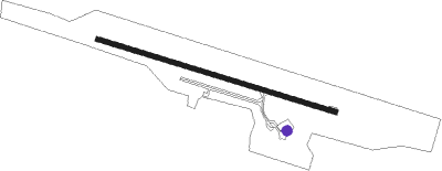
Cooktown
Airport details
| Country | Australia |
| State | Queensland |
| Region | YB |
| Airspace | Brisbane Ctr |
| Municipality | Cook Shire |
| Elevation | 22ft (7m) |
| Timezone | GMT +10 |
| Coordinates | -15.44472, 145.18445 |
| Magnetic var | |
| Type | land |
| Available since | X-Plane v11.50 |
| ICAO code | YCKN |
| IATA code | CTN |
| FAA code | n/a |
Communication
| Cooktown AWIS | 133.350 |
| Cooktown CTAF | 126.700 |
Nearby Points of Interest:
Cooktown Cemetery
-Cook Shire Hall
-Old Cooktown Hospital
-Annan River Bridge
Instrument approach procedures
| runway | airway (heading) | route (dist, bearing) |
|---|---|---|
| RW11-Z | CTNWA (92°) | CTNWA 5100ft CTNWI (5mi, 42°) 3580ft |
| RW11-Z | CTNWB (111°) | CTNWB 5100ft CTNWI (5mi, 111°) 3580ft |
| RW11-Z | CTNWC (130°) | CTNWC 5100ft CTNWI (5mi, 181°) 3580ft |
| RNAV | CTNWI 3580ft CTNWF (5mi, 111°) 1980ft CTNWM (5mi, 111°) 393ft CTNWH (7mi, 99°) (8552mi, 276°) 2900ft | |
| RW29-Z | CTNED (274°) | CTNED 2900ft CTNEI (4mi, 219°) 2900ft |
| RW29-Z | CTNEE (288°) | CTNEE 2900ft CTNEI (3mi, 288°) 2900ft |
| RW29-Z | CTNEG (305°) | CTNEG 5100ft CTNEI (5mi, 358°) 4200ft |
| RNAV | CTNEI 2900ft CTNEF (5mi, 288°) 2610ft CTNEM (7mi, 288°) 382ft CTNEH (4mi, 288°) (8545mi, 276°) 1500ft (turn) 2900ft |
Disclaimer
The information on this website is not for real aviation. Use this data with the X-Plane flight simulator only! Data taken with kind consent from X-Plane 12 source code and data files. Content is subject to change without notice.
