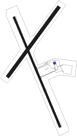
Cowra
Airport details
| Country | Australia |
| State | New South Wales |
| Region | YM |
| Airspace | Melbourne Ctr |
| Municipality | Cowra |
| Elevation | 960ft (293m) |
| Timezone | GMT +10 |
| Coordinates | -33.84472, 148.64890 |
| Magnetic var | |
| Type | land |
| Available since | X-Plane v10.40 |
| ICAO code | YCWR |
| IATA code | CWT |
| FAA code | n/a |
Communication
| Cowra CTAF | 126.700 |
Nearby Points of Interest:
Lachlan River railway bridge, Cowra
-Cowra Prisoner of War Camp Site
-Woodstock railway station, New South Wales
-Cliefden Caves
-Grenfell railway station
-Carcoar railway station
-The Saddlery
-City Bank building
Nearby beacons
| code | identifier | dist | bearing | frequency |
|---|---|---|---|---|
| CWR | COWRA NDB | 0.2 | 92° | 299 |
| PKS | PARKES NDB | 46.4 | 330° | 242 |
| PKS | PARKES VOR/DME | 47.5 | 330° | 112 |
Instrument approach procedures
| runway | airway (heading) | route (dist, bearing) |
|---|---|---|
| RW15-Z | CWRNA (136°) | CWRNA 5200ft CWRNI (5mi, 91°) 4370ft |
| RW15-Z | CWRNC (158°) | CWRNC 5200ft CWRNI (5mi, 158°) 4370ft |
| RW15-Z | CWRND (182°) | CWRND 5200ft CWRNI (5mi, 236°) 4370ft |
| RNAV | CWRNI 4370ft CWRNF (5mi, 158°) 2780ft YCWR (6mi, 157°) 1017ft CWRNH (2mi, 161°) (8117mi, 283°) 5200ft | |
| RW33-Z | CWRSE (316°) | CWRSE 5200ft CWRSI (5mi, 271°) 4290ft |
| RW33-Z | CWRSG (338°) | CWRSG 5200ft CWRSI (5mi, 338°) 4290ft |
| RW33-Z | CWRSJ (3°) | CWRSJ 5200ft CWRSI (5mi, 56°) 4290ft |
| RNAV | CWRSI 4290ft CWRSF (5mi, 338°) 2700ft YCWR (6mi, 339°) 1023ft CWRSH (2mi, 336°) (8119mi, 283°) 5200ft |
Disclaimer
The information on this website is not for real aviation. Use this data with the X-Plane flight simulator only! Data taken with kind consent from X-Plane 12 source code and data files. Content is subject to change without notice.

