Durrie
Airport details
| Country | Australia |
| State | Queensland |
| Region | YB |
| Airspace | Brisbane Ctr |
| Municipality | Birdsville |
| Elevation | 189ft (58m) |
| Timezone | GMT +10 |
| Coordinates | -25.68472, 140.22333 |
| Magnetic var | |
| Type | land |
| Available since | X-Plane v10.40 |
| ICAO code | YDRI |
| IATA code | DRR |
| FAA code | n/a |
Communication
| Durrie CTAF | 126.700 |
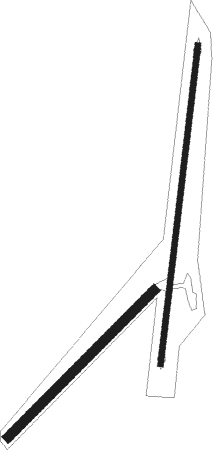
Runway info
Runway 01 / 19  | ||
| length | 1036m (3399ft) | |
| bearing | 12° / 192° | |
| width | 18m (59ft) | |
| surface | dirt | |
| Runway 05 / 23 | ||
| length | 668m (2192ft) | |
| bearing | 52° / 232° | |
| width | 30m (98ft) | |
| surface | dirt | |
Nearby beacons
| code | identifier | dist | bearing | frequency |
|---|---|---|---|---|
| BDV | BIRDSVILLE NDB | 48.7 | 256° | 413 |
Disclaimer
The information on this website is not for real aviation. Use this data with the X-Plane flight simulator only! Data taken with kind consent from X-Plane 12 source code and data files. Content is subject to change without notice.