Gulgong - Gulgong Aero Park
Airport details
| Country | Australia |
| State | New South Wales |
| Region | YB |
| Airspace | Brisbane Ctr |
| Municipality | Mid-Western Regional Council |
| Elevation | 1442ft (440m) |
| Timezone | GMT +11 |
| Coordinates | -32.29869, 149.55957 |
| Magnetic var | |
| Type | land |
| Available since | X-Plane v10.40 |
| ICAO code | YGGG |
| IATA code | n/a |
| FAA code | n/a |
Communication
Nearby Points of Interest:
Gulgong railway bridge over Wialdra Creek
-Mudgee railway station
-St. Mary's Roman Catholic Church, Presbytery, Convent & Hall
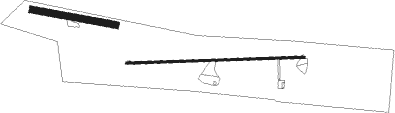
Runway info
Runway 09 / 27  | ||
| length | 1010m (3314ft) | |
| bearing | 92° / 272° | |
| width | 10m (33ft) | |
| surface | asphalt | |
| Runway 10 / 28 | ||
| length | 479m (1572ft) | |
| bearing | 102° / 282° | |
| width | 40m (131ft) | |
| surface | grass | |
Nearby beacons
| code | identifier | dist | bearing | frequency |
|---|---|---|---|---|
| MDG | MUDGEE NDB | 16.2 | 168° | 398 |
| QDI | QUIRINDI NDB | 68.9 | 50° | 386 |
Disclaimer
The information on this website is not for real aviation. Use this data with the X-Plane flight simulator only! Data taken with kind consent from X-Plane 12 source code and data files. Content is subject to change without notice.