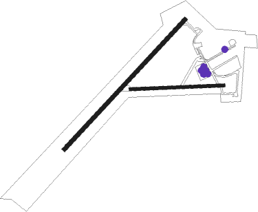
Goulburn
Airport details
| Country | Australia |
| State | New South Wales |
| Region | YM |
| Airspace | Melbourne Ctr |
| Municipality | Goulburn Mulwaree Council |
| Elevation | 2141ft (653m) |
| Timezone | GMT +10 |
| Coordinates | -34.81028, 149.72639 |
| Magnetic var | |
| Type | land |
| Available since | X-Plane v10.40 |
| ICAO code | YGLB |
| IATA code | GUL |
| FAA code | n/a |
Communication
| Goulburn CTAF | 127.150 |
Nearby Points of Interest:
Old Goulburn Brewery
-Goulburn railway station
-Goulburn Court House
-Goulburn Post Office
-Colonial Mutual Life Building, Goulburn
-St Clair, Goulburn
-Goulburn Correctional Centre
-Rossi Bridge over Wollondilly River
-Kenmore Asylum
-Towrang Convict Stockade
-Christ Church Anglican Church, Bungonia
-Marulan railway station
-Tarago
-Tallong railway station
-Wingello railway station
-Gunning railway station
-Crookwell railway station
-Bungendore
Nearby beacons
| code | identifier | dist | bearing | frequency |
|---|---|---|---|---|
| GLB | GOULBURN NDB | 0.5 | 74° | 407 |
| CB | CANBERRA VOR/DME | 38.4 | 228° | 116.70 |
| CB | CANBERRA NDB | 38.7 | 227° | 263 |
| NWA | NOWRA NDB | 40.4 | 100° | 359 |
| NWA | NOWRA TACAN | 40.6 | 100° | 116.40 |
Instrument approach procedures
| runway | airway (heading) | route (dist, bearing) |
|---|---|---|
| RW04-Z | GZBSA (31°) | GZBSA 4700ft GZBSI (5mi, 333°) 4700ft |
| RW04-Z | GZBSB (53°) | GZBSB 4700ft GZBSI (5mi, 53°) 4700ft |
| RW04-Z | GZBSC (73°) | GZBSC 4700ft GZBSI (5mi, 113°) 4700ft |
| RNAV | GZBSI 4700ft GZBSF (5mi, 53°) 3780ft YGLB (5mi, 53°) 2191ft GZBSH (3mi, 52°) (8120mi, 283°) 4700ft | |
| RW22-Z | GZBND (211°) | GZBND 4700ft GZBNI (5mi, 153°) 4700ft |
| RW22-Z | GZBNE (233°) | GZBNE 4700ft GZBNI (5mi, 233°) 4700ft |
| RW22-Z | GZBNG (252°) | GZBNG 4700ft GZBNI (5mi, 293°) 4700ft |
| RNAV | GZBNI 4700ft GZBNF (5mi, 233°) 3780ft YGLB (5mi, 233°) 2139ft GZBNH (3mi, 234°) (8115mi, 283°) 4700ft |
Disclaimer
The information on this website is not for real aviation. Use this data with the X-Plane flight simulator only! Data taken with kind consent from X-Plane 12 source code and data files. Content is subject to change without notice.

