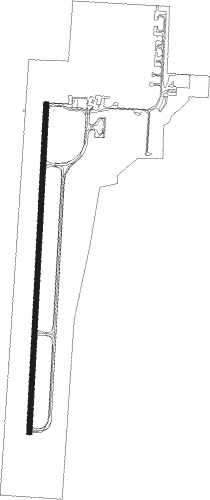
Melbourne - Avalon
Airport details
| Country | Australia |
| State | Victoria |
| Region | YM |
| Airspace | Melbourne Ctr |
| Municipality | City of Greater Geelong |
| Elevation | 35ft (11m) |
| Timezone | GMT +10 |
| Coordinates | -38.02630, 144.48067 |
| Magnetic var | |
| Type | land |
| Available since | X-Plane v10.32 |
| ICAO code | YMAV |
| IATA code | AVV |
| FAA code | n/a |
Communication
| Avalon Avalon ATIS | 118.200 |
| Avalon Avalon Tower | 120.100 |
| Avalon Avalon Approach | 133.550 |
Approach frequencies
| ILS-cat-I | RW18 | 109.5 | 18.00mi |
| 3° GS | RW18 | 109.5 | 18.00mi |
Nearby Points of Interest:
Osborne House
-Geelong Customs House
-Moorabool railway station
-Geelong Town Hall
-Geelong Post Office building
-Reedy Lake
-Swan Bay
-Barwon Heads Bridge
-West Channel Pile Light
-Lethbridge railway station
-Melton Viaduct
-South Channel Pile Light
-Newport Workshops
-Baker House
-Meredith railway station
-Williamstown Lighthouse
-Bells Beach
-CFA Training College
-Footscray Town Hall
-Station Pier
-Maribyrnong River Viaduct
-Port Melbourne railway station
-Victoria Dock
-Saltwater River Rail Bridge
-St Kilda Pavilion
Nearby beacons
| code | identifier | dist | bearing | frequency |
|---|---|---|---|---|
| AV | AVALON VOR/DME | 1.7 | 224° | 116.10 |
| ML | MELBOURNE VOR/DME | 27.8 | 45° | 114.10 |
| MB | MOORABBIN (MELBOURNE) NDB | 29 | 85° | 398 |
Departure and arrival routes
| Transition altitude | 10000ft |
| Transition level | 11000ft |
| SID end points | distance | outbound heading | |
|---|---|---|---|
| RW18 | |||
| JUSTY2 | 28mi | 45° | |
| RW36 | |||
| JUSTY2 | 28mi | 45° | |
| STAR starting points | distance | inbound heading | |
|---|---|---|---|
| RW18 | |||
| JAYBI5 | 23.2 | 188° | |
| RW36 | |||
| JAYBI5 | 23.2 | 188° | |
Instrument approach procedures
| runway | airway (heading) | route (dist, bearing) |
|---|---|---|
| RW18 | AVVND (221°) | AVVND 3700ft AVVNI (6mi, 260°) 2950ft |
| RW18 | AVVNE (187°) | AVVNE 3700ft AVVNI (6mi, 190°) 2950ft |
| RNAV | AVVNI 2950ft AVVNF (3mi, 190°) 2090ft AVVNM (6mi, 190°) 82ft AVVNH (2mi, 190°) (7798mi, 285°) 3000ft | |
| RW36-Z | AVVSA (34°) | AVVSA 3000ft AVVSI (4mi, 73°) 2180ft |
| RW36-Z | AVVSB (13°) | AVVSB 3000ft AVVSI (3mi, 10°) 2180ft |
| RW36-Z | AVVSC (350°) | AVVSC 3000ft AVVSI (4mi, 300°) 2180ft |
| RNAV | AVVSI 2180ft AVVSF (3mi, 10°) 1360ft AVVSM (4mi, 10°) 86ft AVVSH (2mi, 10°) (7800mi, 285°) 3000ft |
Holding patterns
| STAR name | hold at | type | turn | heading* | altitude | leg | speed limit |
|---|---|---|---|---|---|---|---|
| JAYBI5 | APPLE | VHF | left | 300 (120)° | 20000ft - 60000ft | 1.5min timed | ICAO rules |
| JAYBI5 | CANTY | VHF | right | 339 (159)° | < 60000ft | 1.0min timed | ICAO rules |
| JAYBI5 | TEMPL | VHF | left | 356 (176)° | DME 4.0mi | ICAO rules | |
| *) magnetic outbound (inbound) holding course | |||||||
Disclaimer
The information on this website is not for real aviation. Use this data with the X-Plane flight simulator only! Data taken with kind consent from X-Plane 12 source code and data files. Content is subject to change without notice.
