Warwick
Airport details
| Country | Australia |
| State | Queensland |
| Region | YB |
| Airspace | Brisbane Ctr |
| Municipality | Southern Downs Regional |
| Elevation | 1500ft (457m) |
| Timezone | GMT +10 |
| Coordinates | -28.14944, 151.94305 |
| Magnetic var | |
| Type | land |
| Available since | X-Plane v10.40 |
| ICAO code | YWCK |
| IATA code | WAZ |
| FAA code | n/a |
Communication
| Warwick CTAF | 127.850 |
Nearby Points of Interest:
Assmanshausen Winery
-Warwick War Memorial
-Residence, 50 Guy Street, Warwick
-St George's Masonic Centre, Warwick
-Warwick Post Office
-First St. Mary's Roman Catholic Church, Warwick
-St Mary's Presbytery, Warwick
-Glennie Hall
-Aberfoyle, Warwick
-Boer War Memorial, Allora
-St Davids Anglican Church, Allora
-Braeside Homestead
-Cherry Gully Tunnel
-Victor Denton War Memorial
-Dalveen Tunnel
-Greenmount War Memorial
-Main Range National Park
-Eton Vale Homestead Ruins
-St Denys Anglican Church
-Wilsons Peak Flora Reserve
-Stanthorpe Post Office
-Pittsworth Shire Council Chambers and Shire Hall
-Quart Pot Creek Rail Bridge
-Gabbinbar homestead
-O'Shea's Drayton Cottage
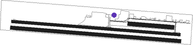
Runway info
Runway 09R / 27L  | ||
| length | 1655m (5430ft) | |
| bearing | 98° / 278° | |
| width | 35m (115ft) | |
| surface | grass | |
| Runway 09 / 27 | ||
| length | 1644m (5394ft) | |
| bearing | 98° / 278° | |
| width | 30m (99ft) | |
| surface | asphalt | |
| Runway 09L / 27R | ||
| length | 421m (1381ft) | |
| bearing | 98° / 278° | |
| width | 41m (134ft) | |
| surface | grass | |
Nearby beacons
| code | identifier | dist | bearing | frequency |
|---|---|---|---|---|
| OK | OAKEY NDB | 45 | 344° | 254 |
| OK | OAKEY VOR/DME | 46.3 | 345° | 112.90 |
| AMB | AMBERLEY TACAN | 51.1 | 57° | 108.10 |
| BML | BROMELTON NDB | 51.9 | 79° | 374 |
Instrument approach procedures
| runway | airway (heading) | route (dist, bearing) |
|---|---|---|
| RWNVE | WCKEA (259°) | WCKEA 5700ft WCKEI (5mi, 212°) 5210ft |
| RWNVE | WCKEB (278°) | WCKEB 5700ft WCKEI (5mi, 278°) 5210ft |
| RWNVE | WCKEC (297°) | WCKEC 5700ft WCKEI (5mi, 347°) 5210ft |
| RNAV | WCKEI 5210ft WCKEF (5mi, 278°) 3620ft WCKEM (5mi, 278°) 2290ft WCKEH (3mi, 278°) (8472mi, 280°) 4200ft (turn) 5700ft |
Disclaimer
The information on this website is not for real aviation. Use this data with the X-Plane flight simulator only! Data taken with kind consent from X-Plane 12 source code and data files. Content is subject to change without notice.