Changsha - Huanghua
Airport details
| Country | China |
| State | Hunan |
| Region | ZG |
| Airspace | Guangzhou Ctr |
| Municipality | Changsha |
| Elevation | 210ft (64m) |
| Timezone | GMT +8 |
| Coordinates | 28.19000, 113.21833 |
| Magnetic var | |
| Type | land |
| Available since | X-Plane v10.40 |
| ICAO code | ZGHA |
| IATA code | CSX |
| FAA code | n/a |
Communication
| Huanghua ATIS | 128.800 |
| Huanghua Ground Control | 121.750 |
| Huanghua Tower | 128.000 |
| Huanghua Tower | 118.550 |
| Huanghua ChangSha | 119.650 |
| Huanghua ChangSha | 120.600 |
Approach frequencies
| ILS-cat-I | RW36R | 111.1 | 18.00mi |
| ILS-cat-I | RW18L | 109.3 | 18.00mi |
| ILS-cat-I | RW36L | 109.9 | 18.00mi |
| ILS-cat-I | RW18R | 110.3 | 18.00mi |
| 3° GS | RW36R | 111.1 | 18.00mi |
| 3° GS | RW18L | 109.3 | 18.00mi |
| 3° GS | RW36L | 109.9 | 18.00mi |
| 3° GS | RW18R | 110.3 | 18.00mi |
Nearby Points of Interest:
Former Residence of Huang Xing
-Autumn-Admiring Pavilion
-Lushan Temple
-Tan Sitong's Former Residence
-Peng Dehuai Residence
-Liu Shaoqi's Former Residence
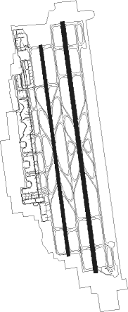
Runway info
Runway 18R / 36L  | ||
| length | 3213m (10541ft) | |
| bearing | 176° / 356° | |
| width | 45m (148ft) | |
| surface | asphalt | |
| blast zone | 60m (197ft) / 60m (197ft) | |
| Runway 18L / 36R | ||
| length | 3816m (12520ft) | |
| bearing | 176° / 356° | |
| width | 60m (197ft) | |
| surface | concrete | |
| blast zone | 120m (394ft) / 120m (394ft) | |
Nearby beacons
| code | identifier | dist | bearing | frequency |
|---|---|---|---|---|
| Q | CHANGSHA NDB | 1.4 | 173° | 265 |
| W | GUTANG NDB | 1.7 | 359° | 388 |
| SV | LUCHONG NDB | 7 | 78° | 345 |
| DTM | TIAOMA VOR/DME | 13.3 | 204° | 114.05 |
| LYH | LIUYANG VOR/DME | 13.8 | 32° | 113.55 |
| ZK | DATUOPU NDB | 16.9 | 236° | 520 |
| LIG | LILING VOR/DME | 36.1 | 151° | 112.40 |
Departure and arrival routes
| Transition altitude | 9843ft |
| Transition level | 11811ft |
| SID end points | distance | outbound heading | |
|---|---|---|---|
| RW18L | |||
| DPR12D, DPR7W | 68mi | 22° | |
| OVT7W, OVT12D | 60mi | 89° | |
| NIV12D, NIV7W | 56mi | 155° | |
| PUK7W, PUK6W | 58mi | 259° | |
| LLC12D, LLC7W, LLC6W, LLC14D | 54mi | 263° | |
| RW18R | |||
| DPR11D, DPR9W | 68mi | 22° | |
| OVT9W, OVT11D | 60mi | 89° | |
| NIV11D, NIV9W | 56mi | 155° | |
| PUK9W, PUK8W | 58mi | 259° | |
| LLC8W, LLC11D, LLC13D, LLC9W | 54mi | 263° | |
| RW36L | |||
| DPR01D, DPR9X | 68mi | 22° | |
| OVT9X, OVT01D | 60mi | 89° | |
| NIV01D, NIV9X | 56mi | 155° | |
| PUK9X | 58mi | 259° | |
| LLC9X, LLC03D, LLC01D | 54mi | 263° | |
| RW36R | |||
| DPR02D, DPR7X | 68mi | 22° | |
| OVT7X, OVT02D | 60mi | 89° | |
| NIV7X, NIV02D | 56mi | 155° | |
| PUK7X | 58mi | 259° | |
| LLC7X, LLC02D, LLC04D | 54mi | 263° | |
| STAR starting points | distance | inbound heading | |
|---|---|---|---|
| RW18 (ALL) | |||
| LLC1W, LLC11A | 53.9 | 83° | |
| BEM1W | 50.0 | 87° | |
| DPR1W, DPR11A | 67.8 | 202° | |
| OVT11A, OVT1W | 59.7 | 269° | |
| LIG11A, LIG1W | 36.1 | 331° | |
| RW36 (ALL) | |||
| LLC01A, LLC1X, LLC2X, LLC02A | 53.9 | 83° | |
| BEM2X, BEM1X | 50.0 | 87° | |
| DPR1X, DPR01A | 67.8 | 202° | |
| OVT1X, OVT01A | 59.7 | 269° | |
| LIG2X, LIG1X, LIG02A, LIG01A | 36.1 | 331° | |
Holding patterns
| STAR name | hold at | type | turn | heading* | altitude | leg | speed limit |
|---|---|---|---|---|---|---|---|
| BEM1W | HA365 | VHF | right | 182 (2)° | > 3940ft | 1.0min timed | 205 |
| BEM1X | HA375 | VHF | right | 152 (332)° | > 3940ft | 1.0min timed | 205 |
| DPR01A | D051R | VHF | left | 7 (187)° | > 7880ft | 1.0min timed | 205 |
| DPR01A | D091M | VHF | right | 91 (271)° | > 3940ft | 1.0min timed | 205 |
| DPR01A | D181J | VHF | left | 1 (181)° | > 6890ft | 1.0min timed | 205 |
| DPR11A | D051R | VHF | left | 7 (187)° | > 7880ft | 1.0min timed | 205 |
| DPR1W | HA384 | VHF | left | 7 (187)° | > 7880ft | 1.0min timed | 205 |
| DPR1X | HA375 | VHF | right | 152 (332)° | > 3940ft | 1.0min timed | 205 |
| DPR1X | HA381 | VHF | left | 38 (218)° | > 6890ft | 1.0min timed | 205 |
| DPR1X | HA384 | VHF | left | 7 (187)° | > 7880ft | 1.0min timed | 205 |
| LIG01A | D091M | VHF | right | 91 (271)° | > 3940ft | 1.0min timed | 205 |
| LIG01A | D348M | VHF | right | 168 (348)° | > 4930ft | 1.0min timed | 205 |
| LIG02A | D348M | VHF | right | 168 (348)° | > 4930ft | 1.0min timed | 205 |
| LIG11A | D182J | VHF | right | 182 (2)° | > 6890ft | 1.0min timed | 205 |
| LIG11A | D359S | VHF | right | 140 (320)° | > 9850ft | 1.0min timed | 205 |
| LIG1W | HA358 | VHF | right | 187 (7)° | > 9850ft | 1.0min timed | 205 |
| LIG1W | HA365 | VHF | right | 182 (2)° | > 3940ft | 1.0min timed | 205 |
| LIG1X | HA375 | VHF | right | 152 (332)° | > 3940ft | 1.0min timed | 205 |
| LIG1X | HA378 | VHF | right | 168 (348)° | > 4930ft | 1.0min timed | 205 |
| LIG2X | HA378 | VHF | right | 168 (348)° | > 4930ft | 1.0min timed | 205 |
| LLC01A | D091M | VHF | right | 91 (271)° | > 3940ft | 1.0min timed | 205 |
| LLC01A | LLC | NDB | left | 214 (34)° | > 9850ft | 1.0min timed | 205 |
| LLC02A | LLC | NDB | left | 214 (34)° | > 9850ft | 1.0min timed | 205 |
| LLC11A | LLC | NDB | left | 214 (34)° | > 9850ft | 1.0min timed | 205 |
| LLC1W | HA365 | VHF | right | 182 (2)° | > 3940ft | 1.0min timed | 205 |
| LLC1W | LLC | NDB | left | 214 (34)° | > 9850ft | 1.0min timed | 205 |
| LLC1X | HA375 | VHF | right | 152 (332)° | > 3940ft | 1.0min timed | 205 |
| LLC1X | LLC | NDB | left | 214 (34)° | > 9850ft | 1.0min timed | 205 |
| LLC2X | LLC | NDB | left | 214 (34)° | > 9850ft | 1.0min timed | 205 |
| OVT01A | D091M | VHF | right | 91 (271)° | > 3940ft | 1.0min timed | 205 |
| OVT01A | D181J | VHF | left | 1 (181)° | > 6890ft | 1.0min timed | 205 |
| OVT01A | W32 | VHF | left | 90 (270)° | > 6890ft | 1.0min timed | 205 |
| OVT11A | D182J | VHF | right | 182 (2)° | > 6890ft | 1.0min timed | 205 |
| OVT11A | W32 | VHF | left | 90 (270)° | > 6890ft | 1.0min timed | 205 |
| OVT1W | HA357 | VHF | left | 90 (270)° | > 6890ft | 1.0min timed | 205 |
| OVT1W | HA365 | VHF | right | 182 (2)° | > 3940ft | 1.0min timed | 205 |
| OVT1X | HA357 | VHF | left | 90 (270)° | > 6890ft | 1.0min timed | 205 |
| OVT1X | HA375 | VHF | right | 152 (332)° | > 3940ft | 1.0min timed | 205 |
| OVT1X | HA381 | VHF | left | 38 (218)° | > 6890ft | 1.0min timed | 205 |
| *) magnetic outbound (inbound) holding course | |||||||
Disclaimer
The information on this website is not for real aviation. Use this data with the X-Plane flight simulator only! Data taken with kind consent from X-Plane 12 source code and data files. Content is subject to change without notice.