Wuhan - Tianhe
Airport details
| Country | China |
| State | Hubei |
| Region | ZH |
| Airspace | Wuhan Ctr |
| Municipality | Wuhan |
| Elevation | 115ft (35m) |
| Timezone | GMT +8 |
| Coordinates | 30.78500, 114.20667 |
| Magnetic var | |
| Type | land |
| Available since | X-Plane v10.40 |
| ICAO code | ZHHH |
| IATA code | WUH |
| FAA code | n/a |
Communication
| Tianhe ATIS | 126.200 |
| Tianhe CDL | 121.800 |
| Tianhe WUHAN Ground Control West | 121.650 |
| Tianhe WUHAN Ground Control East | 121.975 |
| Tianhe WUHAN Tower 1 | 124.350 |
| Tianhe WUHAN Tower 2 | 118.025 |
Approach frequencies
| ILS-cat-II | RW04R | 111.5 | 18.00mi |
| ILS-cat-I | RW04L | 109.3 | 18.00mi |
| ILS-cat-I | RW22R | 108.5 | 18.00mi |
| ILS-cat-I | RW22L | 111.1 | 18.00mi |
| 3° GS | RW04L | 109.3 | 18.00mi |
| 3° GS | RW22R | 108.5 | 18.00mi |
| 3° GS | RW22L | 111.1 | 18.00mi |
| 3° GS | RW04R | 111.5 | 18.00mi |
Nearby Points of Interest:
Consulate General of the United States, Wuhan
-Dazhimen railway station
-Baotong Temple
Runway info
Runway 04L / 22R  | ||
| length | 3405m (11171ft) | |
| bearing | 46° / 226° | |
| width | 45m (148ft) | |
| surface | concrete | |
| blast zone | 122m (400ft) / 121m (397ft) | |
| Runway 04R / 22L | ||
| length | 3605m (11827ft) | |
| bearing | 46° / 226° | |
| width | 45m (148ft) | |
| surface | concrete | |
| blast zone | 122m (400ft) / 121m (397ft) | |
Airport layout
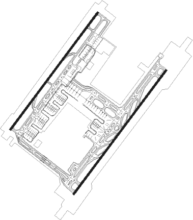
Taxiway locations
|
Parking locations
|
Nearby beacons
| code | identifier | dist | bearing | frequency |
|---|---|---|---|---|
| WHA | TIANHE VOR/DME | 0.2 | 225° | 112.20 |
| HG | TIANHE NDB | 11.3 | 47° | 254 |
| DHB | HEBAOHU VOR/DME | 13.1 | 250° | 114.45 |
| DHP | HUANGPI VOR/DME | 14.5 | 72° | 113.75 |
| DCD | CAIDIAN VOR/DME | 20.8 | 188° | 114.25 |
| HOK | HEKOU VOR/DME | 34.4 | 22° | 116 |
| LKO | LONGKOU VOR/DME | 59.1 | 210° | 115.80 |
Departure and arrival routes
| Transition altitude | 9842ft |
| Transition level | 11811ft |
| SID end points | distance | outbound heading | |
|---|---|---|---|
| RW04L | |||
| UBG09D, UBG07D, UBG03D, UBG01D | 57mi | 18° | |
| BIV01D, BIV03D, BIV07D, BIV09D | 59mi | 72° | |
| XSH09D, XSH07D, XSH01D, XSH05D | 59mi | 108° | |
| LKO09D, LKO07D, LKO01D | 59mi | 210° | |
| GUG01D, GUG09D | 63mi | 241° | |
| RW04R | |||
| UBG08D, UBG06D, UBG04D, UBG02D | 57mi | 18° | |
| BIV08D, BIV02D, BIV04D, BIV06D | 59mi | 72° | |
| XSH08D, XSH06D, XSH02D, XSH04D | 59mi | 108° | |
| LKO08D, LKO06D, LKO02D | 59mi | 210° | |
| GUG02D, GUG08D | 63mi | 241° | |
| RW22L | |||
| UBG18D, UBG12D, UBG16D | 57mi | 18° | |
| BIV18D, BIV14D, BIV12D, BIV16D | 59mi | 72° | |
| XSH18D, XSH14D, XSH12D, XSH16D | 59mi | 108° | |
| LKO18D, LKO16D, LKO14D, LKO12D | 59mi | 210° | |
| GUG16D, GUG12D | 63mi | 241° | |
| RW22R | |||
| UBG19D, UBG11D | 57mi | 18° | |
| BIV17D, BIV19D, BIV13D, BIV11D | 59mi | 72° | |
| XSH19D, XSH17D, XSH13D, XSH11D | 59mi | 108° | |
| LKO19D, LKO17D, LKO13D, LKO11D | 59mi | 210° | |
| GUG17D, GUG11D | 63mi | 241° | |
| STAR starting points | distance | inbound heading | |
|---|---|---|---|
| RW04 (ALL) | |||
| LKO09A | 59.1 | 30° | |
| RW04L | |||
| LKO01A | 40.4 | 35° | |
| XSH02A, ONI01A | 13.1 | 70° | |
| AVP09A | 22.1 | 79° | |
| AVP01A | 22.7 | 80° | |
| RW04R | |||
| LKO01A | 40.4 | 35° | |
| XSH02A, ONI01A | 13.1 | 70° | |
| AVP09A | 22.1 | 79° | |
| AVP01A | 22.7 | 80° | |
| RW22 (ALL) | |||
| LKO19A, LKO11A | 59.1 | 30° | |
| AVP19A, AVP11A | 49.2 | 87° | |
| ONI11A, ONI19A | 60.4 | 191° | |
| XSH18A | 58.6 | 288° | |
| RW22L | |||
| XSH12A, XSH11A, LKO12A, AVP12A | 14.5 | 252° | |
| RW22R | |||
| XSH12A, XSH11A, LKO12A, AVP12A | 14.5 | 252° | |
Holding patterns
| STAR name | hold at | type | turn | heading* | altitude | leg | speed limit |
|---|---|---|---|---|---|---|---|
| AVP01A | D278Y | VHF | right | 278 (98)° | > 8860ft | 1.0min timed | 205 |
| AVP09A | HH420 | VHF | right | 278 (98)° | > 8860ft | 1.0min timed | 205 |
| AVP11A | D278S | VHF | right | 278 (98)° | > 8860ft | 1.0min timed | 205 |
| AVP12A | D278S | VHF | right | 278 (98)° | > 8860ft | 1.0min timed | 205 |
| AVP18A | HH518 | VHF | right | 278 (98)° | > 8860ft | 1.0min timed | 205 |
| AVP19A | HH518 | VHF | right | 278 (98)° | > 8860ft | 1.0min timed | 205 |
| LKO01A | DHB31 | VHF | left | 201 (21)° | > 8860ft | 1.0min timed | 205 |
| LKO09A | HH417 | VHF | left | 196 (16)° | > 8860ft | 1.0min timed | 205 |
| LKO11A | DHB31 | VHF | left | 201 (21)° | > 8860ft | 1.0min timed | 205 |
| LKO12A | DHB31 | VHF | left | 201 (21)° | > 8860ft | 1.0min timed | 205 |
| LKO18A | HH519 | VHF | left | 201 (21)° | > 8860ft | 1.0min timed | 205 |
| LKO19A | HH519 | VHF | left | 201 (21)° | > 8860ft | 1.0min timed | 205 |
| ONI01A | D360Q | VHF | right | 360 (180)° | > 11800ft | 1.0min timed | 220 |
| ONI02A | D360Q | VHF | right | 360 (180)° | > 11800ft | 1.0min timed | 220 |
| ONI08A | HH405 | VHF | right | 360 (180)° | > 11800ft | 1.0min timed | 220 |
| ONI09A | HH405 | VHF | right | 360 (180)° | > 11800ft | 1.0min timed | 220 |
| ONI11A | D170G | VHF | left | 350 (170)° | > 6890ft | 1.0min timed | 205 |
| ONI19A | HH521 | VHF | left | 1 (181)° | > 6890ft | 1.0min timed | 205 |
| XSH01A | D307N | VHF | right | 127 (307)° | > 11800ft | 1.0min timed | 220 |
| XSH02A | D307N | VHF | right | 127 (307)° | > 11800ft | 1.0min timed | 220 |
| XSH08A | HH407 | VHF | right | 127 (307)° | > 11800ft | 1.0min timed | 220 |
| XSH09A | HH407 | VHF | right | 127 (307)° | > 11800ft | 1.0min timed | 220 |
| XSH11A | D288O | VHF | right | 108 (288)° | > 11800ft | 1.0min timed | 220 |
| XSH12A | D307N | VHF | right | 127 (307)° | > 11800ft | 1.0min timed | 220 |
| XSH17A | HH461 | VHF | right | 99 (279)° | > 11800ft | 1.0min timed | 220 |
| XSH18A | HH516 | VHF | right | 154 (334)° | > 11800ft | 1.0min timed | 220 |
| XSH19A | HH515 | VHF | right | 108 (288)° | > 11800ft | 1.0min timed | 220 |
| *) magnetic outbound (inbound) holding course | |||||||
Disclaimer
The information on this website is not for real aviation. Use this data with the X-Plane flight simulator only! Data taken with kind consent from X-Plane 12 source code and data files. Content is subject to change without notice.