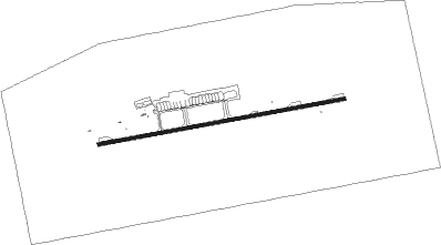
Dunhuang
Airport details
| Country | China |
| State | Gansu |
| Region | ZL |
| Airspace | Lanzhou Ctr |
| Municipality | Dunhuang City |
| Elevation | 3688ft (1124m) |
| Timezone | GMT +8 |
| Coordinates | 40.16550, 94.80600 |
| Magnetic var | |
| Type | land |
| Available since | X-Plane v10.40 |
| ICAO code | ZLDH |
| IATA code | DNH |
| FAA code | n/a |
Communication
Approach frequencies
| ILS-cat-I | RW26 | 108.7 | 18.00mi |
| ILS-cat-I | RW08 | 109.3 | 18.00mi |
| 3° GS | RW26 | 108.7 | 18.00mi |
| 3° GS | RW08 | 109.3 | 18.00mi |
Nearby Points of Interest:
Mogao Caves
-Xuanquanzhi
Nearby beacons
| code | identifier | dist | bearing | frequency |
|---|---|---|---|---|
| DNH | DUNHUANG VOR/DME | 1.7 | 93° | 115.50 |
Departure and arrival routes
| Transition altitude | 9842ft |
| Transition level | 11811ft |
| SID end points | distance | outbound heading | |
|---|---|---|---|
| RW08 | |||
| NUK01D, NUK09D | 103mi | 13° | |
| VIK09D, VIK01D | 70mi | 115° | |
| TUS09D, TUS01D | 133mi | 247° | |
| BIK09D, BIK01D | 63mi | 308° | |
| RW26 | |||
| NUK19D, NUK11D | 103mi | 13° | |
| VIK11D, VIK19D | 70mi | 115° | |
| TUS11D, TUS19D | 133mi | 247° | |
| BIK19D, BIK11D | 63mi | 308° | |
| STAR starting points | distance | inbound heading | |
|---|---|---|---|
| RW08 | |||
| TUS09A, TUS02A, TUS01A | 132.8 | 67° | |
| MOV01A, MOV02A, MOV09A | 64.8 | 117° | |
| NUK01A, NUK02A, NUK09A | 103.4 | 193° | |
| TOD09A, TOD01A | 89.6 | 286° | |
| RW26 | |||
| TUS19A, TUS11A | 132.8 | 67° | |
| MOV11A, MOV19A | 64.8 | 117° | |
| NUK11A, NUK19A, NUK12A | 103.4 | 193° | |
| TOD11A, TOD19A | 89.6 | 286° | |
Holding patterns
| STAR name | hold at | type | turn | heading* | altitude | leg | speed limit |
|---|---|---|---|---|---|---|---|
| MOV02A | DNH | NDB | right | 84 (264)° | > 7880ft | 1.0min timed | ICAO rules |
| MOV09A | DH603 | VHF | right | 354 (174)° | > 6890ft | 1.0min timed | ICAO rules |
| MOV11A | DNH | NDB | right | 84 (264)° | > 7880ft | 1.0min timed | ICAO rules |
| MOV19A | DH703 | VHF | left | 354 (174)° | > 8860ft | 1.0min timed | ICAO rules |
| NUK02A | DNH | NDB | right | 84 (264)° | > 7880ft | 1.0min timed | ICAO rules |
| NUK09A | DH603 | VHF | right | 354 (174)° | > 6890ft | 1.0min timed | ICAO rules |
| NUK12A | DNH | NDB | right | 84 (264)° | > 7880ft | 1.0min timed | ICAO rules |
| NUK19A | DH703 | VHF | left | 354 (174)° | > 8860ft | 1.0min timed | ICAO rules |
| TOD01A | DNH | NDB | right | 84 (264)° | > 7880ft | 1.0min timed | ICAO rules |
| TOD09A | DH603 | VHF | right | 354 (174)° | > 6890ft | 1.0min timed | ICAO rules |
| TOD19A | DH704 | VHF | right | 84 (264)° | > 8860ft | 1.0min timed | ICAO rules |
| TUS02A | DNH | NDB | right | 84 (264)° | > 7880ft | 1.0min timed | ICAO rules |
| TUS09A | DH604 | VHF | left | 264 (84)° | > 7880ft | 1.0min timed | ICAO rules |
| TUS11A | DNH | NDB | right | 84 (264)° | > 7880ft | 1.0min timed | ICAO rules |
| TUS19A | DH703 | VHF | left | 354 (174)° | > 8860ft | 1.0min timed | ICAO rules |
| *) magnetic outbound (inbound) holding course | |||||||
Disclaimer
The information on this website is not for real aviation. Use this data with the X-Plane flight simulator only! Data taken with kind consent from X-Plane 12 source code and data files. Content is subject to change without notice.