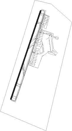
Nanchang - Nanchang Changbei International Airport
Airport details
| Country | China |
| State | Jiangxi |
| Region | ZS |
| Airspace | Shanghai Ctr |
| Municipality | Lehua |
| Elevation | 143ft (44m) |
| Timezone | GMT +8 |
| Coordinates | 28.86333, 115.90000 |
| Magnetic var | |
| Type | land |
| Available since | X-Plane v10.40 |
| ICAO code | ZSCN |
| IATA code | KHN |
| FAA code | n/a |
Communication
| NANCHANG Changbei International Airport ATIS | 128.400 |
| NANCHANG Changbei International Airport NANCHANG Ground Control | 121.700 |
| NANCHANG Changbei International Airport NANCHANG Tower | 118.650 |
| NANCHANG Changbei International Airport NANCHANG Tower | 130.000 |
| NANCHANG Changbei International Airport NANCHANG Approach | 119.950 |
Approach frequencies
| ILS-cat-I | RW03 | 111.7 | 18.00mi |
| ILS-cat-I | RW21 | 110.5 | 18.00mi |
| 3° GS | RW03 | 111.7 | 18.00mi |
| 3° GS | RW21 | 110.5 | 18.00mi |
Nearby Points of Interest:
Nanchang ba yi qi yi ji nian guan
-Former Headquarters of the New Fourth Army
-Zhenru Temple
Nearby beacons
| code | identifier | dist | bearing | frequency |
|---|---|---|---|---|
| E | CHANGBEI NDB | 1.4 | 202° | 192 |
| NCH | CHANGBEI VOR/DME | 1.5 | 29° | 115.10 |
| RP | LIJIA NDB | 17.8 | 218° | 210 |
| KHN | XIANGTANG VOR/DME | 26 | 177° | 112.70 |
Departure and arrival routes
| Transition altitude | 9843ft |
| Transition level | 11811ft |
| SID end points | distance | outbound heading | |
|---|---|---|---|
| RW03 | |||
| OSO93D, OSO92D, OSO91D, OSO01D | 67mi | 193° | |
| ANI92D, ANI91D, ANI01D | 59mi | 238° | |
| LAP91D, LAP01D | 46mi | 340° | |
| RW21 | |||
| OSO81D, OSO11D, OSO82D | 67mi | 193° | |
| ANI11D, ANI81D | 59mi | 238° | |
| LAP11D, LAP81D | 46mi | 340° | |
| STAR starting points | distance | inbound heading | |
|---|---|---|---|
| RW03 | |||
| OSO92A, OSO91A, OSO01A | 67.2 | 13° | |
| ANI01A, ANI91A | 58.5 | 58° | |
| LAP91A, LAP01A | 46.1 | 160° | |
| RW21 | |||
| OSO82A, OSO81A, OSO11A | 67.2 | 13° | |
| ANI11A, ANI81A | 58.5 | 58° | |
| LAP82A, LAP81A, LAP11A | 46.1 | 160° | |
Holding patterns
| STAR name | hold at | type | turn | heading* | altitude | leg | speed limit |
|---|---|---|---|---|---|---|---|
| ANI01A | D230Z | VHF | right | 230 (50)° | > 8860ft | 1.0min timed | 230 |
| ANI11A | NCH | NDB | right | 40 (220)° | > 5910ft | 1.0min timed | 230 |
| ANI81A | CN212 | VHF | left | 206 (26)° | > 12800ft | 1.0min timed | 230 |
| ANI91A | CN106 | VHF | right | 228 (48)° | > 8860ft | 1.0min timed | 230 |
| LAP01A | EMRAL | VHF | left | 346 (166)° | > 9850ft | 1.0min timed | 230 |
| LAP01A | NCH | NDB | right | 40 (220)° | > 5910ft | 1.0min timed | 230 |
| LAP81A | PEXEK | VHF | left | 343 (163)° | 1.0min timed | 230 | |
| LAP82A | PEXEK | VHF | left | 343 (163)° | 1.0min timed | 230 | |
| LAP91A | CN112 | VHF | left | 26 (206)° | > 7880ft | 1.0min timed | 230 |
| LAP91A | EMRAL | VHF | left | 346 (166)° | > 9850ft | 1.0min timed | 230 |
| OSO01A | D230Z | VHF | right | 230 (50)° | > 8860ft | 1.0min timed | 230 |
| OSO11A | NCH | NDB | right | 40 (220)° | > 5910ft | 1.0min timed | 230 |
| OSO81A | CN212 | VHF | left | 206 (26)° | > 12800ft | 1.0min timed | 230 |
| OSO91A | CN106 | VHF | right | 228 (48)° | > 8860ft | 1.0min timed | 230 |
| OSO91A | CN109 | VHF | right | 167 (347)° | 12800ft - 13800ft | 1.0min timed | 230 |
| *) magnetic outbound (inbound) holding course | |||||||
Disclaimer
The information on this website is not for real aviation. Use this data with the X-Plane flight simulator only! Data taken with kind consent from X-Plane 12 source code and data files. Content is subject to change without notice.