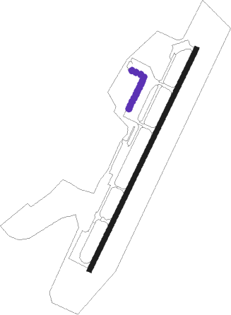
Quanzhou - Quanzhou Jinjiang
Airport details
| Country | China |
| State | Fujian |
| Region | ZS |
| Airspace | Shanghai Ctr |
| Municipality | Jinjiang City |
| Elevation | 28ft (9m) |
| Timezone | GMT +8 |
| Coordinates | 24.79833, 118.58833 |
| Magnetic var | |
| Type | land |
| Available since | X-Plane v10.40 |
| ICAO code | ZSQZ |
| IATA code | JJN |
| FAA code | n/a |
Communication
Approach frequencies
| ILS-cat-I | RW03 | 111.7 | 18.00mi |
| ILS-cat-I | RW21 | 108.7 | 18.00mi |
| 3° GS | RW03 | 111.7 | 18.00mi |
| 3° GS | RW21 | 108.7 | 18.00mi |
Runway info
| Runway 03 / 21 | ||
| length | 2608m (8556ft) | |
| bearing | 33° / 213° | |
| width | 50m (164ft) | |
| surface | asphalt | |
| blast zone | 58m (190ft) / 62m (203ft) | |
Nearby beacons
| code | identifier | dist | bearing | frequency |
|---|---|---|---|---|
| JNJ | JINJIANG VOR/DME | 0.4 | 55° | 117 |
| O | JINJIANG (QUANZHOU) NDB | 1.1 | 36° | 438 |
| D | JINJIANG NDB | 1.2 | 209° | 405 |
| OJ | JINJIANG NDB | 4.4 | 33° | 212 |
| BS | KINMEN NDB | 25.8 | 213° | 345 |
| KIN | CHIN MEN TACAN | 25.9 | 213° | 109.20 |
| XMN | XIAMEN VOR/DME | 29.6 | 241° | 114.50 |
| XLN | XINGLIN VOR/DME | 34.2 | 248° | 114.70 |
| FQG | FUQING VOR/DME | 71.2 | 40° | 117.40 |
Departure and arrival routes
| Transition altitude | 5925ft |
| Transition level | 11800ft |
| SID end points | distance | outbound heading | |
|---|---|---|---|
| RW03 | |||
| FQG11D, FQG71D, FQG72D | 71mi | 40° | |
| NUS72D, NUS71D | 69mi | 232° | |
| XLN11D | 34mi | 248° | |
| RW21 | |||
| FQG12D, FQG61D, FQG62D | 71mi | 40° | |
| NUS61D, NUS62D | 69mi | 232° | |
| XLN12D | 34mi | 248° | |
| STAR starting points | distance | inbound heading | |
|---|---|---|---|
| RW03 | |||
| TEB72A, TEB71A | 71.4 | 59° | |
| XLN01A | 34.2 | 68° | |
| FQG01A, FQG72A, FQG71A | 71.2 | 220° | |
| RW21 | |||
| TEB62A, TEB61A | 71.4 | 59° | |
| XLN04A, XLN02A | 34.2 | 68° | |
| FQG62A, FQG61A, FQG02A | 71.2 | 220° | |
Holding patterns
| STAR name | hold at | type | turn | heading* | altitude | leg | speed limit |
|---|---|---|---|---|---|---|---|
| FQG01A | JNJ | NDB | left | 14 (194)° | > 4950ft | 1.0min timed | 215 |
| FQG02A | ATSAB | VHF | right | 50 (230)° | > 5930ft | 1.0min timed | 230 |
| FQG61A | ATSAB | VHF | right | 50 (230)° | > 5930ft | 1.0min timed | 230 |
| FQG62A | QZ110 | VHF | right | 214 (34)° | > 4950ft | 1.0min timed | 230 |
| FQG71A | ATSAB | VHF | right | 50 (230)° | > 5930ft | 1.0min timed | 230 |
| FQG72A | ATSAB | VHF | right | 50 (230)° | > 5930ft | 1.0min timed | 230 |
| FQG72A | QZ109 | VHF | left | 34 (214)° | > 5930ft | 1.0min timed | 230 |
| TEB61A | QZ309 | VHF | left | 315 (135)° | > 5930ft | 1.0min timed | 230 |
| TEB62A | QZ110 | VHF | right | 214 (34)° | > 4950ft | 1.0min timed | 230 |
| TEB72A | QZ109 | VHF | left | 34 (214)° | > 5930ft | 1.0min timed | 230 |
| TEB72A | QZ309 | VHF | left | 315 (135)° | > 5930ft | 1.0min timed | 230 |
| XLN02A | JNJ | NDB | left | 14 (194)° | > 4950ft | 1.0min timed | 215 |
| *) magnetic outbound (inbound) holding course | |||||||
Disclaimer
The information on this website is not for real aviation. Use this data with the X-Plane flight simulator only! Data taken with kind consent from X-Plane 12 source code and data files. Content is subject to change without notice.
