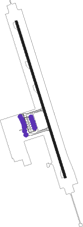
Yangzhou And Taizhou - Yangzhou Taizhou
Airport details
| Country | China |
| State | Jiangsu |
| Region | ZS |
| Airspace | Shanghai Ctr |
| Municipality | Yangzhou City |
| Elevation | 16ft (5m) |
| Timezone | GMT +8 |
| Coordinates | 32.56167, 119.71833 |
| Magnetic var | |
| Type | land |
| Available since | X-Plane v10.40 |
| ICAO code | ZSYA |
| IATA code | YTY |
| FAA code | n/a |
Communication
| Yangzhou Taizhou Tower Secondry | 123.550 |
| Yangzhou Taizhou Tower | 130.450 |
Approach frequencies
| ILS-cat-I | RW35 | 110.1 | 18.00mi |
| ILS-cat-I | RW17 | 110.7 | 18.00mi |
| 3° GS | RW35 | 110.1 | 18.00mi |
| 3° GS | RW17 | 110.7 | 18.00mi |
Nearby beacons
| code | identifier | dist | bearing | frequency |
|---|---|---|---|---|
| SJD | YANGZHOU VOR/DME | 1.1 | 159° | 113.10 |
| ZJ | BENNIU NDB | 37.2 | 181° | 217 |
| CZO | CHANGZHOU VOR/DME | 38.5 | 175° | 113.80 |
| VMB | WUXI VOR/DME | 54.7 | 150° | 113.90 |
| YCH | YANCHENG VOR/DME | 57.2 | 29° | 115.30 |
| GT | QUNLI NDB | 57.4 | 221° | 276 |
| A | DAJIAOCHANG NDB | 58.3 | 238° | 511 |
| MLJ | MOLING VOR/DME | 61.4 | 230° | 117.05 |
| NJL | LUKOU VOR/DME | 64.3 | 226° | 113.60 |
| SNQ | SHIQIU VOR/DME | 65.2 | 220° | 115.75 |
| Z | LUKOU NDB | 67.9 | 226° | 420 |
Departure and arrival routes
| Transition altitude | 9843ft |
| Transition level | 11811ft |
| SID end points | distance | outbound heading | |
|---|---|---|---|
| RW17 | |||
| VMB12D, VMB92D, VMB94D, VMB14D | 55mi | 150° | |
| NOB12D, NOB92D | 58mi | 238° | |
| NIX92D, NIX12D | 36mi | 304° | |
| RW35 | |||
| VMB91D, VMB13D, VMB11D, VMB93D | 55mi | 150° | |
| NOB11D, NOB91D | 58mi | 238° | |
| NIX91D, NIX11D | 36mi | 304° | |
| STAR starting points | distance | inbound heading | |
|---|---|---|---|
| RW17 | |||
| NOB02A, NOB92A | 57.5 | 58° | |
| NIX02A, NIX92A | 36.2 | 124° | |
| VMB94A, VMB92A, VMB04A, VMB02A | 54.7 | 330° | |
| RW35 | |||
| NOB91A, NOB01A | 57.5 | 58° | |
| NIX91A, NIX01A | 36.2 | 124° | |
| VMB01A, VMB03A, VMB91A, VMB93A | 54.7 | 330° | |
Holding patterns
| STAR name | hold at | type | turn | heading* | altitude | leg | speed limit |
|---|---|---|---|---|---|---|---|
| NIX01A | SJD | NDB | left | 158 (338)° | > 3940ft | 1.0min timed | 230 |
| NIX91A | YA104 | VHF | left | 353 (173)° | > 3940ft | 1.0min timed | 230 |
| NIX92A | YA204 | VHF | right | 263 (83)° | > 3940ft | 1.0min timed | 230 |
| NOB02A | SJD | NDB | left | 158 (338)° | > 3940ft | 1.0min timed | 230 |
| NOB91A | YA104 | VHF | left | 353 (173)° | > 3940ft | 1.0min timed | 230 |
| NOB92A | YA204 | VHF | right | 263 (83)° | > 3940ft | 1.0min timed | 230 |
| VMB02A | SJD | NDB | left | 158 (338)° | > 3940ft | 1.0min timed | 230 |
| VMB04A | SJD | NDB | left | 158 (338)° | > 3940ft | 1.0min timed | 230 |
| VMB92A | YA204 | VHF | right | 263 (83)° | > 3940ft | 1.0min timed | 230 |
| VMB94A | YA204 | VHF | right | 263 (83)° | > 3940ft | 1.0min timed | 230 |
| ZJ02A | SJD | NDB | left | 158 (338)° | > 3940ft | 1.0min timed | 230 |
| ZJ92A | YA204 | VHF | right | 263 (83)° | > 3940ft | 1.0min timed | 230 |
| *) magnetic outbound (inbound) holding course | |||||||
Disclaimer
The information on this website is not for real aviation. Use this data with the X-Plane flight simulator only! Data taken with kind consent from X-Plane 12 source code and data files. Content is subject to change without notice.
