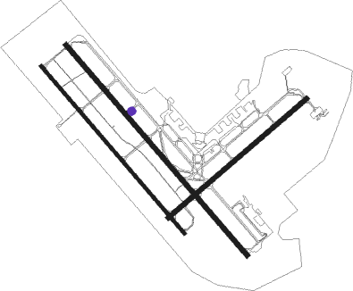
Cold Lake
Airport details
| Country | Canada |
| State | Alberta |
| Region | CY |
| Airspace | Edmonton Ctr |
| Municipality | City of Cold Lake |
| Elevation | 1771ft (540m) |
| Timezone | GMT -7 |
| Coordinates | 54.40500, -110.27944 |
| Magnetic var | |
| Type | land |
| Available since | X-Plane v10.40 |
| ICAO code | CYOD |
| IATA code | YOD |
| FAA code | YOD |
Communication
| Cold Lake Ground Control | 121.900 |
| Cold Lake Tower | 126.200 |
| Cold Lake ARR | 134.100 |
| Cold Lake ARR | 120.600 |
| Cold Lake ARR | 119.400 |
| Cold Lake ARR | 128.200 |
| Cold Lake ARR/Departure | 124.500 |
Approach frequencies
| ILS-cat-I | RW31R | 109.3 | 18.00mi |
| 3° GS | RW31R | 109.3 | 18.00mi |
Runway info
Nearby beacons
| code | identifier | dist | bearing | frequency |
|---|---|---|---|---|
| YOD | COLD LAKE NDB | 0.5 | 136° | 398 |
| UOD | COLD LAKE TACAN | 0.6 | 282° | 113.50 |
| 8M | ELK POINT NDB | 35.3 | 224° | 414 |
Instrument approach procedures
| runway | airway (heading) | route (dist, bearing) |
|---|---|---|
| RW04 | EBMUX (81°) | EBMUX OMLUN (5mi, 128°) 4100ft |
| RW04 | NORAV (46°) | NORAV OMLUN (5mi, 308°) 4100ft |
| RNAV | OMLUN 4100ft RERIM (5mi, 67°) 4050ft CYOD (7mi, 65°) 1822ft (6104mi, 116°) 5000ft OTODI (6092mi, 296°) 5000ft | |
| RW13L | ANEKA (153°) | ANEKA UDKAM (5mi, 247°) 4100ft |
| RW13L | NAGDU (110°) | NAGDU UDKAM (5mi, 67°) 4100ft |
| RNAV | UDKAM 4100ft AGLAV (5mi, 128°) 4050ft ITGUG (5mi, 128°) 2620ft CYOD (4mi, 125°) 1822ft (6104mi, 116°) 5000ft OTODI (6092mi, 296°) 5000ft | |
| RW13R | ALNAS (152°) | ALNAS SEBAT (5mi, 247°) 4100ft |
| RW13R | BOLRA (109°) | BOLRA SEBAT (5mi, 67°) 4100ft |
| RNAV | SEBAT 4100ft UDNIR (5mi, 128°) 4050ft ELVUV (5mi, 128°) 2620ft CYOD (4mi, 122°) 1821ft (6104mi, 116°) 5000ft OTODI (6092mi, 296°) 5000ft | |
| RW22 | ALUXI (262°) | ALUXI EMGUL (5mi, 309°) 4100ft |
| RW22 | VITUV (229°) | VITUV EMGUL (5mi, 129°) 4100ft |
| RNAV | EMGUL 4100ft TUDEL (5mi, 247°) 4050ft CYOD (8mi, 248°) 1817ft (6104mi, 116°) 5000ft OTODI (6092mi, 296°) 5000ft | |
| RW31L | ALSAG (291°) | ALSAG EPBED (5mi, 247°) 4100ft |
| RW31L | ILULU (339°) | ILULU EPBED (5mi, 67°) 4100ft |
| RNAV | EPBED 4100ft OBMUX (5mi, 309°) 4050ft BIRDA (3mi, 309°) 3030ft CYOD (4mi, 315°) 1823ft (6104mi, 116°) 5000ft OTODI (6092mi, 296°) 5000ft | |
| RW31R | PITID (337°) | PITID TAMAV (5mi, 67°) 4100ft |
| RW31R | UDPAG (291°) | UDPAG TAMAV (5mi, 247°) 4100ft |
| RNAV | TAMAV 4100ft UDLOT (5mi, 309°) 4050ft APMEG (4mi, 309°) 2650ft CYOD (3mi, 312°) 1819ft (6104mi, 116°) 5000ft OTODI (6092mi, 296°) 5000ft |
Disclaimer
The information on this website is not for real aviation. Use this data with the X-Plane flight simulator only! Data taken with kind consent from X-Plane 12 source code and data files. Content is subject to change without notice.

