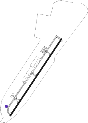
Lomé - Gnassingbe Eyadema Intl
Airport details
| Country | Togo |
| State | Maritime Region |
| Region | DX |
| Airspace | Accra Ctr |
| Municipality | Lomé |
| Elevation | 70ft (21m) |
| Timezone | GMT +0 |
| Coordinates | 6.16594, 1.25431 |
| Magnetic var | |
| Type | land |
| Available since | X-Plane v10.40 |
| ICAO code | DXXX |
| IATA code | LFW |
| FAA code | n/a |
Communication
| Gnassingbe Eyadema Intl A/G VOICE RDO | 123.600 |
| Gnassingbe Eyadema Intl Tower | 120.700 |
Approach frequencies
| ILS-cat-II | RW22 | 110.1 | 18.00mi |
| 3° GS | RW22 | 110.1 | 18.00mi |
Nearby beacons
| code | identifier | dist | bearing | frequency |
|---|---|---|---|---|
| LM | LOME VOR/DME | 1.3 | 39° | 115.30 |
| LE | LOME NDB | 4.9 | 39° | 294 |
Departure and arrival routes
| Transition altitude | 2600ft |
| SID end points | distance | outbound heading | |
|---|---|---|---|
| RW04 | |||
| MONO1N | 32mi | 79° | |
| KETA1N | 16mi | 249° | |
| AMSO1N | 27mi | 339° | |
| RW22 | |||
| MONO1S | 32mi | 79° | |
| KETA1S | 16mi | 249° | |
| AMSO1S | 27mi | 339° | |
| STAR starting points | distance | inbound heading | |
|---|---|---|---|
| ALL | |||
| KETA1V | 16.2 | 69° | |
| AMSO1V | 26.7 | 159° | |
| MONO1V | 32.1 | 259° | |
| RW04 | |||
| KETA2I, KETA1I, KETA1D | 16.2 | 69° | |
| AMSO2I | 26.7 | 159° | |
| MONO1I, MONO2I | 32.1 | 259° | |
| RW22 | |||
| KETA2L, KETA1L | 16.2 | 69° | |
| AMSO2L, AMSO1L | 26.7 | 159° | |
| MONO1L, MONO2L | 32.1 | 259° | |
Instrument approach procedures
| runway | airway (heading) | route (dist, bearing) |
|---|---|---|
| RW04 | IPELI (39°) | IPELI 2000ft |
| RW04 | LM011 (58°) | LM011 IPELI (5mi, 109°) 2000ft |
| RW04 | LM012 (19°) | LM012 IPELI (5mi, 329°) 2000ft |
| RNAV | IPELI 2000ft LM013 (5mi, 39°) 2000ft LM014 (2mi, 39°) 1330ft DXXX (5mi, 39°) 112ft LM015 (4mi, 39°) LM016 (13mi, 139°) 2000ft | |
| RW22 | LIGOL (219°) | LIGOL 2000ft |
| RW22 | LM005 (200°) | LM005 LIGOL (5mi, 149°) 2000ft |
| RW22 | LM006 (237°) | LM006 LIGOL (5mi, 289°) 2000ft |
| RNAV | LIGOL 2000ft LM007 (6mi, 219°) 2000ft LE (2mi, 218°) 1450ft LM008 (2mi, 219°) 750ft DXXX (3mi, 219°) 114ft LM009 (2mi, 219°) LM010 (13mi, 119°) 2000ft |
Holding patterns
| STAR name | hold at | type | turn | heading* | altitude | leg | speed limit |
|---|---|---|---|---|---|---|---|
| AMSO1L | LIGOL | VHF | left | 43 (223)° | 2000ft - 9000ft | DME 5.0mi | 230 |
| GAGU1I | IPELI | VHF | right | 223 (43)° | 2000ft - 9000ft | DME 5.0mi | 230 |
| GAGU1L | LIGOL | VHF | left | 43 (223)° | 2000ft - 9000ft | DME 5.0mi | 230 |
| GASO1L | LIGOL | VHF | left | 43 (223)° | 2000ft - 9000ft | DME 5.0mi | 230 |
| GASO2L | LIGOL | VHF | left | 43 (223)° | 2000ft - 9000ft | DME 5.0mi | 230 |
| KETA1I | IPELI | VHF | right | 223 (43)° | 2000ft - 9000ft | DME 5.0mi | 230 |
| KETA1L | LIGOL | VHF | left | 43 (223)° | 2000ft - 9000ft | DME 5.0mi | 230 |
| MILT1I | IPELI | VHF | right | 223 (43)° | 2000ft - 9000ft | DME 5.0mi | 230 |
| MILT1L | LIGOL | VHF | left | 43 (223)° | 2000ft - 9000ft | DME 5.0mi | 230 |
| MIMS1L | LIGOL | VHF | left | 43 (223)° | 2000ft - 9000ft | DME 5.0mi | 230 |
| MIMS2L | LIGOL | VHF | left | 43 (223)° | 2000ft - 9000ft | DME 5.0mi | 230 |
| MONO1I | IPELI | VHF | right | 223 (43)° | 2000ft - 9000ft | DME 5.0mi | 230 |
| MONO1L | LIGOL | VHF | left | 43 (223)° | 2000ft - 9000ft | DME 5.0mi | 230 |
| SABG1I | IPELI | VHF | right | 223 (43)° | 2000ft - 9000ft | DME 5.0mi | 230 |
| SABG1L | LIGOL | VHF | left | 43 (223)° | 2000ft - 9000ft | DME 5.0mi | 230 |
| *) magnetic outbound (inbound) holding course | |||||||
Disclaimer
The information on this website is not for real aviation. Use this data with the X-Plane flight simulator only! Data taken with kind consent from X-Plane 12 source code and data files. Content is subject to change without notice.
