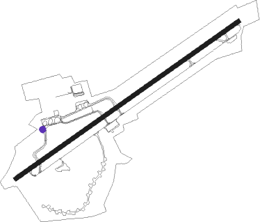
Memmingen - Memmingen/ Allgaeu
Airport details
| Country | Germany |
| State | Bavaria |
| Region | ED |
| Airspace | Munich Ctr |
| Municipality | Memmingerberg |
| Elevation | 2062ft (628m) |
| Timezone | GMT +1 |
| Coordinates | 47.98882, 10.23948 |
| Magnetic var | |
| Type | land |
| Available since | X-Plane v10.40 |
| ICAO code | EDJA |
| IATA code | FMM |
| FAA code | n/a |
Communication
| Memmingen/ Allgaeu Memmingen ATIS | 118.855 |
| Memmingen/ Allgaeu Memmingen Ground | 121.680 |
| Memmingen/ Allgaeu Memmingen Tower | 126.855 |
| Memmingen/ Allgaeu Memmingen Departure | 129.450 |
Approach frequencies
| ILS-cat-I | RW06 | 111.1 | 18.00mi |
| ILS-cat-I | RW24 | 110.1 | 18.00mi |
| 3° GS | RW06 | 111.1 | 18.00mi |
| 3° GS | RW24 | 110.1 | 18.00mi |
Nearby Points of Interest:
St. Johannes (Ungerhausen)
-St. Gordian und Epimachus
-St. Johann Nepomuk
-Pulverturm (Memmingen)
-Pfarrkirche Herbishofen
-Kreuzstraße 11
-Kalchstraße 25
-St. Peter und Paul
-Kreuzherrenkloster
-Storchenfärbe
-Elefantenapotheke
-Einhornapotheke (Memmingen)
-Kramerstraße 13
-Gasthaus zum Raben
-Hartliebhaus
-Town hall of Memmingen
-Zum Goldenen Löwen
-Miller am Markt
-Steuerhaus
-Wachterhaus
-Baumstraße 1
-Kramerzunft
-Herrenstraße 16
-Herrenstraße 18
-Herrenstraße 22
Nearby beacons
| code | identifier | dist | bearing | frequency |
|---|---|---|---|---|
| ALD | (MEMMINGEN/ALLGAU) DME | 0.3 | 269° | 117.20 |
| ALG | ALLGAEU (MEMMINGEN) NDB | 1 | 69° | 341 |
| KPT | KEMPTEN VOR/DME | 15.2 | 156° | 108.40 |
| LUP | LAUPHEIM NDB | 19 | 305° | 407 |
| LCH | LECHFELD TACAN | 27.6 | 72° | 108.80 |
| FHD | DME | 35.3 | 246° | 112.60 |
| AGB | AUGSBURG NDB | 38.1 | 58° | 318 |
| AUG | DME | 38.3 | 58° | 115.90 |
| WLD | WALDA VOR/DME | 50.2 | 56° | 112.80 |
| TGO | TANGO TACAN | 54.4 | 303° | 112.50 |
| STG | STUTTGART VOR/DME | 57.8 | 306° | 116.85 |
| NEU | NEUBURG TACAN | 58.2 | 53° | 108.90 |
| LBU | LUBURG VOR/DME | 66 | 316° | 109.20 |
Departure and arrival routes
| Transition altitude | 5000ft |
| SID end points | distance | outbound heading | |
|---|---|---|---|
| RW06 | |||
| KPT4B | 15mi | 156° | |
| UMTE2B | 26mi | 256° | |
| LUPO5B | 19mi | 305° | |
| RW24 | |||
| KPT4A | 15mi | 156° | |
| UMTE1A | 26mi | 256° | |
| LUPO5A | 19mi | 305° | |
| STAR starting points | distance | inbound heading | |
|---|---|---|---|
| RW06 | |||
| ALOX1C | 17.1 | 51° | |
| LUPO1C | 19.0 | 125° | |
| KPT1C | 15.2 | 336° | |
| RW24 | |||
| ALOX1D | 17.1 | 51° | |
| LUPO1D | 19.0 | 125° | |
| KPT1D | 15.2 | 336° | |
Instrument approach procedures
| runway | airway (heading) | route (dist, bearing) |
|---|---|---|
| RW06 | ALG (249°) | ALG 6000ft JA555 (10mi, 210°) 6000ft JA450 (4mi, 248°) 5000ft JA430 (6mi, 319°) 4000ft FIMPE (4mi, 68°) 4000ft |
| RW06 | JA430 (68°) | JA430 4000ft FIMPE (4mi, 68°) 4000ft |
| RNAV | FIMPE 4000ft EDJA (7mi, 68°) 2129ft JA062 (5mi, 68°) (2935mi, 192°) 3100ft ALG (2932mi, 12°) 6000ft | |
| RW24 | ALG (249°) | ALG 6000ft JA456 (8mi, 101°) 6000ft JA458 (4mi, 68°) 5000ft JA438 (6mi, 319°) 4000ft TUXNE (4mi, 248°) 4000ft |
| RW24 | JA438 (248°) | JA438 4000ft TUXNE (4mi, 248°) 4000ft |
| RNAV | TUXNE 4000ft EDJA (7mi, 248°) 2110ft JA248 (5mi, 248°) (2927mi, 192°) 3100ft ALG (2932mi, 12°) 6000ft |
Holding patterns
| STAR name | hold at | type | turn | heading* | altitude | leg | speed limit |
|---|---|---|---|---|---|---|---|
| KPT1C | KPT | NDB | right | 70 (250)° | 15000ft - 31000ft | 1.5min timed | ICAO rules |
| KPT1D | KPT | NDB | right | 70 (250)° | 15000ft - 31000ft | 1.5min timed | ICAO rules |
| LUPO1C | LUPOL | VHF | left | 311 (131)° | > 7000ft | 1.0min timed | 230 |
| LUPO1D | LUPOL | VHF | left | 311 (131)° | > 7000ft | 1.0min timed | 230 |
| *) magnetic outbound (inbound) holding course | |||||||
Disclaimer
The information on this website is not for real aviation. Use this data with the X-Plane flight simulator only! Data taken with kind consent from X-Plane 12 source code and data files. Content is subject to change without notice.