Liverpool
Airport details
| Country | United Kingdom |
| State | England |
| Region | EG |
| Airspace | London Ctr |
| Municipality | Liverpool |
| Elevation | 80ft (24m) |
| Timezone | GMT +0 |
| Coordinates | 53.33361, -2.84972 |
| Magnetic var | |
| Type | land |
| Available since | X-Plane v10.40 |
| ICAO code | EGGP |
| IATA code | LPL |
| FAA code | n/a |
Communication
| Liverpool Liverpool Information | 124.330 |
| Liverpool Liverpool Ground | 121.955 |
| Liverpool Liverpool Tower | 126.355 |
| Liverpool Liverpool Approach | 119.855 |
Approach frequencies
| ILS-cat-III | RW27 | 111.75 | 18.00mi |
| ILS-cat-I | RW09 | 111.75 | 18.00mi |
| 3° GS | RW27 | 111.75 | 18.00mi |
| 3° GS | RW09 | 111.75 | 18.00mi |
Nearby Points of Interest:
Manor House, Hale
-Much Woolton Old School
-Woolton Hall
-Allerton Priory
-Allerton Golf Club House
-Ince Manor
-Calderstones House
-Christ Church, Ellesmere Port
-Bridgewater House
-Chapel of the Good Shepherd, Carlett Park
-Runcorn signal box
-Carnegie Library, Runcorn
-Greenbank House, Mossley Hill
-Greenbank Drive Synagogue
-Norwegian Fishermans' Church, Liverpool
-Runcorn Town Hall
-Wavertree Lockup
-Picton Clock Tower
-Widnes Town Hall
-Monk's Well
-Helsby War Memorial
-Ullet Road Unitarian Church
-Rake Hall
-Hapsford Hall
-St Matthew's Church, Bromborough Pool
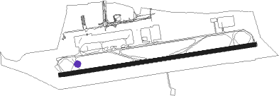
Runway info
| Runway 09 / 27 | ||
| length | 2281m (7484ft) | |
| bearing | 87° / 267° | |
| width | 46m (151ft) | |
| surface | asphalt | |
| displ threshold | 61m (200ft) / 0m (0ft) | |
Nearby beacons
| code | identifier | dist | bearing | frequency |
|---|---|---|---|---|
| LPL | LIVERPOOL NDB | 4.4 | 87° | 349 |
| HAW | HAWARDEN NDB | 10.3 | 220° | 340 |
| WAL | WALLASEY VOR/DME | 10.7 | 282° | 114.10 |
| WHI | WHITEGATE NDB | 12 | 123° | 368 |
| MCT | MANCHESTER VOR/DME | 21.1 | 88° | 113.55 |
| WTN | WARTON TACAN | 24.5 | 355° | 113.20 |
| WTN | WARTON NDB | 25.1 | 360° | 337 |
| BPL | BLACKPOOL NDB | 27.1 | 338° | 318 |
| SWB | SHAWBURY VOR/DME | 32.8 | 161° | 116.80 |
| POL | POLE HILL VOR/DME | 36.2 | 61° | 112.10 |
| WPL | WELSHPOOL NDB | 43.6 | 203° | 323 |
| WL | BARROW (WALNEY ISLAND) NDB | 49.8 | 332° | 385 |
| WBA | WOLVERHAMPTON NDB | 53.5 | 144° | 356 |
| WOL | DME | 53.5 | 144° | 108.60 |
Departure and arrival routes
| Transition altitude | 5000ft |
| SID end points | distance | outbound heading | |
|---|---|---|---|
| RW09 | |||
| POL5V | 36mi | 61° | |
| BART1V | 17mi | 72° | |
| NANT2V | 16mi | 125° | |
| REXA2V | 20mi | 229° | |
| WAL2V | 11mi | 282° | |
| RW27 | |||
| POL4T | 36mi | 61° | |
| BART1T | 17mi | 72° | |
| NANT2T | 16mi | 125° | |
| REXA2T | 20mi | 229° | |
| WAL2T | 11mi | 282° | |
| STAR starting points | distance | inbound heading | |
|---|---|---|---|
| ALL | |||
| KEGU1D, TIPO1J | 28.9 | 36° | |
| TIPO4A | 27.6 | 96° | |
| TIPO2B | 33.6 | 109° | |
| TIPO1C | 20.8 | 227° | |
| TIPO1D | 36.2 | 241° | |
| TIPO1E | 36.1 | 259° | |
| KEGU2B, TIPO2G | 45.6 | 283° | |
| KEGU2A, TIPO2F | 73.4 | 288° | |
| TIPO2H, KEGU2C | 53.9 | 297° | |
Holding patterns
| STAR name | hold at | type | turn | heading* | altitude | leg | speed limit |
|---|---|---|---|---|---|---|---|
| KEGU1D | KEGUN | VHF | left | 184 (4)° | 1.0min timed | ICAO rules | |
| KEGU2A | KEGUN | VHF | left | 184 (4)° | 1.0min timed | ICAO rules | |
| KEGU2B | KEGUN | VHF | left | 184 (4)° | 1.0min timed | ICAO rules | |
| KEGU2C | KEGUN | VHF | left | 184 (4)° | 1.0min timed | ICAO rules | |
| TIPO1C | TIPOD | VHF | right | 297 (117)° | 1.0min timed | 210 | |
| TIPO1D | TIPOD | VHF | right | 297 (117)° | 1.0min timed | 210 | |
| TIPO1E | TIPOD | VHF | right | 297 (117)° | 1.0min timed | 210 | |
| TIPO1J | TIPOD | VHF | right | 297 (117)° | 1.0min timed | 210 | |
| TIPO2B | TIPOD | VHF | right | 297 (117)° | 1.0min timed | 210 | |
| TIPO2F | TIPOD | VHF | right | 297 (117)° | 1.0min timed | 210 | |
| TIPO2G | TIPOD | VHF | right | 297 (117)° | 1.0min timed | 210 | |
| TIPO2H | TIPOD | VHF | right | 297 (117)° | 1.0min timed | 210 | |
| TIPO4A | TIPOD | VHF | right | 297 (117)° | 1.0min timed | 210 | |
| *) magnetic outbound (inbound) holding course | |||||||
Disclaimer
The information on this website is not for real aviation. Use this data with the X-Plane flight simulator only! Data taken with kind consent from X-Plane 12 source code and data files. Content is subject to change without notice.