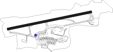
Saint Helier - Jersey
Airport details
| Country | Jersey |
| State | [Other] |
| Region | EG |
| Airspace | Brest Ctr |
| Municipality | St. Peter |
| Elevation | 273ft (83m) |
| Timezone | GMT +0 |
| Coordinates | 49.20795, -2.19552 |
| Magnetic var | |
| Type | land |
| Available since | X-Plane v10.40 |
| ICAO code | EGJJ |
| IATA code | JER |
| FAA code | n/a |
Communication
| Jersey Jersey Information | 134.680 |
| Jersey Jersey Ground | 121.905 |
| Jersey Jersey Tower | 119.455 |
| Jersey Jersey Approach | 120.305 |
Approach frequencies
| ILS-cat-I | RW26 | 110.3 | 18.00mi |
| ILS-cat-I | RW08 | 110.9 | 18.00mi |
| 3° GS | RW26 | 110.3 | 18.00mi |
| 3° GS | RW08 | 110.9 | 18.00mi |
Nearby Points of Interest:
Corps de garde de Carteret
-Phare de Carteret
-baptistère de Portbail
-Camp du Castel
-13 rue du vieux coutainville
Nearby beacons
| code | identifier | dist | bearing | frequency |
|---|---|---|---|---|
| JW | JERSEY NDB | 0.9 | 265° | 329 |
| JSY | JERSEY VOR/DME | 5.9 | 85° | 112.20 |
| GUR | GUERNSEY VOR/DME | 21 | 299° | 109.40 |
| ALD | ALDERNEY NDB | 30 | 360° | 383 |
| DIN | DINARD PLEURTUIT SAINT MA VOR/DME | 37.6 | 170° | 114.30 |
| MP | CHERBOURG NDB | 41.2 | 62° | 373 |
| SB | SAINT BRIEUC NDB | 44.9 | 223° | 353 |
Departure and arrival routes
| Transition altitude | 5000ft |
| SID end points | distance | outbound heading | |
|---|---|---|---|
| RW08 | |||
| ORTA2B | 48mi | 14° | |
| ORIS1D | 49mi | 24° | |
| BENI3B | 34mi | 64° | |
| LUSI1B | 16mi | 89° | |
| ORVA1B | 18mi | 115° | |
| DIN2B | 38mi | 170° | |
| LERA2B | 14mi | 228° | |
| TUNI2B | 87mi | 280° | |
| OYST2B, SKER2B | 61mi | 309° | |
| RW26 | |||
| ORTA3A | 48mi | 14° | |
| ORIS1C | 49mi | 24° | |
| BENI5A | 34mi | 64° | |
| LUSI1A | 16mi | 89° | |
| ORVA1A | 18mi | 115° | |
| DIN3A | 38mi | 170° | |
| LERA2A | 14mi | 228° | |
| TUNI3A | 87mi | 280° | |
| SKER3A | 61mi | 309° | |
| STAR starting points | distance | inbound heading | |
|---|---|---|---|
| RW08 | |||
| LERA1K | 14.1 | 48° | |
| TUNI1K | 33.1 | 102° | |
| SKER1K | 60.9 | 129° | |
| BIGN1K | 53.5 | 142° | |
| LELN1K | 46.6 | 187° | |
| ORTA1K | 48.0 | 194° | |
| BEVA1K | 21.5 | 286° | |
| RW26 | |||
| LERA1J | 14.1 | 48° | |
| TUNI1J | 33.1 | 102° | |
| SKER1L, SKER1J | 60.9 | 129° | |
| BIGN1J, BIGN1L | 53.5 | 142° | |
| LELN1J | 46.6 | 187° | |
| ORTA1J | 48.0 | 194° | |
| BEVA1J | 21.5 | 286° | |
| MINQ1J | 11.8 | 322° | |
Instrument approach procedures
| runway | airway (heading) | route (dist, bearing) |
|---|---|---|
| RW08 | BAGIN (67°) | BAGIN 2000ft GIPTA (5mi, 349°) 2000ft |
| RW08 | LAPLI (102°) | LAPLI 2000ft GIPTA (5mi, 169°) 2000ft |
| RNAV | GIPTA 2000ft JJ08F (5mi, 85°) 2000ft EGJJ (6mi, 85°) 323ft JJM01 (4mi, 85°) JJM02 (5mi, 169°) GAMDU (3mi, 265°) 3000ft | |
| RW26 | TIDMA (248°) | TIDMA 2000ft NENRI (5mi, 169°) 2000ft |
| RW26 | TIXON (282°) | TIXON 2000ft NENRI (5mi, 349°) 2000ft |
| RNAV | NENRI 2000ft JJ26F (5mi, 265°) 2000ft EGJJ (6mi, 265°) 324ft JJM03 (3mi, 265°) JJM04 (5mi, 169°) TIXON (14mi, 85°) 3000ft |
Holding patterns
| STAR name | hold at | type | turn | heading* | altitude | leg | speed limit |
|---|---|---|---|---|---|---|---|
| BEVA1J | JSY | NDB | left | 85 (265)° | > 2000ft | 1.0min timed | 185 |
| BEVA1K | JW | FIX | right | 263 (83)° | > 2000ft | 1.0min timed | 185 |
| BEVA1K | SHARK | VHF | right | 265 (85)° | DME 4.8mi | ICAO rules | |
| BIGN1J | JSY | NDB | left | 85 (265)° | > 2000ft | 1.0min timed | 185 |
| BIGN1K | GUR | NDB | left | 268 (88)° | > 2000ft | 1.0min timed | ICAO rules |
| BIGN1K | JW | FIX | right | 263 (83)° | > 2000ft | 1.0min timed | 185 |
| BIGN1K | SHARK | VHF | right | 265 (85)° | DME 4.8mi | ICAO rules | |
| BIGN1L | JSY | NDB | left | 85 (265)° | > 2000ft | 1.0min timed | 185 |
| LELN1J | JSY | NDB | left | 85 (265)° | > 2000ft | 1.0min timed | 185 |
| LELN1K | D045W | VHF | left | 259 (79)° | 1.0min timed | ICAO rules | |
| LELN1K | JW | FIX | right | 263 (83)° | > 2000ft | 1.0min timed | 185 |
| LELN1K | SHARK | VHF | right | 265 (85)° | DME 4.8mi | ICAO rules | |
| LERA1J | JSY | NDB | left | 85 (265)° | > 2000ft | 1.0min timed | 185 |
| LERA1K | JW | FIX | right | 263 (83)° | > 2000ft | 1.0min timed | 185 |
| LERA1K | SHARK | VHF | right | 265 (85)° | DME 4.8mi | ICAO rules | |
| MINQ1J | JSY | NDB | left | 85 (265)° | > 2000ft | 1.0min timed | 185 |
| ORTA1J | JSY | NDB | left | 85 (265)° | > 2000ft | 1.0min timed | 185 |
| ORTA1K | D045W | VHF | left | 259 (79)° | 1.0min timed | ICAO rules | |
| ORTA1K | JW | FIX | right | 263 (83)° | > 2000ft | 1.0min timed | 185 |
| ORTA1K | SHARK | VHF | right | 265 (85)° | DME 4.8mi | ICAO rules | |
| SKER1J | JSY | NDB | left | 85 (265)° | > 2000ft | 1.0min timed | 185 |
| SKER1K | GUR | NDB | left | 268 (88)° | > 2000ft | 1.0min timed | ICAO rules |
| SKER1K | JW | FIX | right | 263 (83)° | > 2000ft | 1.0min timed | 185 |
| SKER1K | SHARK | VHF | right | 265 (85)° | DME 4.8mi | ICAO rules | |
| SKER1L | JSY | NDB | left | 85 (265)° | > 2000ft | 1.0min timed | 185 |
| TUNI1J | JSY | NDB | left | 85 (265)° | > 2000ft | 1.0min timed | 185 |
| TUNI1K | JW | FIX | right | 263 (83)° | > 2000ft | 1.0min timed | 185 |
| TUNI1K | SHARK | VHF | right | 265 (85)° | DME 4.8mi | ICAO rules | |
| *) magnetic outbound (inbound) holding course | |||||||
Disclaimer
The information on this website is not for real aviation. Use this data with the X-Plane flight simulator only! Data taken with kind consent from X-Plane 12 source code and data files. Content is subject to change without notice.