London - London Gatwick
Airport details
| Country | United Kingdom |
| State | England |
| Region | EG |
| Airspace | London Ctr |
| Municipality | Crawley |
| Elevation | 203ft (62m) |
| Timezone | GMT +0 |
| Coordinates | 51.14806, -0.19028 |
| Magnetic var | |
| Type | land |
| Available since | X-Plane v10.40 |
| ICAO code | EGKK |
| IATA code | LGW |
| FAA code | n/a |
Communication
| London Gatwick Gatwick ATIS | 136.525 |
| London Gatwick Gatwick Clearance Delivery | 121.955 |
| London Gatwick Gatwick Ground | 121.805 |
| London Gatwick Gatwick Tower | 124.230 |
| London Gatwick Gatwick Approach | 118.950 |
| London Gatwick Gatwick Approach | 126.825 |
| London Gatwick Gatwick Approach | 129.025 |
Approach frequencies
| ILS-cat-III | RW08R | 110.9 | 18.00mi |
| ILS-cat-III | RW26L | 110.9 | 18.00mi |
| 3° GS | RW08R | 110.9 | 18.00mi |
| 3° GS | RW26L | 110.9 | 18.00mi |
Nearby Points of Interest:
Charlwood House
-Beehive
-Tree House
-Ancient Priors
-Friary Church of St Francis and St Anthony, Crawley
-Broadfield House, Crawley
-Town Hall
-Wray Common Mill, Reigate
-Broome Hall
-Saint Hill Manor
-Tyes Place
-Stone Farm Rocks
-Balcombe Place
-Chesworth House
-Milton Court
-Greathed Manor
-Leonardslee
-New Mill
-Goddards
-Juniper Hall
-Abinger Common War Memorial
-Cherkley Court
-Barrow Green Court
-Birch Grove
Runway info
Runway 08R / 26L  | ||
| length | 3311m (10863ft) | |
| bearing | 82° / 262° | |
| width | 46m (150ft) | |
| surface | asphalt | |
| displ threshold | 393m (1289ft) / 424m (1391ft) | |
| blast zone | 0m (0ft) / 31m (102ft) | |
| Runway 08L / 26R | ||
| length | 2559m (8396ft) | |
| bearing | 82° / 262° | |
| width | 45m (148ft) | |
| surface | asphalt | |
| displ threshold | 321m (1053ft) / 417m (1368ft) | |
Airport layout
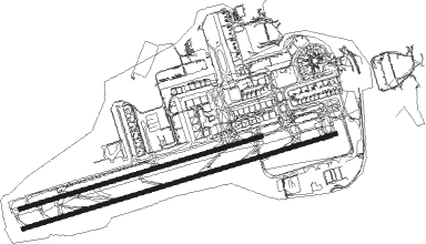
Taxiway locations
|
Parking locations
|
Nearby beacons
| code | identifier | dist | bearing | frequency |
|---|---|---|---|---|
| EPM | EPSOM NDB | 12.3 | 313° | 316 |
| OCK | OCKHAM VOR/DME | 13.5 | 301° | 115.30 |
| BIG | BIGGIN VOR/DME | 13.8 | 51° | 115.10 |
| MAY | MAYFIELD VOR/DME | 13.9 | 113° | 117.90 |
| MID | MIDHURST VOR/DME | 17.3 | 258° | 114 |
| SHM | SHOREHAM NDB | 19.1 | 199° | 332 |
| SRH | DME-ILS | 19.1 | 198° | 109.95 |
| LON | LONDON VOR/DME | 22.8 | 321° | 113.60 |
| LCY | LONDON CITY NDB | 23.4 | 36° | 322 |
| SFD | SEAFORD VOR/DME | 26 | 141° | 117 |
| BLC | DME | 26.7 | 285° | 116.20 |
| BLK | BLACKBUSHE NDB | 26.7 | 285° | 328 |
| GWC | GOODWOOD VOR/DME | 27.7 | 243° | 114.75 |
| BUR | BURNHAM NDB | 28.8 | 307° | 421 |
| ODH | ODIHAM TACAN | 28.9 | 276° | 109.60 |
| CHT | CHILTERN NDB | 31 | 325° | 277 |
| DET | DETLING VOR/DME | 31 | 79° | 117.30 |
| HLS | DME | 31.6 | 90° | 115.95 |
| LSH | HEADCORN (LASHENDEN) NDB | 31.6 | 90° | 340 |
| WOD | WOODLEY NDB | 31.6 | 294° | 352 |
| LAM | LAMBOURNE VOR/DME | 32.5 | 34° | 115.60 |
| BPK | BROOKMANS PARK VOR/DME | 36.2 | 8° | 117.50 |
| BNN | BOVINGDON VOR/DME | 37.2 | 328° | 113.75 |
| LYD | LYDD VOR/DME | 41.3 | 98° | 114.05 |
| SND | SOUTHEND NDB | 42.1 | 64° | 362 |
| HEN | HENTON NDB | 43 | 316° | 433 |
| BSO | BENSON TACAN | 44.1 | 297° | 110 |
| LZD | LYDD NDB | 44.1 | 100° | 397 |
| LUT | LUTON NDB | 44.8 | 355° | 345 |
| WCO | WESTCOTT NDB | 51.2 | 312° | 335 |
| BKY | BARKWAY VOR/DME | 51.4 | 17° | 116.25 |
| CIT | CRANFIELD NDB | 60.5 | 340° | 850 |
| CLN | CLACTON VOR/DME | 65.3 | 62° | 114.55 |
| WTZ | WATTISHAM TACAN | 72 | 49° | 109.30 |
Departure and arrival routes
| Transition altitude | 6000ft |
| SID end points | distance | outbound heading | |
|---|---|---|---|
| RW08L | |||
| LAM5W | 33mi | 34° | |
| FRAN1W | 34mi | 74° | |
| DVR2W | 58mi | 89° | |
| SFD9W | 26mi | 141° | |
| SAM3W | 45mi | 261° | |
| KENE3W | 52mi | 286° | |
| RW08R | |||
| LAM5P, LAM1Z | 33mi | 34° | |
| FRAN1Z, FRAN1P | 34mi | 74° | |
| ODVI2Z | 25mi | 88° | |
| DVR2P | 58mi | 89° | |
| SFD9P, SFD4Z | 26mi | 141° | |
| SAM3P | 45mi | 261° | |
| IMVU1Z | 13mi | 274° | |
| KENE3P | 52mi | 286° | |
| RW26L | |||
| LAM6M, TIGE3M, TIGE1X | 33mi | 34° | |
| DAGA1X, DAGA1M | 65mi | 62° | |
| FRAN1M | 34mi | 74° | |
| MIMF1M | 26mi | 83° | |
| WIZA1X, WIZA4M | 43mi | 92° | |
| HARD5M, HARD1X | 48mi | 135° | |
| SFD5M, SFD1X | 26mi | 141° | |
| BOGN1X, BOGN1M | 27mi | 188° | |
| NOVM1X, NOVM1M | 22mi | 259° | |
| RW26R | |||
| TIGE3V, LAM6V | 33mi | 34° | |
| DAGA1V | 65mi | 62° | |
| FRAN1V | 34mi | 74° | |
| MIMF1V | 26mi | 83° | |
| WIZA4V | 43mi | 92° | |
| HARD5V | 48mi | 135° | |
| SFD5V | 26mi | 141° | |
| BOGN1V | 27mi | 188° | |
| NOVM1V | 22mi | 259° | |
| STAR starting points | distance | inbound heading | |
|---|---|---|---|
| ALL | |||
| NEVI1G | 69.2 | 9° | |
| TELT1G | 29.4 | 59° | |
| VASU1G | 55.9 | 59° | |
| GWC1G | 27.7 | 63° | |
| ABSA1G | 48.1 | 63° | |
| MID1X | 17.3 | 78° | |
| OTME1G | 92.3 | 79° | |
| BEDE1G | 53.1 | 99° | |
| KIDL1G | 57.6 | 118° | |
| DISI1G | 80.6 | 122° | |
| BARM1G | 129.9 | 244° | |
| TEBR2G | 70.6 | 259° | |
| KONA2G | 82.5 | 270° | |
| ARNU1G | 42.6 | 275° | |
| AMDU1G | 46.9 | 296° | |
| KUNA1G | 60.9 | 297° | |
Holding patterns
| STAR name | hold at | type | turn | heading* | altitude | leg | speed limit |
|---|---|---|---|---|---|---|---|
| ABSA1G | GWC | NDB | left | 355 (175)° | 7000ft - 13000ft | 1.0min timed | 220 |
| ABSA1G | WILLO | VHF | left | 103 (283)° | 7000ft - 14000ft | DME 5.1mi | 220 |
| AMDU1G | WILLO | VHF | left | 103 (283)° | 7000ft - 14000ft | DME 5.1mi | 220 |
| ARNU1G | WILLO | VHF | left | 103 (283)° | 7000ft - 14000ft | DME 5.1mi | 220 |
| BARM1G | ARNUN | VHF | right | 36 (216)° | 10000ft - 14000ft | 1.0min timed | 220 |
| BARM1G | TIMBA | VHF | right | 128 (308)° | 7000ft - 14000ft | 1.0min timed | 220 |
| BEDE1G | WILLO | VHF | left | 103 (283)° | 7000ft - 14000ft | DME 5.1mi | 220 |
| DISI1G | WILLO | VHF | left | 103 (283)° | 7000ft - 14000ft | DME 5.1mi | 220 |
| GWC1G | GWC | NDB | left | 355 (175)° | 7000ft - 13000ft | 1.0min timed | 220 |
| GWC1G | WILLO | VHF | left | 103 (283)° | 7000ft - 14000ft | DME 5.1mi | 220 |
| KIDL1G | WILLO | VHF | left | 103 (283)° | 7000ft - 14000ft | DME 5.1mi | 220 |
| KONA2G | ARNUN | VHF | right | 36 (216)° | 10000ft - 14000ft | 1.0min timed | 220 |
| KONA2G | TIMBA | VHF | right | 128 (308)° | 7000ft - 14000ft | 1.0min timed | 220 |
| KUNA1G | AMDUT | VHF | right | 132 (312)° | 16000ft - 19000ft | 1.0min timed | ICAO rules |
| KUNA1G | TIMBA | VHF | right | 128 (308)° | 7000ft - 14000ft | 1.0min timed | 220 |
| MID1X | TIMBA | VHF | right | 128 (308)° | 7000ft - 14000ft | 1.0min timed | 220 |
| NEVI1G | AMDUT | VHF | right | 132 (312)° | 16000ft - 19000ft | 1.0min timed | ICAO rules |
| NEVI1G | TIMBA | VHF | right | 128 (308)° | 7000ft - 14000ft | 1.0min timed | 220 |
| OTME1G | WILLO | VHF | left | 103 (283)° | 7000ft - 14000ft | DME 5.1mi | 220 |
| TEBR2G | ARNUN | VHF | right | 36 (216)° | 10000ft - 14000ft | 1.0min timed | 220 |
| TEBR2G | TIMBA | VHF | right | 128 (308)° | 7000ft - 14000ft | 1.0min timed | 220 |
| TELT1G | TIMBA | VHF | right | 128 (308)° | 7000ft - 14000ft | 1.0min timed | 220 |
| VASU1G | WILLO | VHF | left | 103 (283)° | 7000ft - 14000ft | DME 5.1mi | 220 |
| *) magnetic outbound (inbound) holding course | |||||||
Disclaimer
The information on this website is not for real aviation. Use this data with the X-Plane flight simulator only! Data taken with kind consent from X-Plane 12 source code and data files. Content is subject to change without notice.