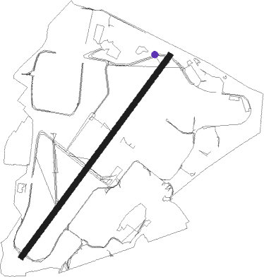
Hawarden
Airport details
| Country | United Kingdom |
| State | Wales |
| Region | EG |
| Airspace | London Ctr |
| Municipality | Flintshire |
| Elevation | 42ft (13m) |
| Timezone | GMT +0 |
| Coordinates | 53.17805, -2.97778 |
| Magnetic var | |
| Type | land |
| Available since | X-Plane v11.33 |
| ICAO code | EGNR |
| IATA code | CEG |
| FAA code | n/a |
Communication
| Hawarden Tower | 124.950 |
| Hawarden unnamed entity | 128.800 |
| Hawarden Approach | 123.350 |
Approach frequencies
| ILS-cat-I | RW22 | 110.35 | 18.00mi |
| ILS-cat-I | RW04 | 110.35 | 18.00mi |
| 3.5° GS | RW04 | 110.35 | 18.00mi |
| 3° GS | RW22 | 110.35 | 18.00mi |
Nearby Points of Interest:
Lower Kinnerton Hall
-Wrexham Road Farm, Eccleston
-Shotwick House
-Overleigh Lodge
-Grosvenor Bridge
-Belgrave Lodge
-Bonewaldesthorne's Tower
-Sedan House, Chester
-Chester Royal Infirmary
-Watergate House, Chester
-Stanley Palace
-Pemberton's Parlour
-10–28 Nicholas Street, Chester
-Guildhall, Chester
-Morgan's Mount
-Bishop Lloyd's House
-St Francis' Church, Chester
-St Ursula's, Chester
-Chester Crown Court
-Chester city walls
-Leche House
-God's Providence House, Chester
-Old Crypt, Chester
-Bluecoat School, Chester
-Chester Town Hall
Nearby beacons
| code | identifier | dist | bearing | frequency |
|---|---|---|---|---|
| HAW | HAWARDEN NDB | 0 | 302° | 340 |
| WHI | WHITEGATE NDB | 12.7 | 89° | 368 |
| LPL | LIVERPOOL NDB | 13.2 | 57° | 349 |
| WAL | WALLASEY VOR/DME | 14 | 324° | 114.10 |
| SWB | SHAWBURY VOR/DME | 25.5 | 140° | 116.80 |
| MCT | MANCHESTER VOR/DME | 27.8 | 76° | 113.55 |
| WPL | WELSHPOOL NDB | 33.5 | 198° | 323 |
| WTN | WARTON TACAN | 34 | 9° | 113.20 |
| WTN | WARTON NDB | 34.7 | 12° | 337 |
| BPL | BLACKPOOL NDB | 35.7 | 355° | 318 |
| POL | POLE HILL VOR/DME | 46.1 | 57° | 112.10 |
| WBA | WOLVERHAMPTON NDB | 47.4 | 133° | 356 |
| WOL | DME | 47.5 | 133° | 108.60 |
| SH | SHOBDON NDB | 56.2 | 174° | 426 |
| WL | BARROW (WALNEY ISLAND) NDB | 57.9 | 343° | 385 |
Departure and arrival routes
| Transition altitude | 5000ft |
| SID end points | distance | outbound heading | |
|---|---|---|---|
| RW04 | |||
| WAL4 | 14mi | 324° | |
| RW22 | |||
| WAL4 | 14mi | 324° | |
| STAR starting points | distance | inbound heading | |
|---|---|---|---|
| ALL | |||
| KEGU1D | 18.5 | 35° | |
| KEGU2B | 47.7 | 275° | |
| KEGU2A | 73.7 | 283° | |
| KEGU2C | 52.3 | 289° | |
Holding patterns
| STAR name | hold at | type | turn | heading* | altitude | leg | speed limit |
|---|---|---|---|---|---|---|---|
| KEGU1D | KEGUN | VHF | left | 184 (4)° | 1.0min timed | ICAO rules | |
| KEGU2A | KEGUN | VHF | left | 184 (4)° | 1.0min timed | ICAO rules | |
| KEGU2B | KEGUN | VHF | left | 184 (4)° | 1.0min timed | ICAO rules | |
| KEGU2C | KEGUN | VHF | left | 184 (4)° | 1.0min timed | ICAO rules | |
| *) magnetic outbound (inbound) holding course | |||||||
Disclaimer
The information on this website is not for real aviation. Use this data with the X-Plane flight simulator only! Data taken with kind consent from X-Plane 12 source code and data files. Content is subject to change without notice.
