Cambridge
Airport details
| Country | United Kingdom |
| State | England |
| Region | EG |
| Airspace | London Ctr |
| Municipality | Cambridgeshire |
| Elevation | 43ft (13m) |
| Timezone | GMT +0 |
| Coordinates | 52.20500, 0.17500 |
| Magnetic var | |
| Type | land |
| Available since | X-Plane v10.40 |
| ICAO code | EGSC |
| IATA code | CBG |
| FAA code | n/a |
Communication
| Cambridge Cambridge Info | 134.600 |
| Cambridge Cambridge Tower | 125.900 |
| Cambridge Cambridge Approach | 123.600 |
| Cambridge Cambridge Radar | 124.975 |
Approach frequencies
| ILS-cat-I | RW23 | 111.3 | 18.00mi |
| 3° GS | RW23 | 111.3 | 18.00mi |
Nearby Points of Interest:
Cherry Hinton Hall
-Abbey House
-Festival Theatre
-Chesterton Hall
-Goldie Boathouse
-Scott Polar Research Institute
-County Hall
-Cambridge Medical School building
-Cambridge Corn Exchange
-Memorial Chapel, The Leys School
-Cambridge Guildhall
-William Stone Building
-Quy Hall
-Senate House
-Pepys Library
-Wren Library
-Garret Hostel Bridge Between Clare Bridge And Trinity Bridge On The Cam
-Newnham Grange
-School of Pythagoras
-Old Vicarage, Grantchester
-Brent Ditch
-Thriplow Meadows
-Hardwick Wood
-Spinney Abbey
-Bourn Hall Clinic
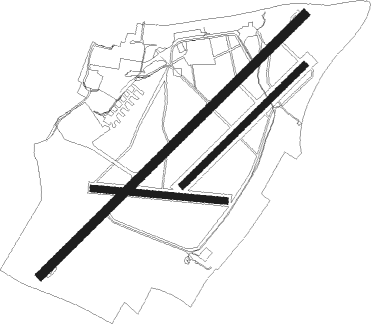
Runway info
Runway 05 / 23  | ||
| length | 1956m (6417ft) | |
| bearing | 63° / 243° | |
| width | 46m (151ft) | |
| surface | asphalt | |
| displ threshold | 211m (692ft) / 143m (469ft) | |
| Runway 05R / 23L | ||
| length | 898m (2946ft) | |
| bearing | 63° / 243° | |
| width | 35m (115ft) | |
| surface | grass | |
| Runway 10 / 28 | ||
| length | 698m (2290ft) | |
| bearing | 96° / 276° | |
| width | 35m (115ft) | |
| surface | grass | |
Nearby beacons
| code | identifier | dist | bearing | frequency |
|---|---|---|---|---|
| CAM | CAMBRIDGE NDB | 0.4 | 55° | 332 |
| BKY | BARKWAY VOR/DME | 13.5 | 208° | 116.25 |
| MLD | MILDENHALL TACAN | 14.9 | 63° | 115.90 |
| LKH | LAKENHEATH TACAN | 18.2 | 62° | 110.20 |
| LUT | LUTON NDB | 24.4 | 234° | 345 |
| CIT | CRANFIELD NDB | 27.3 | 264° | 850 |
| WTZ | WATTISHAM TACAN | 28.6 | 96° | 109.30 |
| BPK | BROOKMANS PARK VOR/DME | 29.2 | 212° | 117.50 |
| MAM | MARHAM TACAN | 30 | 41° | 108.70 |
| LAM | LAMBOURNE VOR/DME | 33.5 | 182° | 115.60 |
| WIT | WITTERING TACAN | 34.5 | 301° | 117.60 |
| BNN | BOVINGDON VOR/DME | 39.3 | 237° | 113.75 |
| CLN | CLACTON VOR/DME | 41.8 | 110° | 114.55 |
| LCY | LONDON CITY NDB | 42.2 | 189° | 322 |
| SND | SOUTHEND NDB | 42.4 | 140° | 362 |
| CHT | CHILTERN NDB | 43.3 | 230° | 277 |
| HEN | HENTON NDB | 44.6 | 245° | 433 |
| WCO | WESTCOTT NDB | 47 | 253° | 335 |
| DTY | DAVENTRY VOR/DME | 47.4 | 269° | 116.40 |
| LON | LONDON VOR/DME | 49.2 | 222° | 113.60 |
| LE | LEICESTER NDB | 50.4 | 288° | 383 |
| BUR | BURNHAM NDB | 51.9 | 231° | 421 |
| BIG | BIGGIN VOR/DME | 52.7 | 189° | 115.10 |
| CGY | CONINGSBY TACAN | 54.6 | 339° | 111.10 |
| CWL | CRANWELL NDB | 54.9 | 321° | 423 |
| CWZ | CRANWELL TACAN | 55 | 321° | 117.40 |
| DET | DETLING VOR/DME | 56.3 | 155° | 117.30 |
| EPM | EPSOM NDB | 56.9 | 212° | 316 |
| OCK | OCKHAM VOR/DME | 58.7 | 215° | 115.30 |
| BSO | BENSON TACAN | 59 | 245° | 110 |
| WOD | WOODLEY NDB | 59.7 | 234° | 352 |
| WAD | WADDINGTON TACAN | 63 | 324° | 117.10 |
| BLC | DME | 65.1 | 229° | 116.20 |
| BLK | BLACKBUSHE NDB | 65.1 | 229° | 328 |
| ODH | ODIHAM TACAN | 71.8 | 229° | 109.60 |
Departure and arrival routes
| Transition altitude | 6000ft |
| STAR starting points | distance | inbound heading | |
|---|---|---|---|
| ALL | |||
| BKY1X | 13.5 | 28° | |
| TELT1L | 90.6 | 34° | |
| AVAN1L | 93.0 | 39° | |
| BEDE1L | 81.5 | 64° | |
| SILV1L | 48.6 | 73° | |
| FINM1L | 47.0 | 80° | |
| BARM2A | 89.4 | 263° | |
| RINI1A | 81.2 | 278° | |
| XAMA1A | 79.8 | 282° | |
| TOSV1A | 77.1 | 286° | |
| LOGA2A | 59.8 | 288° | |
| ABOT1Z | 19.3 | 294° | |
| DET2A | 56.3 | 335° | |
| BANV1L | 102.0 | 341° | |
Instrument approach procedures
| runway | airway (heading) | route (dist, bearing) |
|---|---|---|
| RW05 | BEPOX (74°) | BEPOX 3000ft SC05I (4mi, 91°) 2000ft |
| RNAV | SC05I 2000ft SC05F (3mi, 62°) 1600ft EGSC (5mi, 63°) 86ft (3135mi, 180°) 1600ft CAM (3136mi, 0°) 2000ft CAM (turn) | |
| RW23 | GOPOD (262°) | GOPOD 3000ft SC23I (5mi, 306°) 2000ft |
| RW23 | TIPGO (214°) | TIPGO 3000ft SC23I (5mi, 126°) 2000ft |
| RNAV | SC23I 2000ft SC23F (4mi, 243°) 1700ft EGSC (6mi, 243°) 87ft (3135mi, 180°) 2000ft CAM (3136mi, 0°) 2000ft CAM (turn) |
Holding patterns
| STAR name | hold at | type | turn | heading* | altitude | leg | speed limit |
|---|---|---|---|---|---|---|---|
| ABOT1Z | ABBOT | VHF | right | 85 (265)° | 8000ft - 14000ft | DME 6.0mi | 220 |
| ABOT1Z | LOREL | VHF | left | 8 (188)° | > 7000ft | DME 4.0mi | 220 |
| AVAN1L | LOREL | VHF | left | 8 (188)° | > 7000ft | DME 4.0mi | 220 |
| AVAN1L | VATON | VHF | left | 205 (25)° | 18000ft - 20000ft | 1.5min timed | 240 |
| BANV1L | LOREL | VHF | left | 8 (188)° | > 7000ft | DME 4.0mi | 220 |
| BANV1L | UNDUG | VHF | right | 139 (319)° | 20000ft - 24000ft | 1.5min timed | 240 |
| BANV1L | VATON | VHF | left | 205 (25)° | 18000ft - 20000ft | 1.5min timed | 240 |
| BARM2A | ABBOT | VHF | right | 85 (265)° | 8000ft - 14000ft | DME 6.0mi | 220 |
| BARM2A | LAPRA | VHF | right | 64 (244)° | 15000ft - 21000ft | 1.5min timed | 240 |
| BEDE1L | LOREL | VHF | left | 8 (188)° | > 7000ft | DME 4.0mi | 220 |
| BEDE1L | VATON | VHF | left | 205 (25)° | 18000ft - 20000ft | 1.5min timed | 240 |
| BKY1X | ABBOT | VHF | right | 85 (265)° | 8000ft - 14000ft | DME 6.0mi | 220 |
| BPK1X | ABBOT | VHF | right | 85 (265)° | 8000ft - 14000ft | DME 6.0mi | 220 |
| DET2A | ABBOT | VHF | right | 85 (265)° | 8000ft - 14000ft | DME 6.0mi | 220 |
| FINM1L | BOMBO | VHF | left | 271 (91)° | < 14000ft | DME 5.0mi | 220 |
| FINM1L | LOREL | VHF | left | 8 (188)° | > 7000ft | DME 4.0mi | 220 |
| LIST1L | BOMBO | VHF | left | 271 (91)° | < 14000ft | DME 5.0mi | 220 |
| LIST1L | LOREL | VHF | left | 8 (188)° | > 7000ft | DME 4.0mi | 220 |
| LOGA2A | ABBOT | VHF | right | 85 (265)° | 8000ft - 14000ft | DME 6.0mi | 220 |
| LOGA2A | LOGAN | VHF | left | 108 (288)° | 15000ft - 41000ft | 1.5min timed | 240 |
| RINI1A | ABBOT | VHF | right | 85 (265)° | 8000ft - 14000ft | DME 6.0mi | 220 |
| RINI1A | LAPRA | VHF | right | 64 (244)° | 15000ft - 21000ft | 1.5min timed | 240 |
| SILV1L | BOMBO | VHF | left | 271 (91)° | < 14000ft | DME 5.0mi | 220 |
| SILV1L | LOREL | VHF | left | 8 (188)° | > 7000ft | DME 4.0mi | 220 |
| TELT1L | LOREL | VHF | left | 8 (188)° | > 7000ft | DME 4.0mi | 220 |
| TELT1L | VATON | VHF | left | 205 (25)° | 18000ft - 20000ft | 1.5min timed | 240 |
| TOSV1A | ABBOT | VHF | right | 85 (265)° | 8000ft - 14000ft | DME 6.0mi | 220 |
| TOSV1A | LAPRA | VHF | right | 64 (244)° | 15000ft - 21000ft | 1.5min timed | 240 |
| XAMA1A | ABBOT | VHF | right | 85 (265)° | 8000ft - 14000ft | DME 6.0mi | 220 |
| XAMA1A | LAPRA | VHF | right | 64 (244)° | 15000ft - 21000ft | 1.5min timed | 240 |
| *) magnetic outbound (inbound) holding course | |||||||
Disclaimer
The information on this website is not for real aviation. Use this data with the X-Plane flight simulator only! Data taken with kind consent from X-Plane 12 source code and data files. Content is subject to change without notice.