London - London Stansted
Airport details
| Country | United Kingdom |
| State | England |
| Region | EG |
| Airspace | London Ctr |
| Municipality | Uttlesford |
| Elevation | 348ft (106m) |
| Timezone | GMT +0 |
| Coordinates | 51.88500, 0.23500 |
| Magnetic var | |
| Type | land |
| Available since | X-Plane v10.40 |
| ICAO code | EGSS |
| IATA code | STN |
| FAA code | n/a |
Communication
| London Stansted Stansted Information | 127.180 |
| London Stansted Stansted Delivery | 121.955 |
| London Stansted Stansted Ground | 121.730 |
| London Stansted Stansted Tower | 125.550 |
| London Stansted Stansted Tower | 123.805 |
| London Stansted Essex Radar | 120.625 |
Approach frequencies
| ILS-cat-III | RW04 | 110.5 | 18.00mi |
| ILS-cat-III | RW22 | 110.5 | 18.00mi |
| 3° GS | RW04 | 110.5 | 18.00mi |
| 3° GS | RW22 | 110.5 | 18.00mi |
Nearby Points of Interest:
Stansted Hall
-Portingbury Hills
-Hatfield Forest
-Stansted Mountfitchet Windmill
-Orford House
-Barrington Hall
-Boar's Head Inn
-Horham Hall
-Sawbridgeworth Marsh
-Aythorpe Roding Windmill
-Berden Priory
-Patmore Heath
-Debden Water SSSI
-St Leonard's Church, Sandridge
-West Wood, Little Sampford
-Town Hall
-Hunsdon House
-Plashes Wood
-Hare Street House
-Hunsdon Mead
-Hales and Shadwell Woods
-Duck End Mill
-Youngsbury
-Spains Hall
-Blake Hall
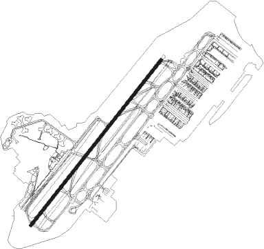
Runway info
| Runway 04 / 22 | ||
| length | 3051m (10010ft) | |
| bearing | 56° / 236° | |
| width | 46m (151ft) | |
| surface | asphalt | |
| displ threshold | 303m (994ft) / 0m (0ft) | |
| blast zone | 0m (0ft) / 9m (30ft) | |
Nearby beacons
| code | identifier | dist | bearing | frequency |
|---|---|---|---|---|
| BKY | BARKWAY VOR/DME | 8.9 | 301° | 116.25 |
| LAM | LAMBOURNE VOR/DME | 14.6 | 199° | 115.60 |
| BPK | BROOKMANS PARK VOR/DME | 15 | 248° | 117.50 |
| LUT | LUTON NDB | 18 | 271° | 345 |
| CAM | CAMBRIDGE NDB | 19.6 | 351° | 332 |
| LCY | LONDON CITY NDB | 23.6 | 204° | 322 |
| SND | SOUTHEND NDB | 25.3 | 124° | 362 |
| WTZ | WATTISHAM TACAN | 29.7 | 71° | 109.30 |
| MLD | MILDENHALL TACAN | 30.2 | 28° | 115.90 |
| BNN | BOVINGDON VOR/DME | 30.6 | 259° | 113.75 |
| CHT | CHILTERN NDB | 32.1 | 251° | 277 |
| CIT | CRANFIELD NDB | 32.7 | 287° | 850 |
| LKH | LAKENHEATH TACAN | 33.3 | 31° | 110.20 |
| CLN | CLACTON VOR/DME | 33.9 | 92° | 114.55 |
| BIG | BIGGIN VOR/DME | 34.1 | 200° | 115.10 |
| LON | LONDON VOR/DME | 35.3 | 240° | 113.60 |
| DET | DETLING VOR/DME | 37.4 | 148° | 117.30 |
| HEN | HENTON NDB | 38.7 | 263° | 433 |
| BUR | BURNHAM NDB | 40.4 | 248° | 421 |
| EPM | EPSOM NDB | 40.8 | 227° | 316 |
| OCK | OCKHAM VOR/DME | 43.1 | 230° | 115.30 |
| WCO | WESTCOTT NDB | 44.4 | 268° | 335 |
| HLS | DME | 46.5 | 150° | 115.95 |
| LSH | HEADCORN (LASHENDEN) NDB | 46.5 | 150° | 340 |
| MAM | MARHAM TACAN | 47.3 | 23° | 108.70 |
| WOD | WOODLEY NDB | 48.9 | 249° | 352 |
| WIT | WITTERING TACAN | 51.1 | 315° | 117.60 |
| BSO | BENSON TACAN | 52.2 | 259° | 110 |
| MAY | MAYFIELD VOR/DME | 52.3 | 188° | 117.90 |
| BLC | DME | 52.5 | 243° | 116.20 |
| BLK | BLACKBUSHE NDB | 52.5 | 243° | 328 |
| DTY | DAVENTRY VOR/DME | 52.8 | 282° | 116.40 |
| LYD | LYDD VOR/DME | 58.3 | 144° | 114.05 |
| CPT | COMPTON VOR/DME | 59 | 255° | 114.35 |
| ODH | ODIHAM TACAN | 59 | 241° | 109.60 |
| MID | MIDHURST VOR/DME | 59.3 | 226° | 114 |
| LZD | LYDD NDB | 61.5 | 143° | 397 |
| LE | LEICESTER NDB | 63.7 | 300° | 383 |
Departure and arrival routes
| Transition altitude | 6000ft |
| Transition level | 6000ft |
| SID end points | distance | outbound heading | |
|---|---|---|---|
| RW04 | |||
| CLN4S | 34mi | 92° | |
| DET1D, DET1S | 37mi | 148° | |
| LAM2S | 15mi | 199° | |
| NUGB1S | 12mi | 286° | |
| UTAV1S | 13mi | 287° | |
| BKY2S | 15mi | 321° | |
| RW22 | |||
| CLN1E, CLN8R | 34mi | 92° | |
| DET1R | 37mi | 148° | |
| LAM3R | 15mi | 199° | |
| NUGB1R | 12mi | 286° | |
| UTAV1R | 13mi | 287° | |
| BKY5R | 11mi | 311° | |
| STAR starting points | distance | inbound heading | |
|---|---|---|---|
| ALL | |||
| TELT1L | 74.4 | 43° | |
| AVAN1L | 77.6 | 48° | |
| BEDE1L | 73.6 | 74° | |
| SILV1L | 46.0 | 88° | |
| FINM1L | 48.1 | 95° | |
| ABOT1Z | 15.6 | 250° | |
| BARM2A | 93.0 | 256° | |
| RINI1A | 77.3 | 269° | |
| XAMA1A | 74.0 | 273° | |
| LOGA2A | 51.7 | 276° | |
| TOSV1A | 69.4 | 276° | |
| DET2A | 37.4 | 328° | |
| BANV1L | 82.8 | 339° | |
Holding patterns
| STAR name | hold at | type | turn | heading* | altitude | leg | speed limit |
|---|---|---|---|---|---|---|---|
| ABOT1Z | ABBOT | VHF | right | 85 (265)° | 8000ft - 14000ft | DME 6.0mi | 220 |
| ABOT1Z | LOREL | VHF | left | 8 (188)° | > 7000ft | DME 4.0mi | 220 |
| AVAN1L | LOREL | VHF | left | 8 (188)° | > 7000ft | DME 4.0mi | 220 |
| AVAN1L | VATON | VHF | left | 205 (25)° | 18000ft - 20000ft | 1.5min timed | 240 |
| BANV1L | LOREL | VHF | left | 8 (188)° | > 7000ft | DME 4.0mi | 220 |
| BANV1L | UNDUG | VHF | right | 139 (319)° | 20000ft - 24000ft | 1.5min timed | 240 |
| BANV1L | VATON | VHF | left | 205 (25)° | 18000ft - 20000ft | 1.5min timed | 240 |
| BARM2A | ABBOT | VHF | right | 85 (265)° | 8000ft - 14000ft | DME 6.0mi | 220 |
| BARM2A | LAPRA | VHF | right | 64 (244)° | 15000ft - 21000ft | 1.5min timed | 240 |
| BEDE1L | LOREL | VHF | left | 8 (188)° | > 7000ft | DME 4.0mi | 220 |
| BEDE1L | VATON | VHF | left | 205 (25)° | 18000ft - 20000ft | 1.5min timed | 240 |
| BKY1X | ABBOT | VHF | right | 85 (265)° | 8000ft - 14000ft | DME 6.0mi | 220 |
| BPK1X | ABBOT | VHF | right | 85 (265)° | 8000ft - 14000ft | DME 6.0mi | 220 |
| DET2A | ABBOT | VHF | right | 85 (265)° | 8000ft - 14000ft | DME 6.0mi | 220 |
| FINM1L | BOMBO | VHF | left | 271 (91)° | < 14000ft | DME 5.0mi | 220 |
| FINM1L | LOREL | VHF | left | 8 (188)° | > 7000ft | DME 4.0mi | 220 |
| LIST1L | BOMBO | VHF | left | 271 (91)° | < 14000ft | DME 5.0mi | 220 |
| LIST1L | LOREL | VHF | left | 8 (188)° | > 7000ft | DME 4.0mi | 220 |
| LOGA2A | ABBOT | VHF | right | 85 (265)° | 8000ft - 14000ft | DME 6.0mi | 220 |
| LOGA2A | LOGAN | VHF | left | 108 (288)° | 15000ft - 41000ft | 1.5min timed | 240 |
| RINI1A | ABBOT | VHF | right | 85 (265)° | 8000ft - 14000ft | DME 6.0mi | 220 |
| RINI1A | LAPRA | VHF | right | 64 (244)° | 15000ft - 21000ft | 1.5min timed | 240 |
| SILV1L | BOMBO | VHF | left | 271 (91)° | < 14000ft | DME 5.0mi | 220 |
| SILV1L | LOREL | VHF | left | 8 (188)° | > 7000ft | DME 4.0mi | 220 |
| TELT1L | LOREL | VHF | left | 8 (188)° | > 7000ft | DME 4.0mi | 220 |
| TELT1L | VATON | VHF | left | 205 (25)° | 18000ft - 20000ft | 1.5min timed | 240 |
| TOSV1A | ABBOT | VHF | right | 85 (265)° | 8000ft - 14000ft | DME 6.0mi | 220 |
| TOSV1A | LAPRA | VHF | right | 64 (244)° | 15000ft - 21000ft | 1.5min timed | 240 |
| XAMA1A | ABBOT | VHF | right | 85 (265)° | 8000ft - 14000ft | DME 6.0mi | 220 |
| XAMA1A | LAPRA | VHF | right | 64 (244)° | 15000ft - 21000ft | 1.5min timed | 240 |
| *) magnetic outbound (inbound) holding course | |||||||
Disclaimer
The information on this website is not for real aviation. Use this data with the X-Plane flight simulator only! Data taken with kind consent from X-Plane 12 source code and data files. Content is subject to change without notice.